Home / Missouri / The Lake of the Ozarks & the Osage River / Ha Ha Tonka State Park
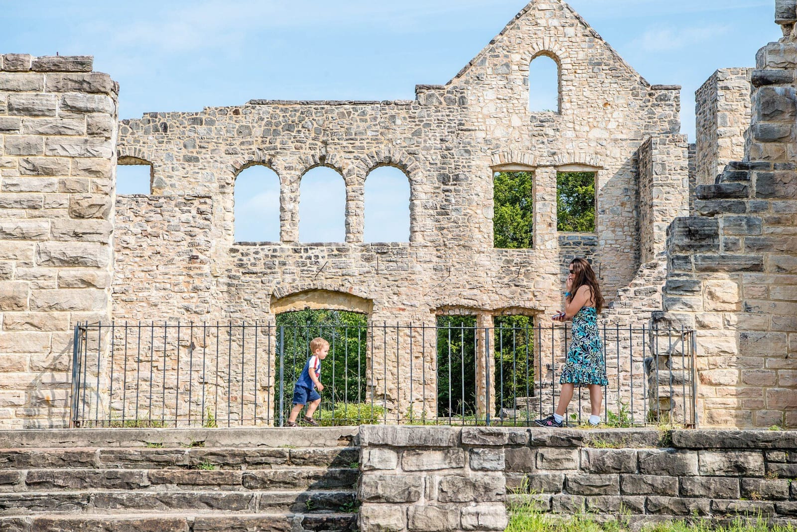
Visitors walking past the stone walls and empty window arches of the Ha Ha Tonka castle ruins.Missouri State Parks / public domain via Wikimedia Commons
🏜️Geological

Ha Ha Tonka State Park

Part ofThe Lake of the Ozarks & the Osage River

Collapsed caverns laid open above the Niangua arm of the Lake of the Ozarks: a natural bridge, a sinkhole amphitheater, a spring in a gorge and the burned stone shell of a Kansas City businessman's castle.

⏱
Duration
Two to four hours.
🎟
Admission
The park's pages list no entrance fee.
📅
Best Season
Grounds open daily, 7 a.m. to sunset April to October and 8 a.m. to sunset November to March; the visitor center is open 10 a.m. to 5 p.m. daily April to October and is not regularly staffed in winter.

The Story

Ha Ha Tonka is a lesson in what water does to limestone and dolomite. Caverns dissolved underground, then their roofs fell in. What is left is a natural bridge 70 feet wide that spans 60 feet and stands more than 100 feet high, a sinkhole called the Colosseum, 500 feet long and 300 wide, and a gorge with 250-foot bluffs where Ha Ha Tonka Spring, the 12th largest in Missouri, puts out more than 48 million gallons a day toward the lake. Between two water-filled channels stands a steep island with a balanced rock and a cave. Wooden stairs circle the chasm from the spring up to the castle.

The castle was Robert M. Snyder's. The Kansas City businessman, who had made his money in wholesale groceries, real estate, banking and utilities, began buying land here after a visit in 1903 and started building in 1905, with sandstone quarried nearby and hauled by mule wagon and a small railroad. He was killed in 1906 in one of Missouri's first automobile accidents, and his sons finished the house in 1922. They fought the building of Bagnell Dam and lost, and the new lake swallowed the small spring-fed lake the castle had overlooked. Leased as a hotel, the house burned in 1942 when chimney sparks caught the roof. The state made the park in 1978.

Away from the ruins, almost 3,000 acres of oak woodland, some trees more than 300 years old, are kept open with prescribed fire.

Visitor Info

⏱
Time Needed
Two to four hours.
🎟
Admission
The park's pages list no entrance fee.
📅
Best Season
Grounds open daily, 7 a.m. to sunset April to October and 8 a.m. to sunset November to March; the visitor center is open 10 a.m. to 5 p.m. daily April to October and is not regularly staffed in winter.
🛣️
Highway
US-54 and State Road D

On the Map

Nearby

The closest stops worth working into your route

geological11 mi away
Ozark Caverns (Lake of the Ozarks State Park)
A guided half-mile walk through a drained Ozark conduit in Lake of the Ozarks State Park, with a shower that falls from solid rock, old claw marks and blind grotto salamanders.
natural19 mi away
Bennett Spring State Park
More than 100 million gallons a day out of a Niangua valley spring, a branch stocked with rainbow trout every day of the season, and the mill valley and CCC lodge that came first.
roadside40 mi away
Devils Elbow Bridge (Route 66)
A 1923 steel truss with a dogleg over the Big Piney, on the original 1926 line of Route 66 at a bend the tie rafters named, still carrying cars after its 2014 rehabilitation.
recreational41 mi away
Harry S Truman State Park
A 1983 park on a peninsula in Truman Lake, the Osage River reservoir first planned as Kaysinger Bluff, with a marina, beach and glades found in no other state park.
historical52 mi away
Lincoln University and the Soldiers' Memorial
The school that Black soldiers of the 62nd and 65th U.S. Colored Infantry paid for out of army wages in 1866, now a land-grant university on its Jefferson City hill.
architectural53 mi away
Missouri State Capitol
The 1917 capitol on the Jefferson City bluff, built after lightning burned its predecessor, with the State Museum downstairs and Thomas Hart Benton's mural of Missouri in the House Lounge.

Historical markers nearby

Roadside plaques and monuments within a short detour

Marker17 mi away
Bagnell Dam
Marker21 mi away
Lebanon
Marker25 mi away
Miller County
Marker29 mi away
Dallas County
Marker30 mi away
Hickory County