Home / Alabama / Birmingham & Central Alabama / Cahaba River National Wildlife Refuge
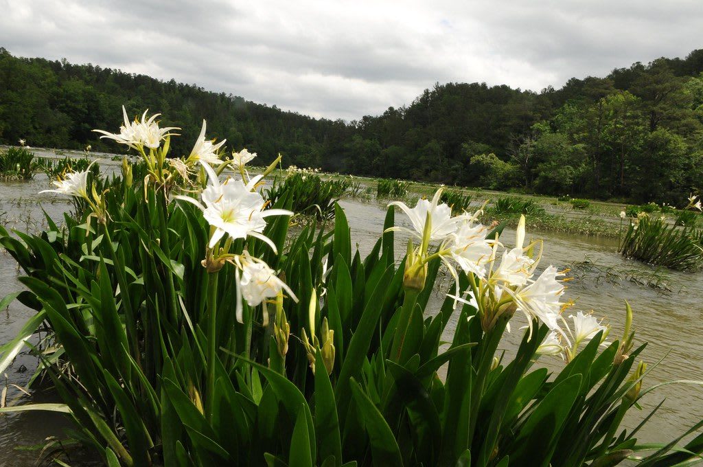
White Cahaba lilies blooming on a rocky shoal of the river, with wooded hills behind.USFWS Southeast / CC BY 2.0 via Flickr
🌲Natural

Cahaba River National Wildlife Refuge

Part ofBirmingham & Central Alabama

A protected stretch of Alabama's longest free-flowing river near West Blocton, with the largest known stand of Cahaba lilies.

⏱
Duration
One hour to a full day on the river.
🎟
Admission
Free.
📅
Best Season
Mid-May to mid-June for the lilies; fall for the woods.

The Story

Creek people of the Upper Towns lived along the Cahaba and its creeks before American squatters came in 1815, the year after the Treaty of Fort Jackson forced the Muscogee (Creek) Nation to cede more than 21 million acres across central and south Alabama. Bibb County was first called Cahaba County after the river. The Cahaba runs almost two hundred miles and is the longest free-flowing river in Alabama, with no high dams, and it holds 131 kinds of fish, more than any other river its size in North America, along with 64 rare and imperiled plants and animals, 13 found nowhere else.

The refuge was set up on September 25, 2002, to protect a stretch of the river and the pine and hardwood hills beside it, and now covers about 3,700 acres in Bibb County. Its shoals hold the largest known stand of the shoals spider-lily, called here the Cahaba lily. The bulbs winter wedged in the rocks of the riverbed; leaves rise in April, and from mid-May into June the white flowers, about three inches across, open each evening over the rapids. West Blocton has held a Cahaba Lily Festival since 1990.

The refuge is about six miles east of West Blocton on County Road 24, with a gravel river access road on the south side about 250 yards past the entrance sign. People come to fish, paddle, hunt in season and walk the forest roads. After rain the river can turn swift and dangerous, so check the water before you wade in for a closer look at the lilies.

Visitor Info

⏱
Time Needed
One hour to a full day on the river.
🎟
Admission
Free.
📅
Best Season
Mid-May to mid-June for the lilies; fall for the woods.
🛣️
Highway
County Road 24

On the Map

Nearby

The closest stops worth working into your route

industrial7.4 mi away
Brierfield Ironworks Historical State Park
Ruins of the only ironworks the Confederacy owned outright, bought in 1863 with nine enslaved people and burned by Wilson's raiders in 1865.
industrial12 mi away
Tannehill Ironworks Historical State Park
Three sandstone blast furnaces in Roupes Valley, worked mostly by enslaved men and burned in 1865, with the Iron & Steel Museum of Alabama and a village of old cabins.
natural25 mi away
Oak Mountain State Park
Alabama's largest state park, just south of Birmingham: ridges, lakes, Peavine Falls, 70 miles of trail and a wildlife center.
historical29 mi away
Foster Auditorium
The 1939 University of Alabama hall where George Wallace stood in the door on June 11, 1963, before Vivian Malone and James Hood registered.
historical30 mi away
First African Baptist Church
The 1907 Tuscaloosa church where 600 marchers set out for the courthouse on June 9, 1964, and were driven back with fire hoses and tear gas on Bloody Tuesday.
historical31 mi away
Capitol Park
The ruins of Alabama's 1829 capitol in Tuscaloosa, built with enslaved labor, where the legislature sat from 1826 until 1846, and first stop on the Tuscaloosa Civil Rights Trail.

Historical markers nearby

Roadside plaques and monuments within a short detour

Marker10 mi away
Alabama Coal Mining
Montevallo
Marker12 mi away
Prentice High School
Montevallo
Marker12 mi away
Ward Chapel A.M.E. Church
Montevallo
Marker12 mi away
University of Montevallo National Historic District
Montevallo
Marker20 mi away
Canaan Baptist Church
Bessemer
Marker21 mi away
Thomas McAdory Owen
Bessemer