The Sonoran Desert at sunset with the sun low behind the ranges and the whole frame filled with dust-gold light. Dozens of saguaro stand across the flat in silhouette and half-light, some many-armed and some bare columns, thinning into the haze toward low desert ranges that step back in paler and paler grey. In the foreground cholla catch the light along every spine, so that each plant reads as a small bright shape against the darker creosote and bursage around it. No road, building or figure is in the frame.
Bureau of Land Management / public domain via Wikimedia Commons
Arizona · Region

The Sonoran South & the Borderlands

Saguaro desert, silver towns, and the border missions — Tucson under its sky-island ranges, Saguaro National Park, the Spanish missions at San Xavier and Tumacácori, and the mining towns of Tombstone and Bisbee, on Tohono O'odham land near the Mexico line.

7 places to explore

This is the desert people mean when they say the desert — the Sonoran, the only one on earth where the saguaro grows, greener and more crowded with life than any desert has a right to be, ringed around Tucson by a dozen sky islands, forested mountains standing straight up out of the cactus. Saguaro National Park guards the giants on two sides of the city. The land is Tohono O'odham — the desert people — and Akimel O'odham before it was anything else, and their nation still straddles the line the United States and Mexico ran straight through in the 1850s.

The Spanish came up this valley first, and the missions are their durable mark. Father Kino rode into the O'odham village of Wa'k in 1692 and began the chain that became San Xavier del Bac — the White Dove of the Desert, its Baroque church finished in 1797 and still the parish of the Tohono O'odham who built it. Down the Santa Cruz stand the ruins of his Tumacácori, and the presidio the Spanish threw up at Tubac in 1752 after the O'odham rose against them. This is among the oldest continuously farmed ground in the country, and none of it was empty when the missions arrived.

The rest is silver and blood. When Ed Schieffelin found silver east of here in 1877, soldiers had told him the only thing he would find was his tombstone; he named the strike, and the town, for the joke. Tombstone boomed, staged its thirty-second gunfight near — not quite at — the O.K. Corral in 1881, and calls itself too tough to die. Bisbee dug copper out of the Mule Mountains until the open pit swallowed the hillside. And all of it happened on Chiricahua Apache ground: Cochise held these mountains, and Geronimo, until the wars ended in exile to Florida. The rhyolite spires of the Chiricahuas — the wonderland of rocks — still carry the people's name. Come for the cactus. The rest is written underneath it.

What to See in The Sonoran South & the Borderlands

7 places across the region, grouped by what they are.

Natural Areas
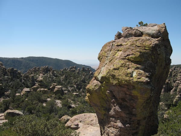
A rhyolite column in the Chiricahua Mountains, Chiricahua Apache homeland, standing close to the camera at the right of the frame — a blocky mass of welded tuff broken along horizontal joints, splashed yellow-green with lichen and carrying a small pine on its cap. Behind it a field of pinnacles and standing columns runs away to the left through pinyon and pine, a wooded ridge closes the middle distance, and a pale valley floor shows through the gap under a cloudless sky. The rock is ash from the Turkey Creek eruption, welded solid twenty-seven million years ago.

Chiricahua National Monument

Willcox

The Land of Standing-Up Rocks — Cochise and Geronimo's stronghold

View details →
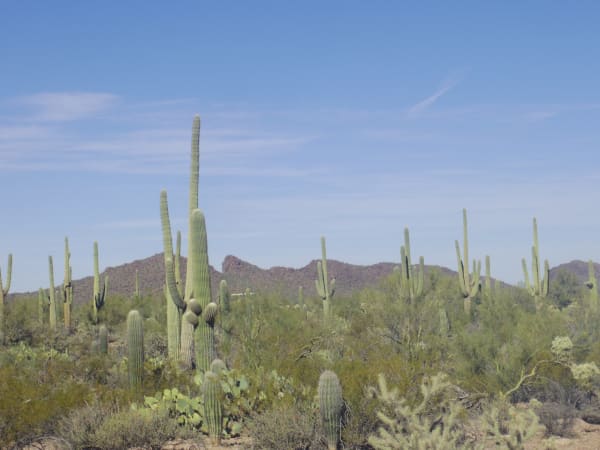
A stand of saguaro in Saguaro National Park outside Tucson, seen level across the flat — one tall cactus in the near ground carrying a single high arm and a cluster of low pups at its base, dozens more standing behind it in every direction, some many-armed and some still unbranched columns. Prickly pear, barrel cactus, cholla and green palo verde fill the ground between them, a low brown ridge runs across the middle distance, and thin cirrus streaks a pale blue sky.

Saguaro National Park

Tucson

The giant cactus, and the O'odham who count it as kin

View details →

Historic Sites

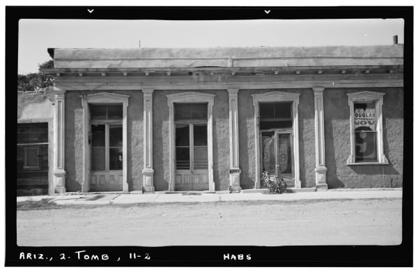
A Historic American Buildings Survey negative photographed in November 1937 and scanned with its black mount and index lettering in frame, reading ARIZ., 2. TOMB, 11-2 and HABS along the bottom edge. The plate is a window detail of the bank at Third and Allen Streets in Tombstone — four openings in a stuccoed front, three tall panelled doorways and a window at the right, moulded hoods over each, pilasters between them and a wooden cornice above, with the render fallen away in patches. A circus bill pasted in the right window advertises a Tuesday, November 9 date at Douglas. No street and no other part of the town is in the frame.

Tombstone

Tombstone

The silver strike named for a death that never came

View details →
The church at Tumacácori at dusk — the façade standing in shadow at the left of the frame with a curved pediment, a cross and ball finial above it, statue niches flanking an upper opening and a dark arched doorway below, and the bell tower beside it left unfinished in bare unplastered brick. A low buttressed adobe range stands in ruin to the right beyond a mesquite, a range shows low and blue on the horizon, and broken altocumulus lit pink and gold fills two thirds of the frame. A concrete path curves in across mown grass in the foreground.

Tumacácori National Historical Park

Tumacácori

Arizona's first mission, on O'odham ground along the Santa Cruz River.

View details →

Towns & Gateways

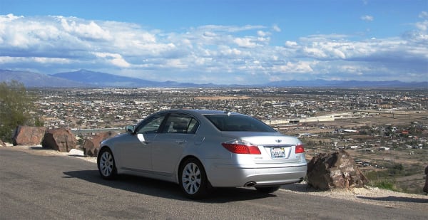
A silver sedan parked at a hillside pullout above Tucson, filling the centre of the frame in three-quarter rear view. Beyond it the city runs flat to the horizon — low houses and streets in the near ground, warehouse roofs and a rail yard in the middle distance, and a long range standing blue along the skyline under piled white cumulus. Broken red rock and gravel edge the pullout on either side. The photograph is composed on the car; the city sits behind it as backdrop, and nothing of the Old Pueblo or its farming ground along the Santa Cruz is legible at this distance.

Tucson

Tucson

The Old Pueblo — four thousand years of farming under the sky islands

View details →

Architecture

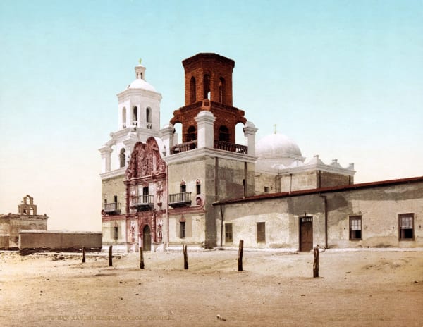
A colour print of Mission San Xavier del Bac issued by the Detroit Photographic Company and copyrighted 1902, the church seen obliquely across a bare sand plaza with wooden posts standing in it. The carved Baroque portal rises in red-brown between the towers, statues set in its niches and turned-wood balconies above the door; the west tower is whitewashed under a domed lantern, and the east tower beside it stands in bare unplastered brick, never finished. A ruined bell gable shows behind a wall at the left. The lantern in this frame is the eighteenth-century original, destroyed by lightning in 1939.

Mission San Xavier del Bac

Tucson

The White Dove of the Desert — the finest Spanish Baroque church in the country

View details →

Industry & Mining

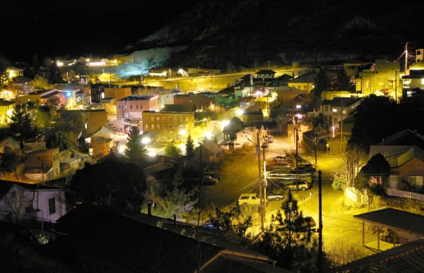
Bisbee at night from the slope above — the town filling the canyon floor and climbing both walls, brick commercial blocks lit orange by sodium lamps in the middle distance, frame houses and sheds stepped up the hillsides on either side, and pickups parked along the streets below. Power poles and slack wire cross the foreground, and a bare pale slope stands out cold and blue under floodlight above a lit yard at the top of the frame. The Copper Queen works and the open pits are not in the frame.

Bisbee

Bisbee

Queen of the Copper Camps — and the deportation it tried to forget

View details →

Stories from The Sonoran South & the Borderlands

Nature

The Desert That Stacks Itself

In Arizona's far southeast the Sonoran floor — ruled by the one giant cactus that grows almost nowhere else — rises into a scatter of lone mountains so tall and so isolated that each is a biological island, and a single day's climb carries you from the desert of Mexico to the forests of Canada.

5 min read

The Sonoran South & the Borderlands rewards the unhurried. Pick a base, fan out, and let the country between the headline stops surprise you.

← Explore more of Open Road Guide