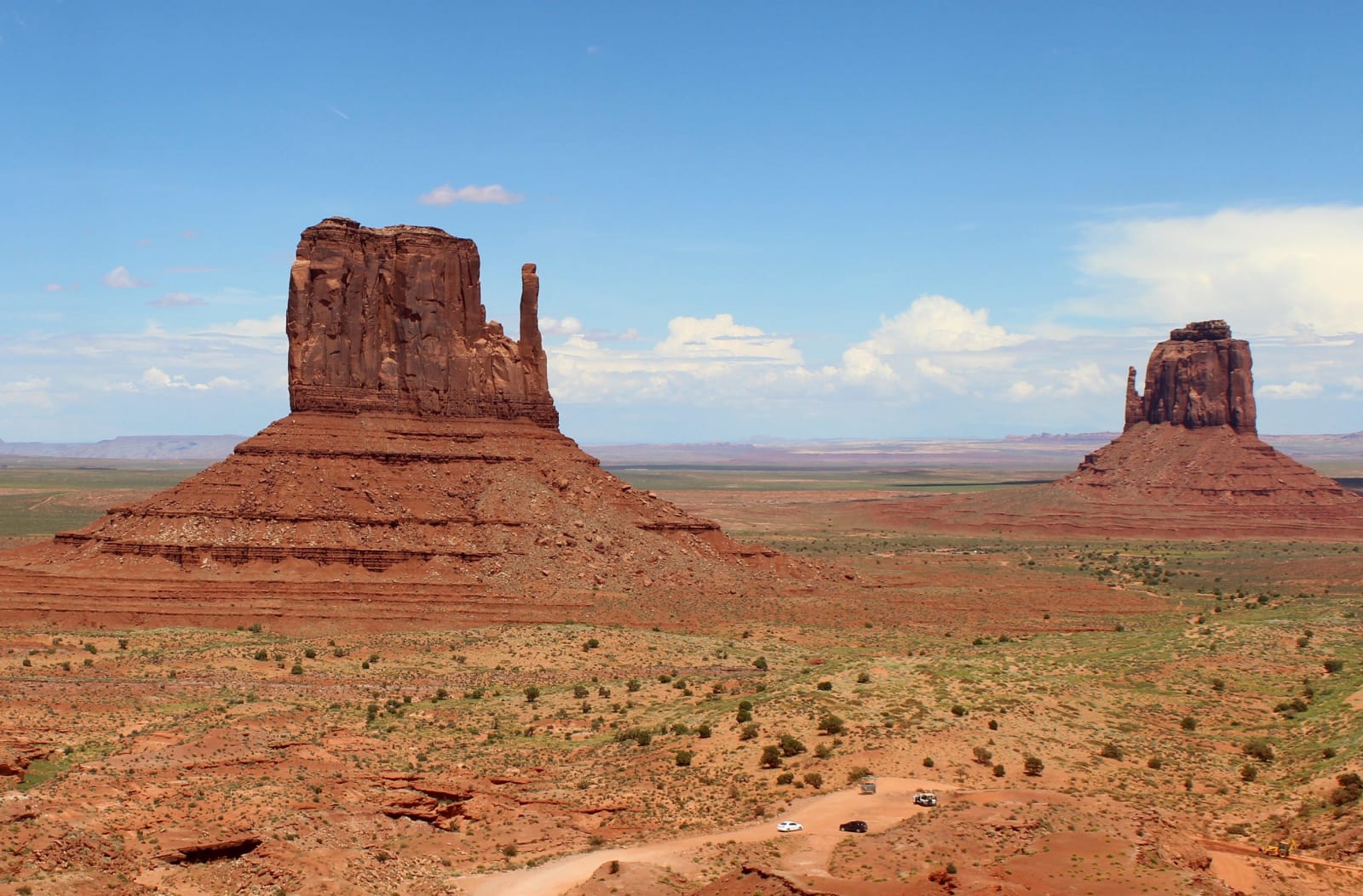
West Mitten Butte and East Mitten Butte in Monument Valley on the Navajo Nation, seen from the rim above the valley floor under midday cumulus. West Mitten stands large at the left, a broad red sandstone tower with a slender detached spire beside it and a banded talus skirt spreading below; East Mitten stands smaller and further off at the right, the same form reversed. Between and beyond them the floor runs flat in red sand and grey-green scrub to a line of low mesas on the horizon. The graded valley road crosses the lower right of the frame with several vehicles stopped along it.
MARELBU / CC BY 3.0 via Wikimedia Commons
Arizona · Region

Navajo & Hopi Country

The Colorado Plateau's tribal heart — Monument Valley and Canyon de Chelly, the Hopi mesas, Lake Powell and Antelope Canyon, and the banded ground of the Painted Desert and Petrified Forest, across the homelands of the Diné and Hopi.

9 places to explore

This is the one region where the land belongs, in law and in fact, to the people who have always held it. The Navajo Nation is the largest reservation in the country, spilling across three states from a capital at Window Rock, and the Hopi mesas sit entirely within it — twelve villages on three fingers of rock, Old Oraibi among the oldest continuously inhabited places in North America. Diné means the people; Hopi carries the sense of the peaceful, the well-behaved. Read the country in their terms first, because the alternative is the tourist's terms, and the tourist is usually wrong.

The scenery you already know from a hundred films is theirs. Monument Valley — the sandstone towers John Ford turned into the backdrop of the American Western — is a Navajo tribal park, and its buttes were never anyone's frontier. Canyon de Chelly, farther east, has been lived in for five thousand years; its cliff dwellings and cottonwoods sit on a canyon floor no visitor may enter without a Diné guide. It is also where the worst of it happened. In the winter of 1864 Kit Carson burned the orchards and starved the people out, and some eight thousand Navajo were marched three hundred miles east to the prison camp at Bosque Redondo — the Long Walk, remembered as the central wound of the nation. Thousands died before the survivors were let home in 1868. Manuelito's band never surrendered at all; the ones who held out in Monument Valley say, still, that they conquered the United States.

The rest is Triassic and stranger. The banded badlands of the Painted Desert run out to the fallen logs of the Petrified Forest — jasper and agate where two-hundred-million-year-old trees used to be. Antelope Canyon carves light down through the Navajo sandstone near Page, above the drowned red rock of Lake Powell. Come for the buttes. Understand whose they are.

What to See in Navajo & Hopi Country

9 places across the region, grouped by what they are.

Geology & Rock Formations
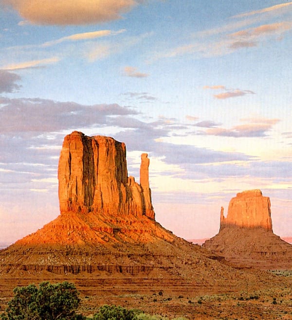
A scanned printed reproduction of the Mittens in Monument Valley at low sun. West Mitten Butte stands at the left, a broad red sandstone tower with a slender detached spire beside it, rising from a talus skirt above the stepped ledges of the valley floor; East Mitten Butte stands smaller and further off at the right with its own thin spire. Warm cloud streaks a pale blue and pink sky, and juniper and sage cover the foreground bench. The frame carries the fine dot screen of the printing it was scanned from.

Monument Valley Navajo Tribal Park

Mexican Hat

The most iconic Western landscape on Earth

View details →

Natural Areas

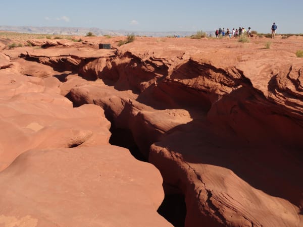
The slickrock bench above Antelope Canyon on the Navajo Nation east of Page, with the slot showing only as a narrow dark fissure winding away across the frame through cross-bedded sandstone worn into overhanging lips and fins. A line of visitors walks the rim toward the entrance in the distance and one hiker crosses the flat at the right, dry grass and low scrub run along the far edge, and the mesas above Lake Powell close a hazy horizon. The carved corridor and the shaft of light the canyon is known for are below the surface and not visible in the frame.

Antelope Canyon

Page

Tsé bighánílíní — where the water runs through the rock

View details →
A broken section of petrified log lying on the badlands floor in Petrified Forest National Park, its cut end showing agatised wood in bands of white, amber, red and grey, the outer side splitting into flat plates along the grain. Chips of the same stone lie scattered across the pink clay ground around it, a longer toppled trunk and low bluffs of banded red and grey mudstone stand behind, and dry grass tufts run along the rise under a blue sky with high cloud.

Petrified Forest National Park

Holbrook

Two hundred million years turned to stone — and a Route 66 ghost

View details →

Historic Sites

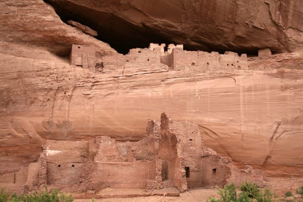
White House Ruin in Canyon de Chelly — Tséyiʼ — an Ancestral Puebloan village built against a sheer sandstone wall on Diné land. The lower block stands on the canyon floor behind a screen of brush, its coursed masonry rooms broken open to show square doorways and standing corners; the upper block sits in a shallow alcove under a great overhang, its rooms stepped along the ledge behind a low parapet with a pale plastered wall at the left end. A panel of white pictographs runs across the cliff face between the two levels, and the sandstone above is streaked with desert varnish.

Canyon de Chelly

Chinle

Tséyiʼ — five thousand years, the Long Walk, and the road home

View details →

Towns & Gateways

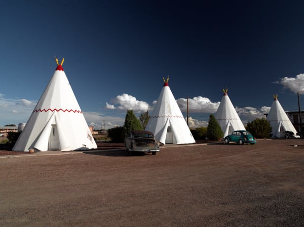
Four of the fifteen concrete teepees of Wigwam Village No. 6 at Holbrook, white cones banded with a red zigzag and topped with painted poles, each with a small door and a square window at its base, ranged around a gravel forecourt under a deep blue sky with cumulus building behind them. A rusted 1950s sedan stands between the first two and a turquoise Volkswagen Beetle beside the third, both parked as permanent exhibits. The units are a 1950 roadside imitation of a Plains teepee, marketed under the wrong word for it. No part of the town of Holbrook is in the frame.

Holbrook

Holbrook

A Santa Fe railroad town once too tough for women and churches, now the seat of Navajo County, gateway to the Petrified Forest, and home to the concrete teepees of the Wigwam Motel.

View details →
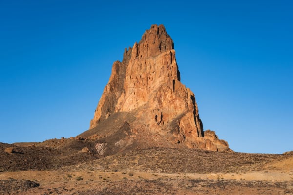
Agathla Peak — Aghaałą́ — the eroded volcanic neck standing seven miles north of Kayenta beside US-163, rising in a single jagged mass of dark breccia more than fifteen hundred feet above the desert, its spires and gullies picked out in low sun and its flanks falling into a long scree apron over pale banded ground. Bare rock and sparse scrub run to the foreground under a cloudless sky. The peak is sacred to the Diné and is not climbed. The town of Kayenta is not in the frame.

Kayenta

Tó Dínéeshzheeʼ — Monument Valley's gateway town and keeper of the Code Talkers' story.

View details →

The Hopi Mesas

Second Mesa

Hopituh Shi-nu-mu — twelve villages on three mesas, and Old Oraibi

View details →
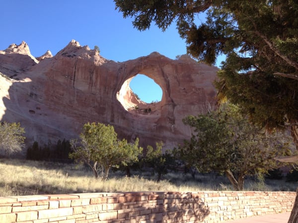
Tségháhoodzání, the arch that gives Window Rock its name — a near-circular hole worn clean through a fin of pale red sandstone, open sky showing through it, with the eroded ridge running away to jagged pinnacles at the left. Junipers stand across the middle ground and a mature juniper fills the upper right of the frame, dry grass covers the slope below, and a low wall of coursed sandstone slabs crosses the foreground. The arch is sacred to the Diné, one of the places where water is gathered for the Water Way, and no one climbs it.

Window Rock

Window Rock

Tségháhoodzání — the sacred arch, and the capital of the Diné

View details →
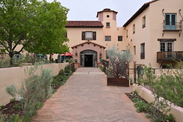
The garden approach to La Posada at Winslow, Mary Colter's 1930 hotel for the Santa Fe and the Fred Harvey Company — a flagstone walk running between low stucco walls and desert planting to an arched entrance under a red tile porch roof, with 1930 set into the plaster above the arch. The main block rises behind in pale stucco with a squat tower, shuttered casements, and wrought-iron balconies on the right-hand wing; cafe umbrellas stand at the left under a large tree. The sky is flat and overcast.

Winslow

Winslow

The town an Eagles lyric made famous — and the home of La Posada, the last great railroad hotel and Mary Colter's finest work, at the southern doorway to Hopi and Navajo country.

View details →

Scenic Drives through Navajo & Hopi Country

Scenic Byway

Historic Route 66

Arizona's stretch of the Mother Road — the longest preserved run of Route 66 in the country, from the ponderosa high country down through Seligman and Kingman to the Oatman switchbacks and the Colorado River.

380 mi · 8 hrs
Scenic Byway

U.S. 163: The Monument Valley Crossing

Sixty-eight miles up US-163 out of the Navajo Nation — from Kayenta and the Code Talkers past sacred Agathla and the buttes the world mistakes for the West, across the reservation's edge into Utah's free-roaming canyon country.

68 mi · 2 hrs
Scenic Byway

US-89: Climbing the Grand Staircase

The climb from Lake Powell to Bryce Canyon — up the Grand Staircase, where each step north is younger rock and higher ground, from the slickrock desert to the Pink Cliffs and their hoodoos.

163 mi · 3.5 hrs

Stories from Navajo & Hopi Country

Culture

A Guest in Two Nations

The northeast corner of Arizona is not scenery with a little history attached — it is the sovereign homeland of the Diné and the Hopi, two nations as unlike each other as either is unlike the United States, who never left this ground and still decide, on their own terms, how a visitor may enter it.

5 min read

Navajo & Hopi Country rewards the unhurried. Pick a base, fan out, and let the country between the headline stops surprise you.

← Explore more of Open Road Guide