Tennessee · Region

Knoxville & the Great Smoky Mountains

Tsiyahi and Kuwohi, Blount Mansion and Fort Southwest Point, Norris Dam, Oak Ridge, the Clinton 12 and Brushy Mountain: East Tennessee's mountains and what was taken.

12 places to explore

Cherokee (Tsalagi) people hunted and farmed these East Tennessee valleys long before any county line was drawn. Their name for Cades Cove, Tsiyahi, means "otter place," and in 2024 the name Kuwohi, "mulberry place," was restored to the highest peak in the Smokies. The Cherokee gave up their last Smoky Mountain claims in 1819, and most were forced west in 1838. On the Cumberland Plateau at Big South Fork, people have lived for more than ten thousand years.

Settlers took the land in turn, and then the state and the federal government took it again. William Blount signed the Treaty of Holston in 1791 and built the Knoxville house where the people he enslaved are named, and soldiers held Fort Southwest Point from 1797. Brushy Mountain prison at Petros opened in 1896 after Coal Creek miners fought convict leasing. The national park, Norris Dam and Oak Ridge moved thousands of families, and Oak Ridge housed its Black workers in hutments.

The 1956 walk of the Clinton 12 from Green McAdoo school and Knoxville's Beck Center belong here too, with the Museum of Appalachia a short drive away. Between them rise Frozen Head, whose forest began as prison land, Big South Fork, and Newfound Gap, where Roosevelt dedicated the park in 1940.

What to See in Knoxville & the Great Smoky Mountains

12 places across the region, grouped by what they are.

Natural Areas

Big South Fork National River and Recreation Area at Bandy Creek

Oneida

The Tennessee gateway to a 125,000-acre Cumberland Plateau river gorge, from the Bandy Creek Visitor Center near Oneida, with Twin Arches and the old No Business country.

View details →

Frozen Head State Park

Wartburg

A 24,000-acre Cumberland Mountains park around a 3,324-foot peak, made from Brushy Mountain prison lands and the CCC, and home to the Barkley Marathons.

View details →

Newfound Gap

Gatlinburg

The lowest drivable pass through the Smokies, at 5,046 feet on the Tennessee and North Carolina line, where Roosevelt dedicated the park in 1940 and Kuwohi's Cherokee name was restored in 2024.

View details →

Historic Sites

American Museum of Science and Energy

Oak Ridge

The Oak Ridge museum that opened in 1949, when the Manhattan Project city's gates opened, in a town whose Black workers were housed in the Gamble Valley hutments.

View details →
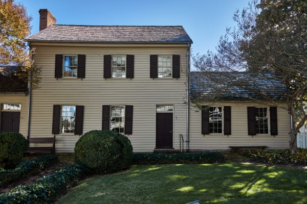
A two-story cream clapboard house with dark shutters, a brick chimney and a lawn with trimmed shrubs in front.

Blount Mansion

Knoxville

The 1792 frame house of William Blount, governor of the Southwest Territory, Knoxville's only National Historic Landmark, where the people he enslaved are named.

View details →
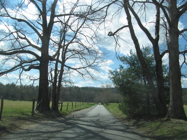
A narrow paved lane runs between tall bare trees and fenced meadows toward distant forested ridges.

Cades Cove

Townsend

A Smokies valley ringed by mountains, once the Cherokee hunting ground of Tsiyahi and later a farming community of 685 people, kept by the park after its families were bought out.

View details →
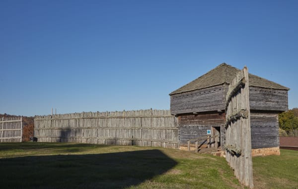
A weathered wooden palisade wall and a log blockhouse with a shingled roof on a grassy hilltop under a clear sky.

Fort Southwest Point State Historic Park

Kingston

A reconstructed 1797 federal fort on a knoll at the meeting of the Clinch and Tennessee rivers, headquarters of Cherokee agent Return J. Meigs, a state park since July 2026.

View details →

Historic Brushy Mountain State Penitentiary

Petros

The coal-mining prison opened in 1896 after the Coal Creek War ended convict leasing, where James Earl Ray escaped in 1977, now a tourist site and distillery.

View details →

Towns & Gateways

Beck Cultural Exchange Center

Knoxville

Knoxville's Black history museum and archive, opened in 1975 in the 1912 Dandridge Avenue house the community bought for $22,500.

View details →

Green McAdoo Cultural Center

Clinton

The 1935 school in Clinton that sent twelve Black students down Foley Hill to desegregate Clinton High School in August 1956, now a museum with bronze statues of the Clinton 12.

View details →
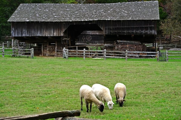
Three sheep graze on a lawn in front of a weathered log cantilever barn with a shingle roof and split-rail fences.

Museum of Appalachia

Clinton

John Rice Irwin's 65-acre collection of moved log cabins and mountain objects north of Knoxville, opened in 1969, with a cabin believed to be Mark Twain's father's.

View details →

Industry & Mining

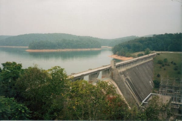
A concrete dam curving across a green lake with wooded hills behind it under a hazy sky.

Norris Dam and Norris Dam State Park

Norris

TVA's first dam, finished in 1936 on the Clinch River, and the state park beside it with the 1798 Rice Grist Mill, built for a valley whose families were moved out.

View details →

Scenic Drives through Knoxville & the Great Smoky Mountains

Scenic Byway

US 441, Newfound Gap Road: Cades Cove to the North Carolina Line

About 59 miles through the Great Smoky Mountains, from Laurel Creek Road near Townsend around Cades Cove, along Little River Road and up US 441 to Newfound Gap on the North Carolina line.

59 mi · 2.4 hrs

Knoxville & the Great Smoky Mountains rewards the unhurried. Pick a base, fan out, and let the country between the headline stops surprise you.

← Explore more of Open Road Guide