Home / Tennessee / Knoxville & the Great Smoky Mountains / Fort Southwest Point State Historic Park
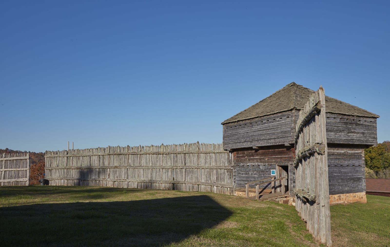
A weathered wooden palisade wall and a log blockhouse with a shingled roof on a grassy hilltop under a clear sky.Carol M. Highsmith / public domain via Library of Congress
🏛️Historical

Fort Southwest Point State Historic Park

Part ofKnoxville & the Great Smoky Mountains

A reconstructed 1797 federal fort on a knoll at the meeting of the Clinch and Tennessee rivers, headquarters of Cherokee agent Return J. Meigs, a state park since July 2026.

⏱
Duration
One to two hours.
🎟
Admission
No entrance fee at Tennessee state parks.
📅
Best Season
Year round; spring and fall are best for the lakeside walk.

The Story

Federal soldiers built Fort Southwest Point in 1797 on a high knoll above the mouth of the Clinch River, where it meets the Tennessee. They came to control boundary disputes between settlers and the Cherokee, who still claimed most of East Tennessee, and the fort stood inside Cherokee territory. An earlier militia blockhouse had stood half a mile upriver on the main road between the Knoxville and Nashville areas. The garrison included the Fourth Infantry under Lieutenant Colonel Thomas Butler, other infantry, artillery and a troop of dragoons.

In 1801 Colonel Return Jonathan Meigs, newly appointed Cherokee agent, made the fort his headquarters, and until 1807 it was a place where the United States dealt with the Cherokee Nation over land and boundaries. In 1807 the agency moved deeper into Cherokee territory to the Hiwassee Garrison, and the fort lost most of its purpose. Troops used it as a supply depot for goods moving overland and then by river until about 1811.

The city of Kingston owned the site, and Tennessee State Parks dedicated it in July 2026 as the state's 66th state park. Archaeologists have dug there for several seasons, and the reconstructed buildings stand on the original foundations. A museum in the visitor center shows what was found, and a walking path follows Watts Bar Lake, with a view on clear days toward Frozen Head and the Cumberland Mountains. The fort has been on the National Register of Historic Places since 1972.

Visitor Info

⏱
Time Needed
One to two hours.
🎟
Admission
No entrance fee at Tennessee state parks.
📅
Best Season
Year round; spring and fall are best for the lakeside walk.
🛣️
Highway
South Kentucky Street

On the Map

Nearby

The closest stops worth working into your route

historical18 mi away
Historic Brushy Mountain State Penitentiary
The coal-mining prison opened in 1896 after the Coal Creek War ended convict leasing, where James Earl Ray escaped in 1977, now a tourist site and distillery.
natural19 mi away
Frozen Head State Park
A 24,000-acre Cumberland Mountains park around a 3,324-foot peak, made from Brushy Mountain prison lands and the CCC, and home to the Barkley Marathons.
historical19 mi away
American Museum of Science and Energy
The Oak Ridge museum that opened in 1949, when the Manhattan Project city's gates opened, in a town whose Black workers were housed in the Gamble Valley hutments.
historical26 mi away
Cumberland Homesteads and the Homesteads Tower
The largest of the New Deal's subsistence homestead communities, a plateau district of Crab Orchard sandstone houses around an octagonal stone tower that now holds a museum.
historical26 mi away
Fort Loudoun State Historic Park
A reconstructed 1756-57 British fort on the Little Tennessee River in Overhill Cherokee country, besieged in 1760 and surrendered on August 9 of that year.
cultural26 mi away
Sequoyah Birthplace Museum
The Eastern Band of Cherokee Indians' museum on Tellico Lake, near the town where Sequoyah was born, telling how he built the Cherokee syllabary and what the Tellico Dam drowned.

Historical markers nearby

Roadside plaques and monuments within a short detour

Marker17 mi away
The Rose Terrace House
Oliver Springs
Marker17 mi away
Thomas "Big Foot" Spencer
Crab Orchard
Marker18 mi away
Freels Bend Cabin
Oak Ridge
Marker20 mi away
Oak Ridge
Oak Ridge
Marker21 mi away
David Glasgow Farragut
Farragut
Marker21 mi away
Battle of Campbell's Station
Farragut