Home / Missouri / Springfield & the Route 66 Southwest / Wilson's Creek National Battlefield
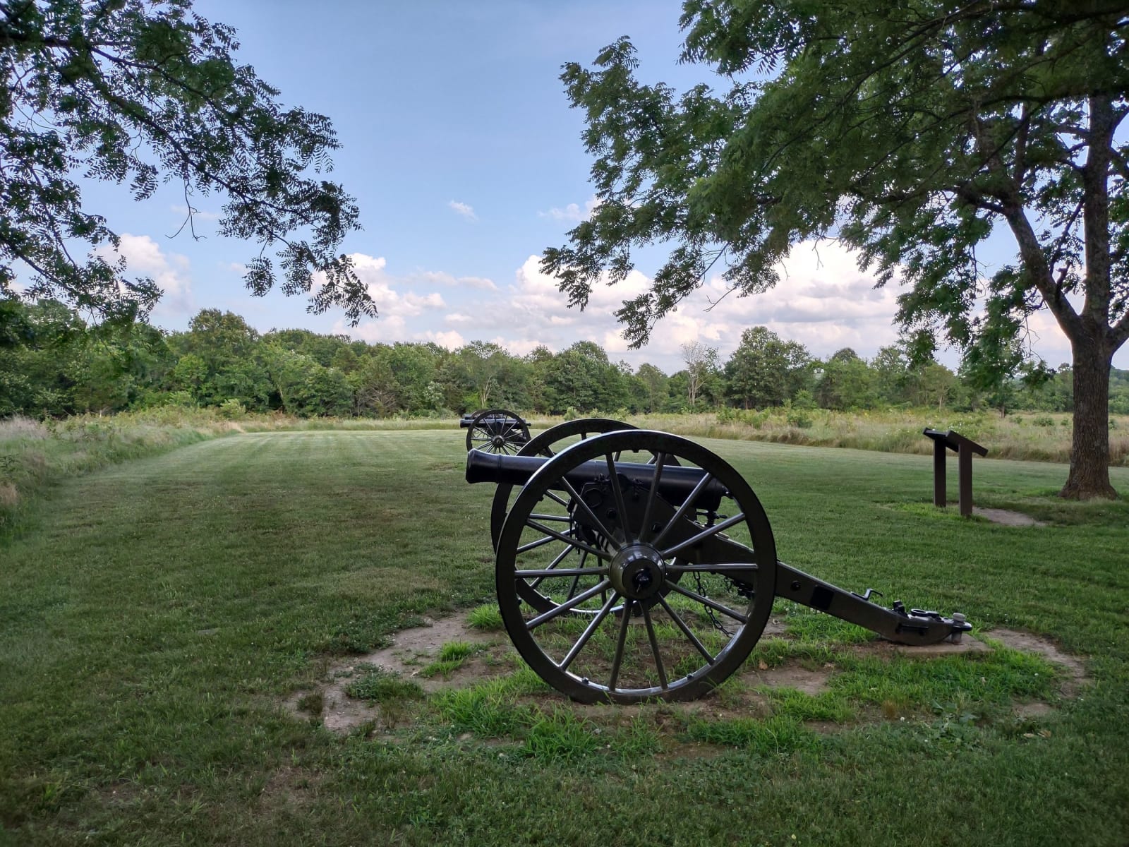
A Civil War cannon on the mown grass under oak trees at Wilsons Creek National Battlefield.Hog Farm / CC BY-SA 4.0 via Wikimedia Commons
🏛️Historical

Wilson's Creek National Battlefield

Part ofSpringfield & the Route 66 Southwest
On this driveRoute 66 Across Missouri: St. Louis to Joplin

The farm valley southwest of Springfield where the first major Civil War battle west of the Mississippi was fought on August 10, 1861, and where Nathaniel Lyon became the first Union general killed.

⏱
Duration
Two to three hours with the tour road.
🎟
Admission
Free. The National Park Service requires no entrance pass.
📅
Best Season
Spring through fall.

The Story

Nothing here was worth a battle in itself: no railroad, no river port, no town. On August 9, 1861, Benjamin McCulloch's Southern army, Confederate troops together with Sterling Price's Missouri State Guard, was camped along Wilson Creek for its water and crops, on the main road to Springfield. McCulloch meant to march on Springfield that night, but rain threatened and he waited. Nathaniel Lyon, holding Springfield with about 5,400 Union troops against some 12,000 Southerners, marched out first in two columns, and at about 5 a.m. on August 10 he struck the camps.

Franz Sigel's guns scattered Southern cavalry from a farm field until a counterattack broke his brigade. On Bloody Hill, Lyon's line held through three assaults, and during the second, at about 9:30 a.m., Lyon was mortally wounded. Short of ammunition, the Union army fell back to Springfield and then to Rolla. Lyon's body was left on the field. Southern soldiers carried it to John Ray's farmhouse, a field hospital by then, where the family laid it out on their best bed, and in Springfield Mary Phelps buried him on her family's farm until relatives took him home to Connecticut.

The South held the field, but its commanders disagreed about what to do next, and the loss pushed the Union to put more troops into Missouri. A five-mile tour road loops past eight stops, among them Bloody Hill, with its 1928 Lyon marker, and the Ray House of 1852. The visitor center holds a museum and the Hulston Civil War research library.

Visitor Info

⏱
Time Needed
Two to three hours with the tour road.
🎟
Admission
Free. The National Park Service requires no entrance pass.
📅
Best Season
Spring through fall.
🛣️
Highway
MO-ZZ/US-60

On the Map

Nearby

The closest stops worth working into your route

cultural9.6 mi away
History Museum on the Square
Springfield's history museum on Park Central Square, on Route 66 itself, with a gallery on how the highway got its number here in 1926 and another on the Osage, Kickapoo and Delaware.
geological31 mi away
Marvel Cave (Silver Dollar City)
A sinkhole cave west of Branson that was mined for guano under a false name, toured by candle from 1894, and turned into Silver Dollar City by the family that leased it in 1950.
cultural32 mi away
Shepherd of the Hills Homestead (Old Matt's Cabin)
The Ross homestead above Mutton Hollow, which Harold Bell Wright's 1907 novel turned into Old Matt's Cabin, drawing readers into the White River hills from the year it appeared.
cultural36 mi away
Ralph Foster Museum
The College of the Ozarks museum named for the Springfield radio pioneer behind KWTO and the Ozark Jubilee, home of the Beverly Hillbillies truck and a Benton painting.
natural43 mi away
Roaring River State Park
A deep valley cut into the edge of the Ozark Plateau south of Cassville, with a fern-hung spring, a trout hatchery on an 1865 mill dam, and land bought with a patent-medicine fortune.
natural45 mi away
Glade Top Trail National Forest Scenic Byway
Twenty-three miles of CCC-built gravel ridge road south of Ava through some of the largest managed glades in the country, with overlooks reaching to the Boston Mountains of Arkansas.

Historical markers nearby

Roadside plaques and monuments within a short detour

Marker2.2 mi away
Springfield
Marker3.4 mi away
Butterfield Overland Mail in Missouri - 1858-1861
Marker13 mi away
Christian County
Marker22 mi away
Galena
Marker23 mi away
Lawrence County
Marker24 mi away
Butterfield Overland Mail in Missouri - 1858-1861