Home / Kentucky / Paducah & Land Between the Lakes / Wickliffe Mounds State Historic Site
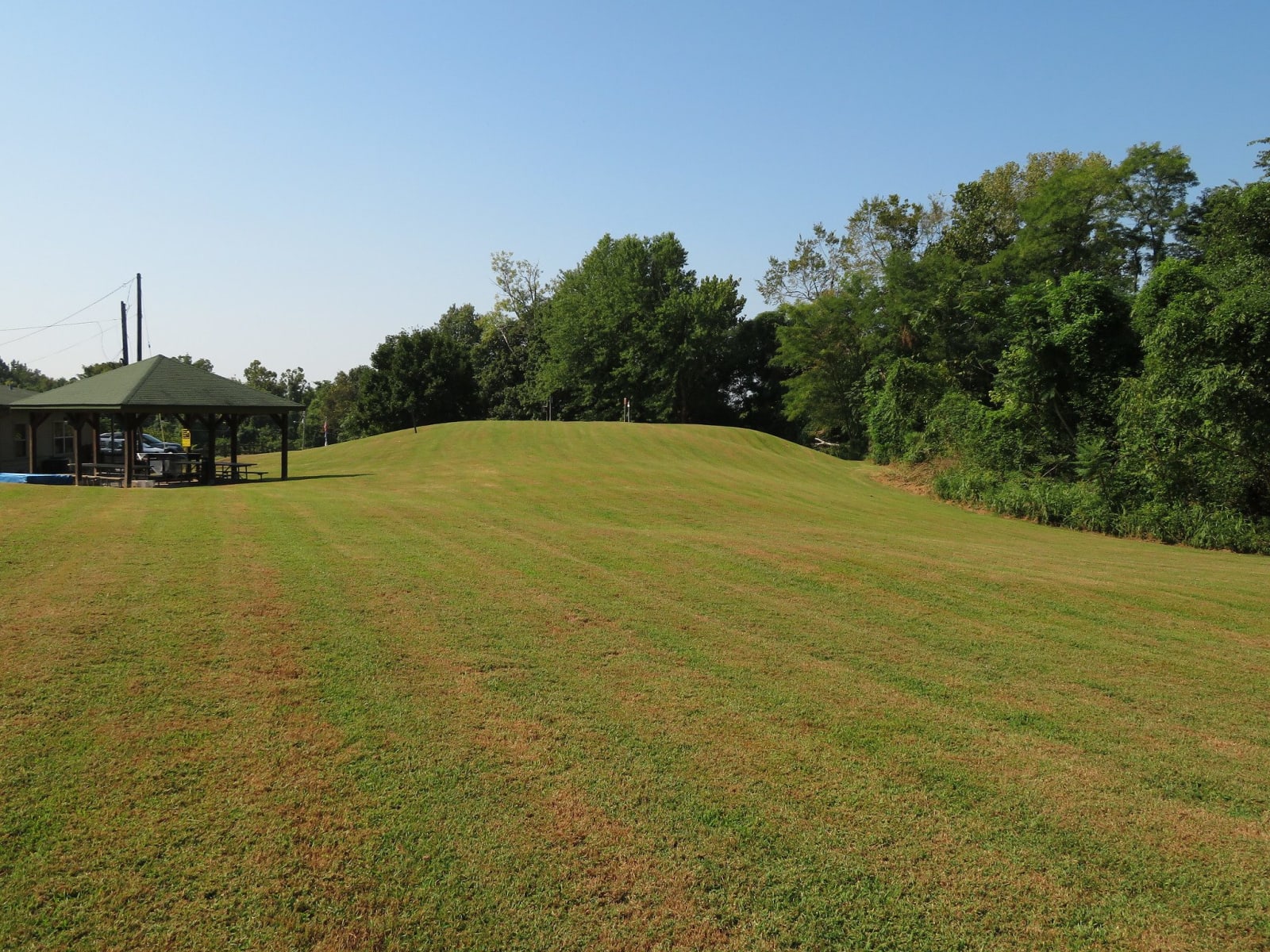
A broad grassy earthen mound rises beside a picnic pavilion under summer trees at Wickliffe Mounds.Ken Lund / CC BY-SA 2.0 via Flickr
🏛️Historical

Wickliffe Mounds State Historic Site

Part ofPaducah & Land Between the Lakes

A Mississippian town of about 1100 to 1350 near the meeting of the Ohio and Mississippi, once a roadside attraction that displayed the dead, now reburied.

⏱
Duration
One to two hours.
🎟
Admission
Museum admission charged; see Kentucky State Parks for current rates.
📅
Best Season
Spring through fall; check Kentucky State Parks for the museum's season and days.

The Story

From about 1100 to 1350 a Mississippian town stood on this bluff three miles from where the Ohio meets the Mississippi. The people who lived here farmed corn and squash, hunted the nearby woods, fished the rivers and built permanent houses around a plaza, with two large platform mounds and at least eight smaller ones. The largest, now called the Ceremonial Mound, held the political and religious life of the town. By about 1350 its people had moved on.

In 1932 Fain King, a Paducah lumberman, paid for the excavation of the mounds and the town's cemetery. He and his wife, Blanche Busey King, opened the site as Ancient Buried City, a roadside attraction that charged admission to see the dead left lying in the ground. A Paducah hospital ran it from 1946 until 1983, when it went to Murray State University. The archaeologist Kit Wesler heard almost at once from Native advocates asking that the bodies be taken off display. They were removed in 1991 and reburied in 2011, and at a public ceremony in 2012 Chickasaw dancers honored the dead. Jefferson Keel, then lieutenant governor of the Chickasaw Nation, said the display had been disgraceful.

Kentucky State Parks has run the site since 2004. The museum shows pottery and stone tools from the town and a painted view of it from above, and a trail follows the bluff. The cemetery is a burial ground, closed to view, and is treated as one.

Visitor Info

⏱
Time Needed
One to two hours.
🎟
Admission
Museum admission charged; see Kentucky State Parks for current rates.
📅
Best Season
Spring through fall; check Kentucky State Parks for the museum's season and days.
🛣️
Highway
US 51 / US 60 / US 62

On the Map

Nearby

The closest stops worth working into your route

historical14 mi away
Columbus-Belmont State Park
The Mississippi bluff Polk fortified in 1861, with a length of his river chain and its anchor, and the town the 1927 flood pushed uphill.
historical21 mi away
Towosahgy State Historic Site
A fortified Mississippian town in the Bootheel fields of Mississippi County, with seven earthen mounds around a plaza and a modern name meant to approximate the Osage and Quapaw words for old town.
natural25 mi away
Big Oak Tree State Park
The last piece of the Bootheel's old bottomland forest, saved in 1938 with schoolchildren's dimes, with a cypress swamp and trees that top 130 feet.
historical28 mi away
Hotel Metropolitan
Maggie Steed's 1908 hotel for Black travelers in Paducah's Upper Town, a Green Book and Chitlin' Circuit stop, now a museum.
cultural29 mi away
National Quilt Museum
Paducah's museum of contemporary quilts since 1991, with more than 700 quilts made after 1980, almost all by women.
cultural29 mi away
Paducah Floodwall Murals
The riverfront wall built after the 1937 flood, painted since 1996 with Paducah's history, at the meeting of the Tennessee and Ohio on land the Chickasaw ceded in 1818.

Historical markers nearby

Roadside plaques and monuments within a short detour

Marker1.1 mi away
Fort Jefferson Site
Wickliffe
Marker8 mi away
County Named, 1886
Bardwell
Marker12 mi away
Mississippi County
Missouri
Marker15 mi away
Columbus
Columbus
Marker17 mi away
Spring Bayou Baptist Church
Paducah
Marker18 mi away
Woodland School
Paducah