Home / Oklahoma / The Wichita Mountains & the Southwest / Wichita Mountains Wildlife Refuge
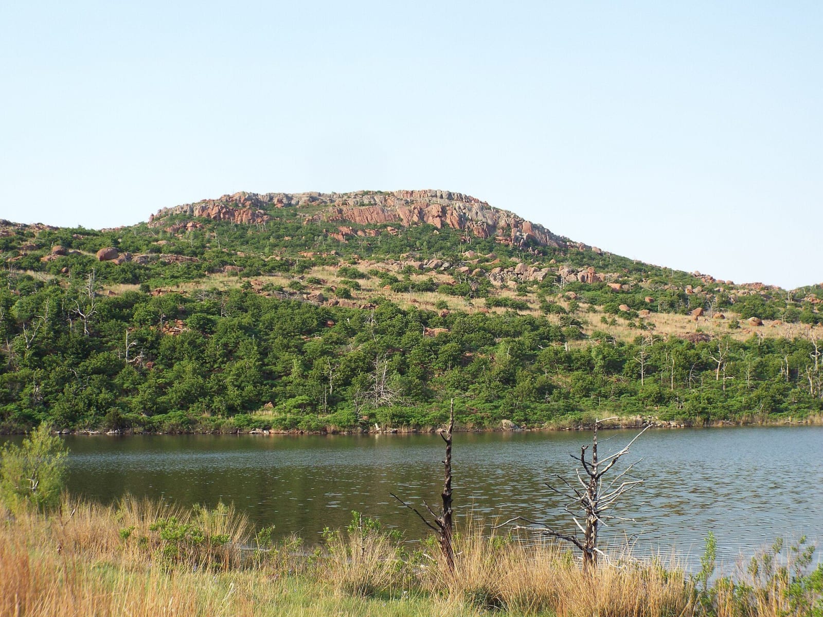
A granite-topped mountain rising above a lake in the Wichita Mountains Wildlife Refuge.gurdonark / CC BY 2.0 via Wikimedia Commons
🌲Natural

Wichita Mountains Wildlife Refuge

Part ofThe Wichita Mountains & the Southwest

Worn granite peaks and mixed-grass prairie in Comanche and Kiowa homeland, set aside in 1901 and restocked in 1907 with fifteen bison sent by train from the New York Zoological Park.

⏱
Duration
Two hours for the Mount Scott drive and the visitor center; a full day with a longer hike such as the six-mile Bison Trail.
🎟
Admission
Free; camping at Doris Campground and Charons Garden backcountry permits carry fees and are booked through Recreation.gov.
📅
Best Season
Year round, sunrise to sunset daily. Animals are most active early and late in the day, and weekdays are far quieter than weekends.

The Story

The Wichitas are old mountains worn low. The granite, rhyolite and gabbro that make them were solidifying underground about 525 million years ago, were pushed up between 330 and 290 million years ago, and have since weathered to hills 400 to 1,000 feet above the plain. The rock defeated the plow, which is why a block of mixed-grass prairie survived here. In 1901, just before the Kiowa-Comanche-Apache reservation around it was opened to settlers, President William McKinley made part of the range a forest reserve.

Theodore Roosevelt turned it into the Wichita Forest and Game Preserve on June 2, 1905. That year the New York Zoological Park, later the Bronx Zoo, offered fifteen bison if the government would fence a range, and in October 1907 the animals arrived by train. Quanah Parker led a Comanche party to meet them, and older Comanche told of the herds they had known before the slaughter. Elk followed in 1908 and longhorn cattle in 1927. The preserve became a wildlife refuge after its 1936 transfer from the Forest Service, and the Charons Garden and North Mountain units were made wilderness in 1970.

Captain Randolph Marcy named Mount Scott in 1851 for General Winfield Scott, and the road to its 2,464-foot top opened in 1938. The refuge covers 59,020 acres, 22,400 of them open to the public. There is no drinking water anywhere on it, cell coverage is patchy, and bison and longhorn wander the roads and trails freely.

Visitor Info

⏱
Time Needed
Two hours for the Mount Scott drive and the visitor center; a full day with a longer hike such as the six-mile Bison Trail.
🎟
Admission
Free; camping at Doris Campground and Charons Garden backcountry permits carry fees and are booked through Recreation.gov.
📅
Best Season
Year round, sunrise to sunset daily. Animals are most active early and late in the day, and weekdays are far quieter than weekends.
🛣️
Highway
OK-49

On the Map

Nearby

The closest stops worth working into your route

cultural14 mi away
Comanche National Museum and Cultural Center
The Comanche Nation's own museum in Lawton, built so that the history, art and lifeways of the Nʉmʉnʉʉ, The People, are told from a Comanche perspective.
cultural33 mi away
Southern Plains Indian Museum
A free federal museum in Anadarko, open since the late 1940s, showing the clothing, shields, cradleboards and art of the Kiowa, Comanche, Wichita, Caddo, Cheyenne, Arapaho, Delaware and Apache nations.
historical39 mi away
Chisholm Trail Heritage Center
Duncan's museum of the cattle trail on US-81, with an 18-minute drive film, a western art gallery and the route through the Chickasaw Nation to Silver City and the Canadian.
historical40 mi away
Museum of the Western Prairie
The Oklahoma Historical Society's museum in Altus, telling southwest Oklahoma from the granite uplift through the Western Trail, Texas's Greer County, dugouts, irrigation and the air base.
natural41 mi away
Quartz Mountain State Park
The granite Quartz Mountains, the low western range of the Wichitas, rising from Lake Altus-Lugert, with a CCC-built park of 1937, a rebuilt lodge and the climbing rock of Baldy Point.
historical59 mi away
Oklahoma Route 66 Museum
The Oklahoma Historical Society's museum of the road in Clinton, decade by decade from the 1926 designation through the Dust Bowl and the war to the 1950s diner.

Historical markers nearby

Roadside plaques and monuments within a short detour

Marker4.7 mi away
Craterville Park
Marker16 mi away
Cutthroat Gap Massacre
Marker19 mi away
Camp Radziminski
Marker27 mi away
Millie Durgan, White Captive
Marker29 mi away
Fort Cobb
Marker30 mi away
Walters, Oklahoma