Home / South Carolina / Greenville & the Upstate Mountains / Table Rock State Park
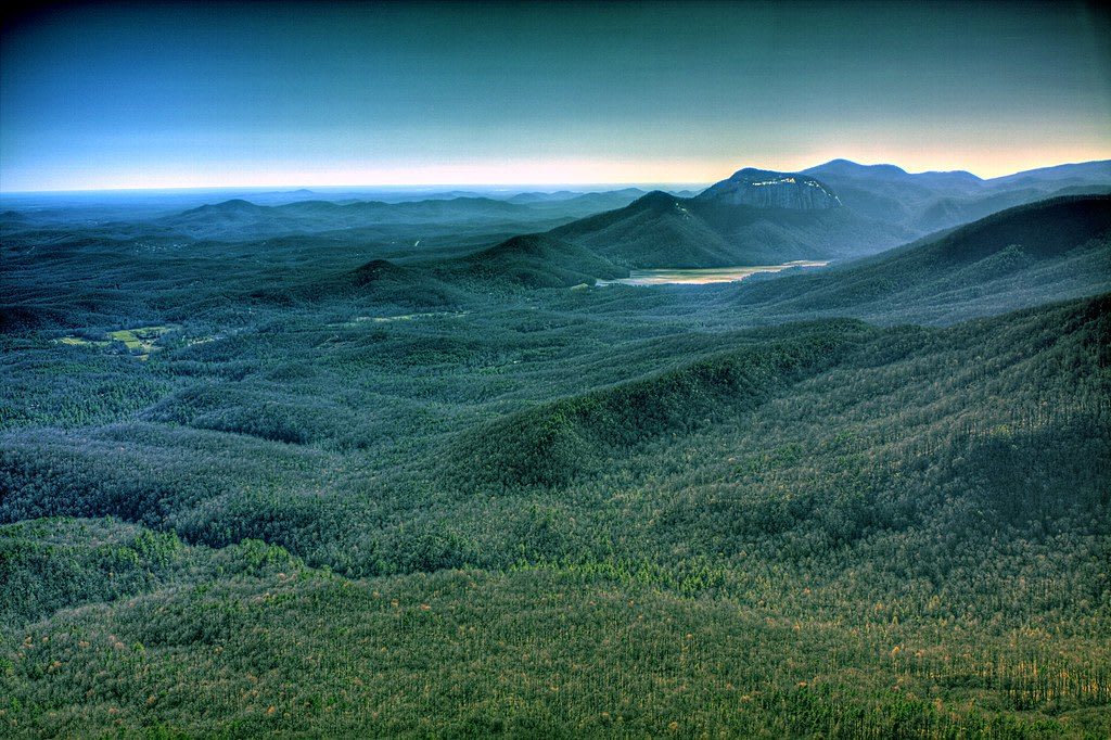
The bare granite face of Table Rock rises above a forested valley and a small lake, seen from a mountaintop at dusk.silicon640c / CC BY 2.0 via Flickr
🌲Natural

Table Rock State Park

Part ofGreenville & the Upstate Mountains
On this driveThe Cherokee Foothills Scenic Highway: Cowpens, Caesars Head, Table Rock, Walhalla and the Chattooga

The bare granite dome the Cherokee called the table of the Great Spirit, and the lodge, lakes and trails the CCC built beneath it in the 1930s.

⏱
Duration
Half a day for the summit; an hour for Carrick Creek Falls.
🎟
Admission
$6 adults, $3.75 South Carolina seniors, $3.50 children 6-15, under 6 free (South Carolina State Parks, 2026).
📅
Best Season
Year round; fall color in late October and November, swimming at the lake in summer.

The Story

The Cherokee knew this country as the Great Blue Hills of God, and by an old account they saw the flat-topped mountain as the table where the Great Spirit took his meals. The rock is old granite. A batholith formed miles underground when a continental fragment or island arc collided with ancient North America about 430 million years ago, later collisions squeezed and reheated it into granitic gneiss, and the softer rock around it wore away, leaving a monadnock that stands alone above the foothills. Look for dark amphibolite, old ocean crust, along the trails at its base.

The park is a Depression work. Civilian Conservation Corps companies built it through the 1930s, junior companies taking over from the original veterans' crews in 1936, and their work includes the lodge and the dam that made Pinnacle Lake. It opened with a ceremony on April 4, 1938, and its CCC buildings became a National Register historic district in 1989.

Register at the trailhead before you climb. The summit trail runs 3.5 miles and gains about 2,000 feet; a fork about 2.5 miles up follows a ridge to Pinnacle Mountain instead. This is also the eastern end of the 80-mile Foothills Trail along the escarpment. For less effort, walk the lakeshore or wade at Carrick Creek in summer.

Visitor Info

⏱
Time Needed
Half a day for the summit; an hour for Carrick Creek Falls.
🎟
Admission
$6 adults, $3.75 South Carolina seniors, $3.50 children 6-15, under 6 free (South Carolina State Parks, 2026).
📅
Best Season
Year round; fall color in late October and November, swimming at the lake in summer.
🛣️
Highway
SC 11

On the Map

Nearby

The closest stops worth working into your route

geological7 mi away
Caesars Head State Park
A granite cliff on the lip of the Blue Ridge Escarpment, with a long view across the Piedmont and the trail to 420-foot Raven Cliff Falls.
historical12 mi away
Keowee-Toxaway State Park
A foothills park on Lake Keowee, whose water covers the Cherokee town of Keowee and the site of Fort Prince George.
natural15 mi away
Devils Fork State Park
The only public way onto Lake Jocassee, a clear, cold reservoir over the Jocassee valley, where Oconee bells bloom along the trail each March.
natural18 mi away
Whitewater Falls
Upper Whitewater Falls, a 411-foot plunge off the Blue Ridge Escarpment just north of the South Carolina line in the Nantahala National Forest.
geological19 mi away
Looking Glass Rock
A bare granite dome rising out of Pisgah National Forest northwest of Brevard, climbed by a forest trail and by rock climbers on its cliffs.
historical20 mi away
Falls Park on the Reedy
The Reedy River falls in downtown Greenville, where Richard Pearis built his mill in the 1770s, reclaimed from old mill land since 1967 and crossed by the Liberty Bridge.

Historical markers nearby

Roadside plaques and monuments within a short detour

Marker9.4 mi away
Hagood-Mauldin House
Pickens
Marker9.6 mi away
Old Pickens Gaol
Pickens
Marker9.6 mi away
Dacusville
Dacusville
Marker11 mi away
Estatoe Path
Rosman, North Carolina
Marker11 mi away
Tanneries
Rosman, North Carolina
Marker12 mi away
NASA Tracking
Rosman, North Carolina