Home / North Carolina / Asheville & the Blue Ridge / Looking Glass Rock
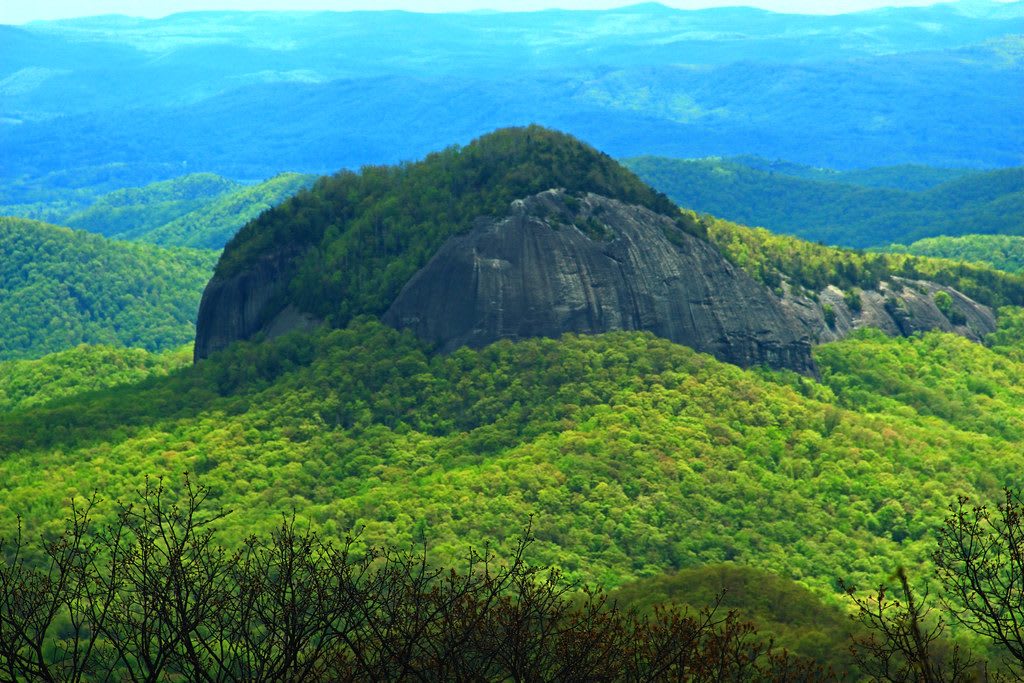
The bare gray granite face of Looking Glass Rock rising from a forested ridge under a hazy blue sky.Mark Steele / Public Domain Mark via Flickr
🏜️Geological

Looking Glass Rock

Part ofAsheville & the Blue Ridge

A bare granite dome rising out of Pisgah National Forest northwest of Brevard, climbed by a forest trail and by rock climbers on its cliffs.

⏱
Duration
Three to five hours for the summit hike.
🎟
Admission
Free (USFS, 2026).
📅
Best Season
Year round in good weather; fall for color, winter for clear views. North Face climbing routes near the falcon nest close mid-January to mid-August.

The Story

Looking Glass Rock is a pluton, a body of granite that cooled deep underground and was later laid bare as the softer rock around it wore away. It is an exfoliation dome, its granite shed in curved sheets, and it rises from the valley floor to almost 4,000 feet, about five and a half miles northwest of Brevard and 25 miles southwest of Asheville. The name comes from the way its bare granite face reflects the sun.

The Looking Glass Rock Trail leaves Forest Service Road 475 and climbs about 1,700 feet in 3.1 miles to a flat slab at the top with a long view across Transylvania County to the Blue Ridge Parkway. It is a steady climb all the way. The cliffs carry dozens of climbing routes on the South Face, North Face, Nose and Sun Wall. Peregrine falcons nest on the North Face, and every year the Forest Service closes the routes near the nest and the ground below them from mid-January to mid-August.

The dome is easiest to see whole from the Blue Ridge Parkway, which has an overlook named for it. Helene shut the Pisgah Ranger District in the fall of 2024; most of its roads and trails reopened that winter, and no closure was posted for this trail in November 2026, though the Forest Service alerts page is worth checking first.

Visitor Info

⏱
Time Needed
Three to five hours for the summit hike.
🎟
Admission
Free (USFS, 2026).
📅
Best Season
Year round in good weather; fall for color, winter for clear views. North Face climbing routes near the falcon nest close mid-January to mid-August.
🛣️
Highway
US 276

On the Map

Nearby

The closest stops worth working into your route

historical4.1 mi away
Cradle of Forestry in America
The Pink Beds valley in Pisgah National Forest where Carl Schenck's Biltmore Forest School trained the country's first generation of foresters.
geological15 mi away
Caesars Head State Park
A granite cliff on the lip of the Blue Ridge Escarpment, with a long view across the Piedmont and the trail to 420-foot Raven Cliff Falls.
historical19 mi away
Carl Sandburg Home (Connemara)
The Flat Rock farm where Carl Sandburg wrote and Lilian Sandburg raised champion goats, first built in 1838 by an enslaver and Confederate treasury secretary.
natural19 mi away
Table Rock State Park
The bare granite dome the Cherokee called the table of the Great Spirit, and the lodge, lakes and trails the CCC built beneath it in the 1930s.
natural22 mi away
Whitewater Falls
Upper Whitewater Falls, a 411-foot plunge off the Blue Ridge Escarpment just north of the South Carolina line in the Nantahala National Forest.
historical23 mi away
Biltmore Estate
George Vanderbilt's 1895 house south of Asheville, built by about a thousand workers on land bought from Shiloh, a Black community the estate moved a mile away.

Historical markers nearby

Roadside plaques and monuments within a short detour

Marker0.4 mi away
Civilian Conservation Corps
Pisgah Forest
Marker4.2 mi away
Estatoe Path
Brevard
Marker4.5 mi away
Brevard College
Brevard
Marker5.6 mi away
Football Team
Brevard
Marker6 mi away
Walton War
Brevard
Marker8.5 mi away
A. S. Merrimon
Brevard