Home / South Carolina / Greenville & the Upstate Mountains / Falls Park on the Reedy
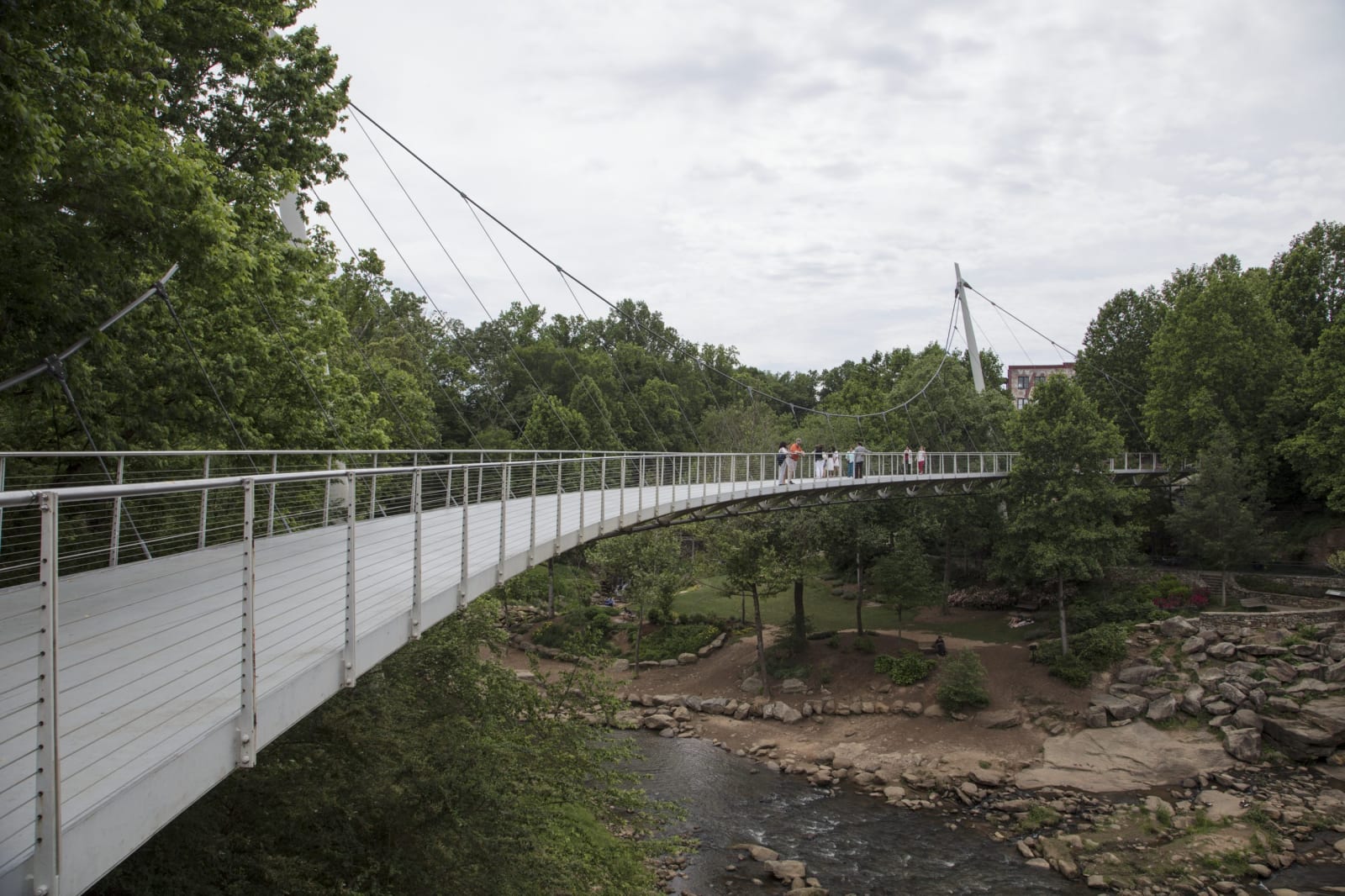
A curving white pedestrian bridge hung from cables on one side crosses a wooded river gorge with rocks below.Carol M. Highsmith / public domain via Library of Congress
🏛️Historical

Falls Park on the Reedy

Part ofGreenville & the Upstate Mountains

The Reedy River falls in downtown Greenville, where Richard Pearis built his mill in the 1770s, reclaimed from old mill land since 1967 and crossed by the Liberty Bridge.

⏱
Duration
One to two hours.
🎟
Admission
Free.
📅
Best Season
Year round; spring and fall are the most comfortable.

The Story

Greenville began at these falls. Sometime after 1770 Richard Pearis, a Virginia trader who had a son, George, with a Cherokee woman in the 1750s, began clearing a hundred acres beside the falls of the Reedy with his family and twelve enslaved people. His claim rested on Cherokee deeds, one of which a court at Ninety Six ordered him to surrender in 1773; he took a new one in his son's name. On the plantation he called Great Plains he built a house, a store, a gristmill and a sawmill. Pearis sided with the Crown in the Revolution, his opponents burned the place in July 1776, and the state confiscated the land in 1778.

The town was laid out in 1797 on both sides of Pearis's wagon road, and after 1815 Vardry McBee put a store and a pair of mills on the river. By 1920 Greenville County ran more spindles than any other county in the state, and the ground around the falls became mill land. The reclaiming began in 1967, when the Carolina Foothills Garden Club took on 26 acres of old mill land, and the city kept at it through the late 1990s.

The centerpiece now is the Liberty Bridge, finished in 2004, a 355-foot footbridge that curves over the falls hung from cables on one side only. A wall of an early mill still stands in the gardens. Come down from Main Street, cross the bridge, then take the paths down along the river.

Visitor Info

⏱
Time Needed
One to two hours.
🎟
Admission
Free.
📅
Best Season
Year round; spring and fall are the most comfortable.
🛣️
Highway
Main Street

On the Map

Nearby

The closest stops worth working into your route

natural20 mi away
Table Rock State Park
The bare granite dome the Cherokee called the table of the Great Spirit, and the lodge, lakes and trails the CCC built beneath it in the 1930s.
geological22 mi away
Caesars Head State Park
A granite cliff on the lip of the Blue Ridge Escarpment, with a long view across the Piedmont and the trail to 420-foot Raven Cliff Falls.
historical25 mi away
Walnut Grove Plantation
The Moore family's 1760s backcountry farm near Roebuck, worked by the family and a dozen enslaved people, where militia mustered before Cowpens.
historical26 mi away
Pendleton Historic District
The 1790 seat of old Pendleton District around its village green and Farmers Hall, with Woodburn, where Jane Edna Hunter was born to sharecroppers in 1882.
cultural27 mi away
Nina Simone's Tryon
The foothill town where Eunice Waymon was born in 1933, learned piano and refused to play until her parents got their front-row seats back.
historical27 mi away
Fort Hill
John C. Calhoun's plantation house on the Clemson campus, kept with the names of the enslaved people who built and worked Fort Hill.

Historical markers nearby

Roadside plaques and monuments within a short detour

Marker0.3 mi away
Joel Roberts Poinsett
Greenville
Marker0.4 mi away
Furman University
Greenville
Marker0.5 mi away
Textile Hall
Greenville
Marker0.5 mi away
Christ Church (Episcopal)
Greenville
Marker0.7 mi away
Hampton-Pinckney Neighborhood
Greenville
Marker0.7 mi away
Springwood Cemetery
Greenville