Home / Georgia / Andersonville, Plains & Southwest Georgia / Providence Canyon State Park
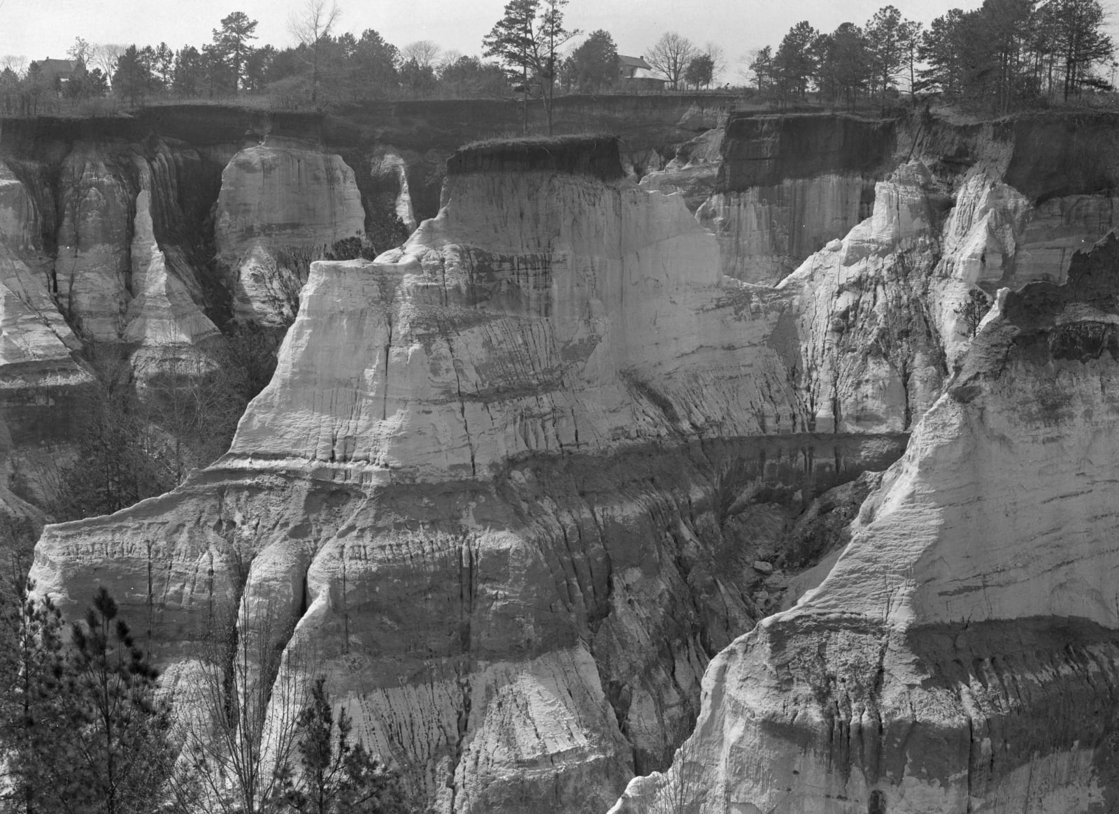
Pale, layered canyon walls and pinnacles of eroded sand in Stewart County, Georgia, photographed in February 1937.Farm Security Administration, 1937 / public domain via the Library of Congress (FSA/OWI, LC-USF34-025202-D)
🏜️Geological

Providence Canyon State Park

Part ofAndersonville, Plains & Southwest Georgia

Sixteen gullies up to 150 feet deep west of Lumpkin, cut not by a river but by rain running off cotton fields cleared in the early 1800s, with walls in dozens of colors.

⏱
Duration
Two to four hours; overnight on the backcountry trail.
🎟
Admission
Georgia State Parks ParkPass parking fee per vehicle; annual passes accepted (2026).
📅
Best Season
Year round; July and August for the plumleaf azalea, fall and winter for cool hiking. The canyon floor is often wet and muddy.

The Story

This was Muscogee (Creek) land until the treaties of 1825 and 1826, and in 1827 the state gave it away by lottery. Settlers cleared the forest and planted cotton, and by mid-century Stewart County was among the top three cotton producers in Georgia. Nothing was done to hold the soil, and rain running off the fields began cutting small gullies that grew quickly deeper; by 1850 the ditches were three to five feet deep, concentrating the runoff and speeding the damage. The canyon takes its name from Providence Methodist Church, founded about 1832 on ground that now lies between the main gorges; its 1859 building still stands across the road.

The walls show what the plows uncovered. The red sands near the top belong to the Clayton formation, laid down just after the age of the dinosaurs. Below them the Providence Sand, more than a hundred feet thick and 67 to 70 million years old, runs from white kaolin through yellow and purple to a black mica clay near the floor, some forty-three colors in all. The canyon is still widening; pinnacles shrink and can fall in a single heavy rain.

The rim trail runs past overlooks into the canyons, and trails drop to the floor, where a thin sheet of water usually covers the trail. Canyons 4 and 5 are the deepest. In July and August the rare plumleaf azalea, found only in this corner of Georgia and Alabama, blooms here in its largest wild colony. Stay behind the fences; the edges collapse, and carving or climbing on the walls is fined.

Visitor Info

⏱
Time Needed
Two to four hours; overnight on the backcountry trail.
🎟
Admission
Georgia State Parks ParkPass parking fee per vehicle; annual passes accepted (2026).
📅
Best Season
Year round; July and August for the plumleaf azalea, fall and winter for cool hiking. The canyon floor is often wet and muddy.
🛣️
Highway
GA 39C

On the Map

Nearby

The closest stops worth working into your route

recreational7.5 mi away
Florence Marina State Park
A small park at the head of Lake Walter F. George on the Chattahoochee, on the site of the river town of Florence, near where Muscogee fighters burned Roanoke in 1836.
natural11 mi away
Eufaula National Wildlife Refuge
An 11,184-acre refuge on Lake Eufaula and the Chattahoochee, set aside in 1964 for wintering waterfowl, with an eight-mile wildlife drive and an observation tower.
historical18 mi away
Seth Lore and Irwinton Historic District
Eufaula's bluff-top downtown and its streets of Italianate houses, laid out on Creek land in the 1830s and the scene of the 1874 election-day attack on Black voters.
historical18 mi away
Fendall Hall
Edward Young's Italianate house on College Hill in Eufaula, finished in 1860 with the work of hired enslaved craftsmen and kept by the Alabama Historical Commission.
historical20 mi away
Fort Mitchell Historic Site
The Chattahoochee River post that guarded the Federal Road through the Creek Nation, housed its agency, and in 1836 became the gathering point for Creek removal west.
cultural23 mi away
National Infantry Museum and Soldier Center
The Army's infantry museum outside the gates of Fort Benning, on ground near the Lower Creek town of Cusseta, with galleries from the Revolution to the present and a restored World War II company street.

Historical markers nearby

Roadside plaques and monuments within a short detour

Marker7.3 mi away
John Wellborn Root Birthplace Site
Lumpkin
Marker7.4 mi away
Lumpkin and Stewart County
Lumpkin
Marker10 mi away
Methodist Camp Ground
Lumpkin
Marker12 mi away
Spanish Fort, 1689-1691
Holy Trinity, Alabama
Marker17 mi away
Quitman County
Georgetown
Marker17 mi away
The Lynching of William "Willie Lee" Jenkins
Eufaula, Alabama