Home / Alabama / Tuskegee & East Alabama / Fort Mitchell Historic Site
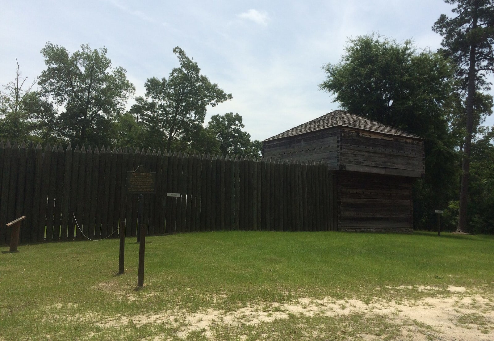
The pointed-log stockade wall and a log blockhouse of the reconstructed Fort Mitchell, on a grassy lawn with a historical marker.dofftoubab / CC BY-SA 3.0 via Wikimedia Commons
🏛️Historical

Fort Mitchell Historic Site

Part ofTuskegee & East Alabama

The Chattahoochee River post that guarded the Federal Road through the Creek Nation, housed its agency, and in 1836 became the gathering point for Creek removal west.

⏱
Duration
One to two hours.
🎟
Admission
Small admission fee for the visitor center and fort.
📅
Best Season
Year round; spring and fall are best for walking the grounds.

The Story

This stretch of the Chattahoochee was the heart of the Lower Creek towns, and Fort Mitchell stood on the horse path that became the Federal Road, the route settlers used to cross the Creek Nation from Georgia. Georgia militia under John Floyd built the first stockade here in 1813 and struck the Red Stick towns of Atasi and Tallassee from it, while the Lower Creek chief Little Prince, Tastanaki Hopayi, kept a tavern beside the fort.

After the war it became the place where the United States dealt with the Creeks. A government trading house moved here in 1817, and in 1821 John Crowell set up the Creek agency. The Fourth Infantry rebuilt the fort in 1825 and held it until 1840, in principle to keep squatters off Creek land; in 1833 Andrew Jackson sent Francis Scott Key to look into the land disputes, and Key reportedly found the settlers at fault. The 1832 Treaty of Cusseta had split the remaining Creek land into allotments, and fraud, theft and violence followed. When some Creeks fought back in 1836, the government ordered the removal of the whole nation, and thousands of men, women and children started west from Fort Mitchell in 1836 and 1837.

A reconstruction of the 1813 stockade stands on the original site beside a visitor center with a film and exhibits. Next door, the Chattahoochee Indian Heritage Center, dedicated in 2002 with the Poarch Band of Creek Indians among its advisers, lists names from the 1833 Creek census on bronze panels around a model town square and a stickball field.

Visitor Info

⏱
Time Needed
One to two hours.
🎟
Admission
Small admission fee for the visitor center and fort.
📅
Best Season
Year round; spring and fall are best for walking the grounds.
🛣️
Highway
AL 165

On the Map

Nearby

The closest stops worth working into your route

cultural4.9 mi away
National Infantry Museum and Soldier Center
The Army's infantry museum outside the gates of Fort Benning, on ground near the Lower Creek town of Cusseta, with galleries from the Revolution to the present and a restored World War II company street.
cultural8.4 mi away
Ma Rainey House and Blues Museum
The two-story frame house on Fifth Avenue that Gertrude "Ma" Rainey, the Mother of the Blues, bought for her mother and came home to in the 1930s, now a small city-run museum.
recreational8.5 mi away
Chattahoochee RiverWalk
Twenty-two miles of riverside path through Columbus, past the falls named for the Muscogee town of Coweta, the old mill district and a whitewater course made by breaching two dams.
cultural8.5 mi away
Springer Opera House
An 1871 theater on Tenth Street, saved from the wrecking ball in 1964 and named the State Theatre of Georgia, still staging a full season under its two balconies.
recreational18 mi away
Florence Marina State Park
A small park at the head of Lake Walter F. George on the Chattahoochee, on the site of the river town of Florence, near where Muscogee fighters burned Roanoke in 1836.
geological20 mi away
Providence Canyon State Park
Sixteen gullies up to 150 feet deep west of Lumpkin, cut not by a river but by rain running off cotton fields cleared in the early 1800s, with walls in dozens of colors.

Historical markers nearby

Roadside plaques and monuments within a short detour

Marker0 mi away
Indian Ball Ground
Fort Mitchell
Marker0.2 mi away
Asbury School and Mission
Fort Mitchell
Marker6.5 mi away
South Girard High School
Phenix City
Marker6.6 mi away
"Torch Hill"
Columbus, Georgia
Marker7.5 mi away
Mother Mary Mission School and Church
Phenix City
Marker8.3 mi away
Columbus Iron Works
Columbus, Georgia