Home / Georgia / Macon, Milledgeville & Middle Georgia / Piedmont National Wildlife Refuge
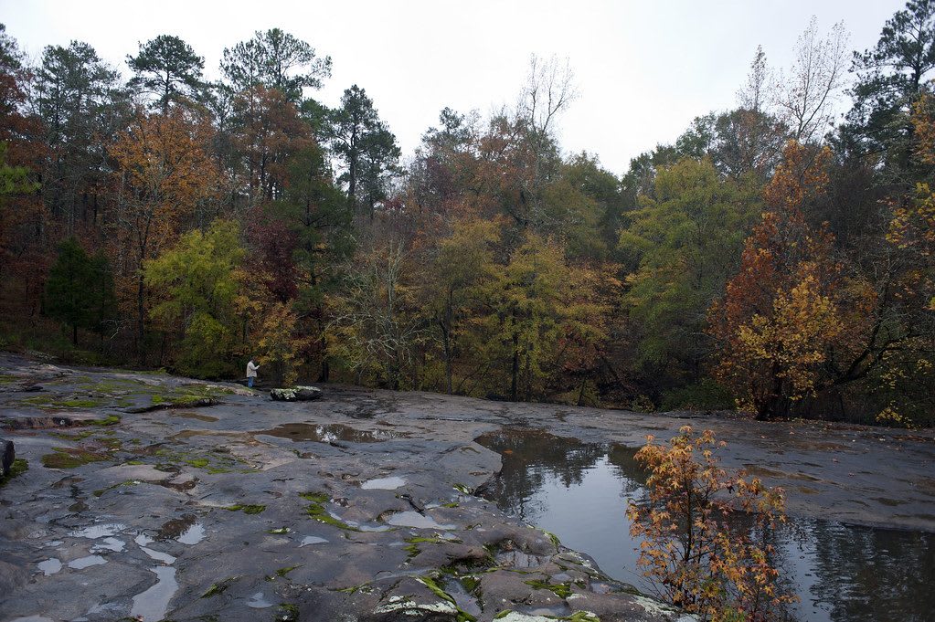
A broad flat rock outcrop with rainwater pools beside a creek, edged by trees in autumn color.USFWS Southeast / CC BY 2.0 via Flickr
🌲Natural

Piedmont National Wildlife Refuge

Part ofMacon, Milledgeville & Middle Georgia

Some 35,000 acres of worn-out cotton land in Jones and Jasper counties, returned to pine and hardwood forest since 1939 and home to red-cockaded woodpeckers.

⏱
Duration
Two hours to a full day.
🎟
Admission
Free; permits required for hunting and fishing (USFWS, 2026).
📅
Best Season
Year round; spring for birds, winter for waterfowl. Open daily sunrise to sunset except during firearm deer hunts; visitor center weekdays 8 a.m. to 4 p.m. as staffing allows (USFWS, 2026).

The Story

This land passed from the Muscogee (Creek) to Georgia in the early 1800s and became cotton country. By the early twentieth century the cotton lands in the northwest corner of Jones County were worn out and eroded. In the 1930s more than 30,000 acres here and in neighboring Jasper County were gathered into a refuge, established in 1939 to show that wildlife could be brought back on exhausted ground.

It worked. Today the refuge covers about 35,000 acres of loblolly pine on the ridges and hardwoods along the creek bottoms, managed as a model of forest care for wildlife. It gives vital habitat to the endangered red-cockaded woodpecker and to migrating waterfowl.

More than 50 miles of gravel roads are open to cars most of the year, and over seven miles of walking trails start near the visitor center on Allison Lake Road, which has exhibits and trail maps. Visiting is free and the refuge is open sunrise to sunset, but parts close during firearm deer hunts; check before you go in the fall. From I-75 take exit 186 at Forsyth and drive east about 18 miles, or come in on GA 11 between Gray and Monticello.

Visitor Info

⏱
Time Needed
Two hours to a full day.
🎟
Admission
Free; permits required for hunting and fishing (USFWS, 2026).
📅
Best Season
Year round; spring for birds, winter for waterfowl. Open daily sunrise to sunset except during firearm deer hunts; visitor center weekdays 8 a.m. to 4 p.m. as staffing allows (USFWS, 2026).
🛣️
Highway
GA 11

On the Map

Nearby

The closest stops worth working into your route

historical4.8 mi away
Jarrell Plantation State Historic Site
A Jones County cotton farm held by one family for 140 years, where 42 enslaved people worked the land by 1863 and later generations ran steam-powered mills.
historical17 mi away
Indian Springs State Park
The mineral spring near Flovilla where William McIntosh signed away the last Muscogee land in Georgia in 1825, and paid for it under Muscogee law; a state park since 1927.
cultural19 mi away
The Allman Brothers Band Museum at the Big House
The Vineville Avenue house in Macon where the Allman Brothers Band, their crew and families lived from 1970 to 1973, now a museum of the band and of Capricorn-era southern rock.
historical20 mi away
Ocmulgee Mounds National Historical Park
Earthworks raised about a thousand years ago on the bluff above the Ocmulgee River, ancestral homeland of the Muscogee (Creek) Nation, with a rebuilt earth lodge over its original floor.
cultural20 mi away
Tubman Museum
Macon's museum of African American art, history and culture, begun by a parish priest in a downtown warehouse in 1981 and now in a building facing Terminal Station.
natural20 mi away
High Falls State Park
Cascades on the Towaliga River northwest of Macon, with the ruins of a mill town the railroad passed by and a lake known for white and hybrid bass.

Historical markers nearby

Roadside plaques and monuments within a short detour

Marker5.1 mi away
Birthplace of Benjamin Harvey Hill
Hillsboro
Marker6.9 mi away
Dames Ferry
Dames Ferry
Marker11 mi away
Samuel Griswold Iron-Master
Gray
Marker11 mi away
Jones County
Gray
Marker13 mi away
Jasper County
Monticello
Marker15 mi away
Tift College
Forsyth