Home / South Dakota / Pierre & the Missouri River Lakes / Oahe Dam
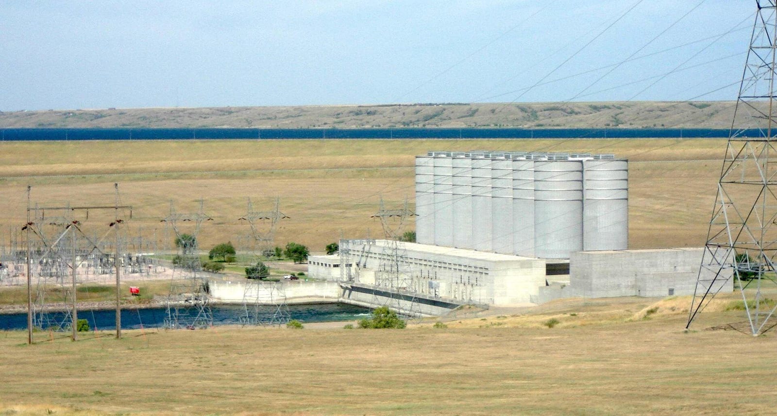
The Oahe powerhouse below the dam, with its row of tall cylindrical surge tanks and transmission towers beside the tailraceWtshymanski / public domain via Wikimedia Commons
🏭Industrial

Oahe Dam

Part ofPierre & the Missouri River Lakes
On this driveThe Missouri: Chamberlain to Mobridge

One of the largest rolled-earth dams in the world, dedicated by President Kennedy in 1962, holding back a reservoir that reaches more than 230 miles to Bismarck.

Free
⏱
Duration
One hour.
🎟
Admission
Free; visitor center open in summer, powerplant tours seasonal.
📅
Best Season
Late spring through early fall.

The Story

Six miles north of Pierre the Missouri stops at a ridge of packed earth more than nine thousand feet long. The Army Corps of Engineers began Oahe Dam in 1948 as the largest of the main-stem dams in the Pick-Sloan plan, building it not of concrete but of earth and shale rolled down in layers, and it remains one of the largest rolled-earth dams in the world. Water reaches the powerhouse at its foot through tunnels driven under the embankment, and the plant's turbines send power across the northern plains.

President John F. Kennedy came to dedicate it in August 1962, speaking to a crowd on the face of the dam about water, power and the development of the West. Behind it Lake Oahe filled over the following years until it stretched more than 230 miles upriver, past Mobridge and into North Dakota almost to Bismarck, one of the largest reservoirs in the country. It drew a new economy of walleye fishing, salmon stocking, marinas and lake cabins.

It also drowned the river's timbered bottomland for most of that distance, and the reservoir now covers ground the Standing Rock and Cheyenne River nations had lived on, along with the farms and agency towns that went with it. The Corps' visitor center above the dam tells the engineering story, and a small white mission chapel kept on the bluff nearby is a reminder of the valley under the water.

Visitor Info

⏱
Time Needed
One hour.
🎟
Admission
Free; visitor center open in summer, powerplant tours seasonal.
📅
Best Season
Late spring through early fall.
🛣️
Highway
SD-1804

On the Map

Nearby

The closest stops worth working into your route

architectural6.3 mi away
South Dakota State Capitol
A copper-domed capitol built to end three elections' worth of fighting over where the capital belonged, beside a lake fed by an artesian well with a gas flame burning in it.
historical6.5 mi away
Verendrye Monument
The hilltop above Fort Pierre where three children found a lead plate in 1913 that two French brothers had buried in 1743 to claim the West for their king.
roadside42 mi away
Pioneer Auto Show
Forty-odd buildings of old cars, tractors, motorcycles and everything else a Murdo car dealer and his sons couldn't stop buying, a block off I-90 since 1954.
cultural56 mi away
Lakota Cultural Center, Eagle Butte
The Cheyenne River Sioux Tribe's own cultural center, beside the tribal headquarters on the highway into Eagle Butte, with a hall of murals by local artists.
cultural69 mi away
Akta Lakota Museum and Cultural Center
A museum on the campus of a Catholic boarding school for Lakota children founded in 1927, built from gifts of the school's alumni and named to honor the people.
cultural70 mi away
Dignity of Earth and Sky
A fifty-foot stainless-steel Lakota woman on the bluff above the Missouri, her star quilt made of 128 blue diamonds that shiver in the wind.