Home / Arkansas / Texarkana, El Dorado & the Timberlands / Magnolia Square and the Columbia County Courthouse
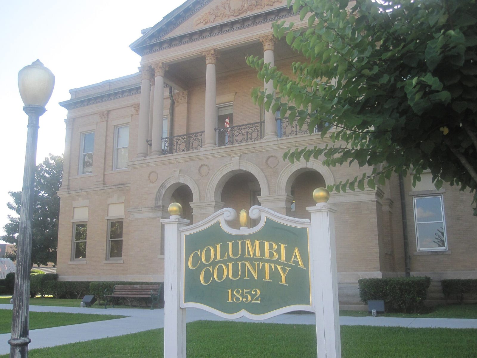
The Columbia County Courthouse in Magnolia, a buff-brick building with a three-arch ground floor and a columned balcony, behind the green county sign.Billy Hathorn / CC BY-SA 3.0 via Wikimedia Commons
🏗️Architectural

Magnolia Square and the Columbia County Courthouse

Part ofTexarkana, El Dorado & the Timberlands

The 1906 courthouse and square at the center of a town founded in 1853, where oil came in 1922, Southern Arkansas University grew from a farm school, and Jordan Jameson was burned to death in 1919.

⏱
Duration
One hour.
🎟
Admission
Free; the square is open to walk, and the courthouse is a working county building with weekday office hours.
📅
Best Season
Year round. Spring is best, with the Magnolia Blossom Festival (Encyclopedia of Arkansas).

The Story

Magnolia was laid out in 1853 after Columbia County was created, on land deeded by J. J. Thomas and John L. McCarty, and a one-room log cabin served as the first courthouse. Cotton drove the early economy, and the Encyclopedia of Arkansas says many early settlers were slaveholders. The current courthouse, finished in 1906 and designed by William S. Hull, is the third on the site and a Second Renaissance Revival building with a three-bay arcade and a colonnaded portico. It reached the National Register on April 15, 1978. Logoly State Park's founders met here in the 1970s.

The square is also where Jordan Jameson died. Jameson, a Black man, reportedly shot and killed Sheriff Benjamin Greer on November 7, 1919, when the sheriff came to arrest him. A posse captured him early on November 11, and a mob took him from it. At about 5 a.m., the Encyclopedia says, he was tied to a stake on the public square, a fire was built around him, and he burned to death as a growing crowd watched. The National Equal Rights League asked Governor Charles Brough to punish the white people who burned him. Brough said he deplored the lynching but would not be swayed by the league on cases arising from the Elaine Massacre.

Oil came to the county on June 8, 1922, and later bromine from oil-field brine. Southern Arkansas University began in 1909 as the Third District Agricultural School, and its campus, once north of the city, has been joined to it by later growth.

Visitor Info

⏱
Time Needed
One hour.
🎟
Admission
Free; the square is open to walk, and the courthouse is a working county building with weekday office hours.
📅
Best Season
Year round. Spring is best, with the Magnolia Blossom Festival (Encyclopedia of Arkansas).
🛣️
Highway
US 79 / US 82

On the Map

Nearby

The closest stops worth working into your route

natural6.4 mi away
Logoly State Park
Arkansas's first environmental education state park, built on the Magnesia Springs resort and a Boy Scout camp, with about 200 acres of mature forest kept as a natural area.
historical29 mi away
Poison Spring Battleground State Park
An 85-acre roadside battlefield west of Camden, where Confederates routed a Union foraging column on April 18, 1864, and many Black soldiers of the 1st Kansas Colored Infantry were killed after surrendering.
industrial31 mi away
Arkansas Museum of Natural Resources
A free state museum on the Smackover field, where a 112-foot derrick, a rebuilt 1920s boomtown street and working pumps tell how oil and bromine remade south Arkansas.
recreational31 mi away
White Oak Lake State Park
A 725-acre park on the lower of two 1961 lakes, where white sand marks an ancient shoreline and the visitor center carries a Poison Spring display eight miles from the battlefield.
historical32 mi away
McCollum-Chidester House Museum
An 1847 Greek Revival house in Camden that served as a stagecoach headquarters and, in April 1864, as General Steele's headquarters, with bullet holes still visible upstairs.
historical34 mi away
El Dorado Commercial Historic District
The courthouse square and brick blocks of a town that jumped from 4,000 people to nearly 30,000 after the 1921 Busey well, listed on the National Register in 2003.