Home / Arkansas / Texarkana, El Dorado & the Timberlands / El Dorado Commercial Historic District
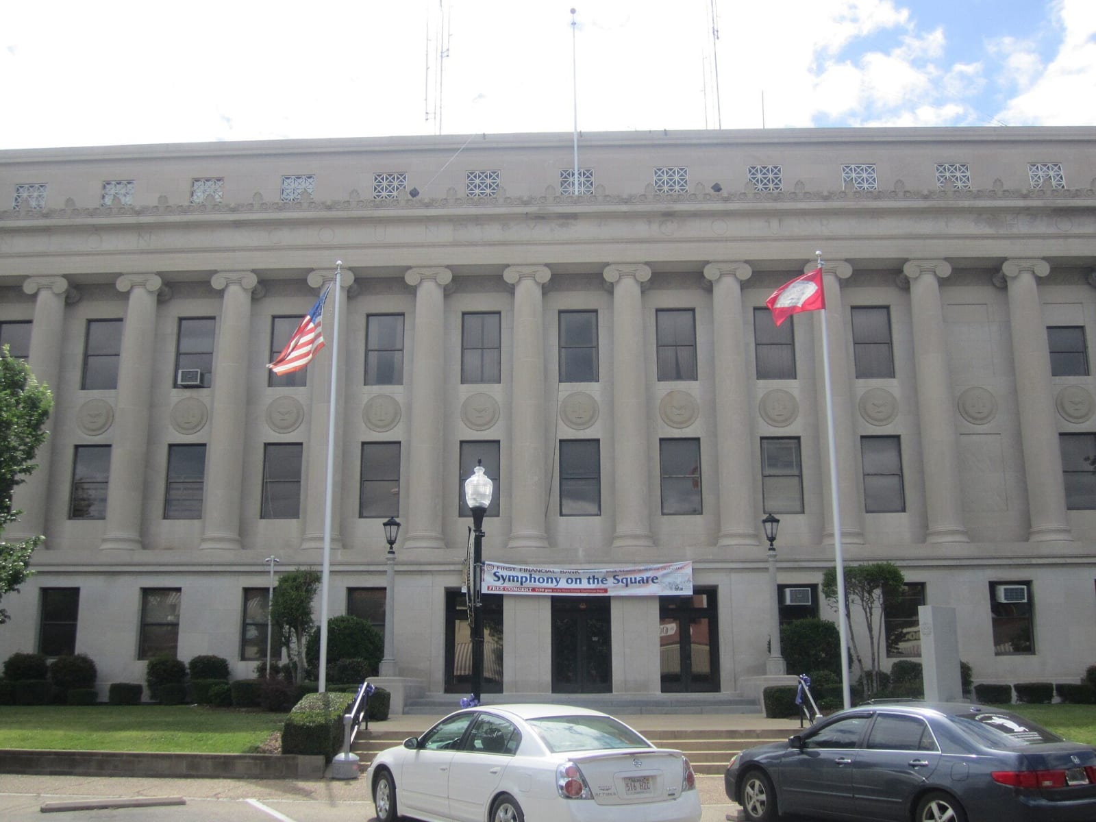
The Union County Courthouse in El Dorado, a stone building with a row of tall columns across its front, two flagpoles and parked cars in front.Billy Hathorn / CC BY-SA 3.0 via Wikimedia Commons
🏛️Historical

El Dorado Commercial Historic District

Part ofTexarkana, El Dorado & the Timberlands

The courthouse square and brick blocks of a town that jumped from 4,000 people to nearly 30,000 after the 1921 Busey well, listed on the National Register in 2003.

⏱
Duration
One to two hours.
🎟
Admission
Free; downtown streets and the courthouse square are open to walk. Individual buildings keep their own hours.
📅
Best Season
Year round. Spring and fall are comfortable for walking; the Mayhaw Festival is in early May and MusicFest in early October (Encyclopedia of Arkansas).

The Story

On January 10, 1921, Dr. Samuel T. Busey finished a well a mile southwest of town. It produced for only forty-five days, but it set off a rush that turned a farm and lumber town of about 4,000 into the state's oil capital. By 1923 El Dorado had fifty-nine oil contracting companies, and with no beds to be had, tents and shacks filled whole neighborhoods. The population reached nearly 30,000 in 1925 and then fell to 16,241 by 1930. It has since been branded Arkansas's Original Boomtown.

The historic district is the commercial heart that boom built around the Union County Courthouse. Most of it is one- and two-story brick, with the nine-story Exchange Bank building, the county's first skyscraper, and the eight-story Murphy Oil building as exceptions. More than forty buildings count as contributing, and the National Register listed the district on August 21, 2003. The Murphy Arts District, which opened its first phase in 2017, now uses several downtown venues.

The town's record includes harder chapters. A young man named Albert Williams was lynched in El Dorado in 1883. On February 26, 1910, a gunfight reportedly broke out between a Black man and three white men outside a Black-owned barbershop, and an armed mob then shot at and vandalized storefronts in the primarily Black business district. The National Guard was called out, and a large share of the Black population left, many for Camden. Accounts of how it began differ, and it is unknown whether others were hurt or killed. Park once and walk the blocks around the courthouse.

Visitor Info

⏱
Time Needed
One to two hours.
🎟
Admission
Free; downtown streets and the courthouse square are open to walk. Individual buildings keep their own hours.
📅
Best Season
Year round. Spring and fall are comfortable for walking; the Mayhaw Festival is in early May and MusicFest in early October (Encyclopedia of Arkansas).
🛣️
Highway
US 82 / AR 7

On the Map

Nearby

The closest stops worth working into your route

industrial9.1 mi away
Arkansas Museum of Natural Resources
A free state museum on the Smackover field, where a 112-foot derrick, a rebuilt 1920s boomtown street and working pumps tell how oil and bromine remade south Arkansas.
recreational19 mi away
Moro Bay State Park
A 117-acre park where Moro Bay and Raymond Lake meet the Ouachita River, home to the old Moro Bay Ferry, a cable ferry that ran from 1828 until bridges replaced it in 1992.
historical28 mi away
McCollum-Chidester House Museum
An 1847 Greek Revival house in Camden that served as a stagecoach headquarters and, in April 1864, as General Steele's headquarters, with bullet holes still visible upstairs.
natural31 mi away
Logoly State Park
Arkansas's first environmental education state park, built on the Magnesia Springs resort and a Boy Scout camp, with about 200 acres of mature forest kept as a natural area.
architectural34 mi away
Magnolia Square and the Columbia County Courthouse
The 1906 courthouse and square at the center of a town founded in 1853, where oil came in 1922, Southern Arkansas University grew from a farm school, and Jordan Jameson was burned to death in 1919.
historical35 mi away
Poison Spring Battleground State Park
An 85-acre roadside battlefield west of Camden, where Confederates routed a Union foraging column on April 18, 1864, and many Black soldiers of the 1st Kansas Colored Infantry were killed after surrendering.