Home / Texas / The Highland Lakes & the Llano Uplift / Longhorn Cavern State Park
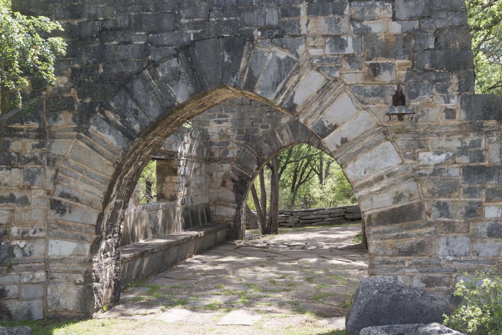
Arched stone walls and a stone walkway built by the Civilian Conservation Corps near the entrance to Longhorn Cavern.Carol M. Highsmith / public domain via the Library of Congress
🏜️Geological

Longhorn Cavern State Park

Part ofThe Highland Lakes & the Llano Uplift

A cave carved by an underground river in the Hill Country, cleared of mud by hand in the 1930s and reached down 52 stone steps on a guided tour.

⏱
Duration
Two to three hours.
🎟
Admission
Park grounds free; cave entry by paid guided tour booked through the concessionaire.
📅
Best Season
Year round; the cave stays at 68 degrees.

The Story

Longhorn Cavern was made by water. An underground river cut its passages through the limestone, and over the last million years it filled them with a thick layer of mud and debris, so that early visitors could use only a small part of the cave. People sheltered in the large room by the main entrance in prehistoric times.

The state acquired the cavern from private owners in the 1930s. Convict labor was used for the first work on it in 1931 until local residents objected, and the Civilian Conservation Corps finished the work, digging out the passages and building the stone stairways, walls and buildings of the park between 1934 and 1938, along with the scenic road that links it to Inks Lake. The original administration building now holds an exhibit on the CCC in Texas. The Department of the Interior made the cavern a National Natural Landmark in 1971.

A concessionaire runs the tours for the state. The walking tour goes down 52 stone steps into air that stays at 68 degrees year round and follows the old riverbed. A wild cave tour goes into the undeveloped lower level, which has no lights or paths. The park grounds, trails and picnic area are free.

Visitor Info

⏱
Time Needed
Two to three hours.
🎟
Admission
Park grounds free; cave entry by paid guided tour booked through the concessionaire.
📅
Best Season
Year round; the cave stays at 68 degrees.
🛣️
Highway
Park Road 4 off US-281

On the Map

Nearby

The closest stops worth working into your route

natural3.5 mi away
Inks Dam National Fish Hatchery
A free federal hatchery below Inks Dam on the Colorado, with thirty production ponds that draw birds and a look at how fish are raised from egg to harvest.
recreational3.9 mi away
Inks Lake State Park
A state park on a constant-level lake of the Colorado, between Buchanan and Inks dams, with pink granite and gneiss at the water and CCC work along Park Road 4.
natural17 mi away
Balcones Canyonlands National Wildlife Refuge: Doeskin Ranch
A free federal refuge north of Lake Travis kept for two songbirds that need old juniper and oak, with trails at the Doeskin Ranch unit near Bertram.
architectural20 mi away
Llano County Courthouse Square
The 1893 Romanesque courthouse on Llano's square, built after a fire at the height of a boom that was meant to make the granite town an iron city.
natural26 mi away
Colorado Bend State Park
Old ranch country on the Colorado above Lake Buchanan, where a spring-fed creek drops 70 feet over fern-covered travertine at Gorman Falls.
natural27 mi away
Pedernales Falls State Park
The Pedernales stepping down over layered limestone east of Johnson City, a river that can turn from a placid stream to a torrent in minutes.

Historical markers nearby

Roadside plaques and monuments within a short detour

Marker0.1 mi away
Longhorn Caverns
Burnet
Marker2.3 mi away
Hoover's Valley Cemetery
Burnet
Marker3.2 mi away
The Tobey Community Cemetery
Marble Falls
Marker5.2 mi away
Buchanan Dam
Burnet
Marker6.6 mi away
Granite Industry in Llano County
Buchanan Dam
Marker6.6 mi away
C.S.A. Salt Works
Buchanan Dam