Home / Texas / Fredericksburg, Kerrville & the Hill Country / Pedernales Falls State Park
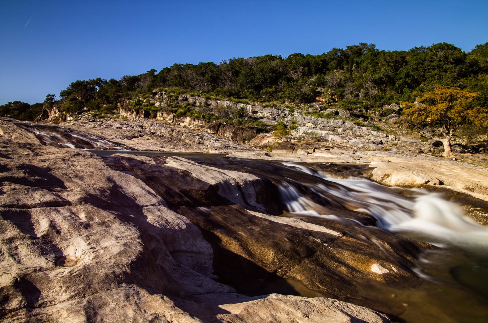
The Pedernales River spilling over smooth layered limestone at Pedernales Falls, with a wooded bluff behind.Corey Leopold / CC BY 2.0 via Flickr
🌲Natural

Pedernales Falls State Park

Part ofFredericksburg, Kerrville & the Hill Country

The Pedernales stepping down over layered limestone east of Johnson City, a river that can turn from a placid stream to a torrent in minutes.

⏱
Duration
Half a day to a full day.
🎟
Admission
State park entrance fee.
📅
Best Season
Spring and fall. Check river and weather conditions before going; flash floods are common in the Hill Country.

The Story

At the falls the Pedernales River runs over and around great slabs of layered limestone, dropping in steps through a broad rocky channel. Most days it is quiet. But the water can rise from a placid stream to a raging torrent in a few minutes, and the park warns visitors to leave the river at once if it rises or turns muddy. For that reason swimming and wading are not allowed in the falls area; there is a separate swimming area, reached by a strenuous quarter-mile hike with steep rock stairs.

Texas Parks and Wildlife bought the 4,860 acres from private owners in 1970. The land is typical Edwards Plateau country: dry grassland, cedar brakes, oak and mesquite woods, and banks lined with bald cypress. More than 150 species of birds live in or pass through the park, among them the golden-cheeked warbler.

The half-mile Twin Falls Nature Trail leads to an overlook, and the six-mile Wolf Mountain Trail circles Tobacco and Wolf mountains. Mountain bikers have the ten-mile Juniper Ridge Trail, riders ten miles of rocky horse trail, and paddlers can put in at the swimming area or Trammell's Crossing, but never at the falls.

Visitor Info

⏱
Time Needed
Half a day to a full day.
🎟
Admission
State park entrance fee.
📅
Best Season
Spring and fall. Check river and weather conditions before going; flash floods are common in the Hill Country.
🛣️
Highway
RR 2766

On the Map

Nearby

The closest stops worth working into your route

historical10 mi away
Lyndon B. Johnson National Historical Park
The Johnson City district of the national park: the Victorian house where Lyndon Johnson grew up, and the stone barns his grandfather built in the Johnson Settlement.
historical23 mi away
Lyndon B. Johnson State Park and Historic Site
A state park on the Pedernales opposite the LBJ Ranch, with a working Texas-German farm kept as it was around the First World War and the permit desk for the ranch tour.
natural24 mi away
Balcones Canyonlands National Wildlife Refuge: Doeskin Ranch
A free federal refuge north of Lake Travis kept for two songbirds that need old juniper and oak, with trails at the Doeskin Ranch unit near Bertram.
geological27 mi away
Longhorn Cavern State Park
A cave carved by an underground river in the Hill Country, cleared of mud by hand in the 1930s and reached down 52 stone steps on a guided tour.
natural28 mi away
Mount Bonnell
Austin's old lookout over the Colorado, named by an 1838 traveler, picnicked on by George and Libbie Custer, and reached by a 1939 flight of about 100 limestone steps.
natural28 mi away
Barton Springs Pool
A three-acre pool in the bed of Barton Creek, fed by the fourth-largest spring in Texas at 68 to 70 degrees, and shared with an endangered salamander found almost nowhere else.

Historical markers nearby

Roadside plaques and monuments within a short detour

Marker9.1 mi away
Home County of Pioneer Leader Joseph Wilson Baines
Johnson City vicinity
Marker9.4 mi away
Thomas C. and Eliza V. Felps
Johnson City
Marker10 mi away
First Christian Church of Johnson City
Johnson City
Marker10 mi away
First Baptist Church of Johnson City
Johnson City
Marker10 mi away
Lyndon B. Johnson and Hill Country Electrification
Johnson City
Marker10 mi away
Dr. James F. Barnwell
Johnson City