Home / Texas / The Highland Lakes & the Llano Uplift / Inks Lake State Park
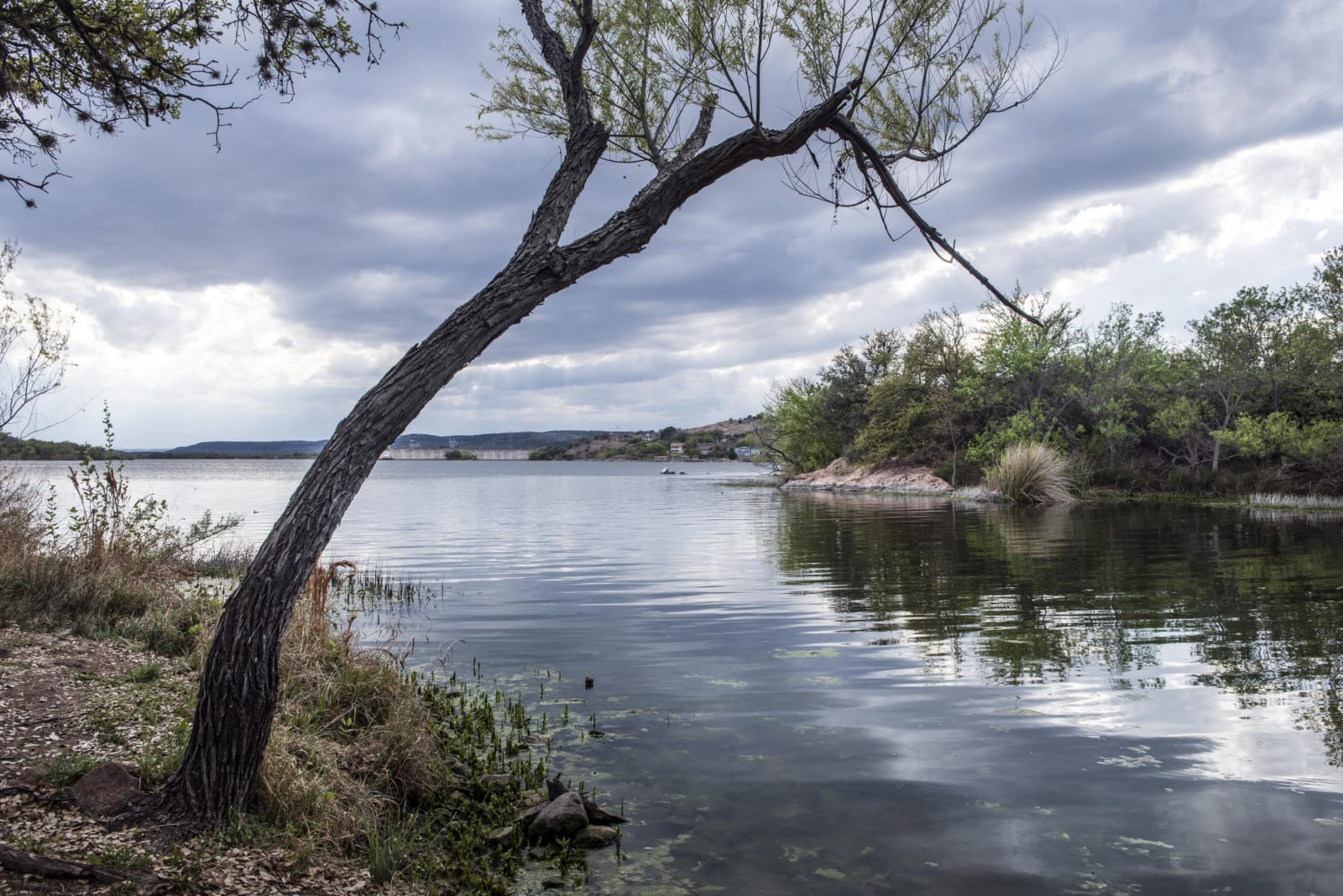
A leaning tree on the rocky shore of Inks Lake, with a wooded island and low hills reflected in the calm water under clouds.Carol M. Highsmith / public domain via the Library of Congress
🏕️Recreational

Inks Lake State Park

Part ofThe Highland Lakes & the Llano Uplift

A state park on a constant-level lake of the Colorado, between Buchanan and Inks dams, with pink granite and gneiss at the water and CCC work along Park Road 4.

⏱
Duration
A day, or a weekend in a cabin or campsite.
🎟
Admission
State park entrance fee; boat rentals extra.
📅
Best Season
Year round; the lake level stays steady. Summer for swimming and paddling.

The Story

Inks Lake is the second of the six Highland Lakes on the Colorado, held between Buchanan Dam to the north and Roy Inks Dam to the south. The Lower Colorado River Authority built Inks Dam, a concrete gravity dam, between 1936 and 1938 and named it for Roy B. Inks of its first board. Because its power plant releases water in step with the flow coming down from Lake Buchanan, the lake stays close to one level, so the shoreline does not change much from season to season.

The rocks at the water's edge are very old: pink gneiss and granite of the Llano Uplift, colored by lichens. The Devil's Waterhole is a small rocky canyon for hiking and swimming, with waterfalls upstream when Valley Spring Creek is running.

The state bought about 1,200 acres from the LCRA in 1940. Civilian Conservation Corps Company 854, which had just finished at Longhorn Cavern, built roads, culverts and a boathouse here and carried the scenic parkway on from the cavern. The camp closed in 1942 and the park opened in 1950. Today it has nearly 200 campsites, 22 cabins, 9 miles of trails, fishing piers and rentals of kayaks, canoes and paddleboards. There are no lifeguards.

Visitor Info

⏱
Time Needed
A day, or a weekend in a cabin or campsite.
🎟
Admission
State park entrance fee; boat rentals extra.
📅
Best Season
Year round; the lake level stays steady. Summer for swimming and paddling.
🛣️
Highway
Park Road 4 off TX-29

On the Map

Nearby

The closest stops worth working into your route

natural1.3 mi away
Inks Dam National Fish Hatchery
A free federal hatchery below Inks Dam on the Colorado, with thirty production ponds that draw birds and a look at how fish are raised from egg to harvest.
geological3.9 mi away
Longhorn Cavern State Park
A cave carved by an underground river in the Hill Country, cleared of mud by hand in the 1930s and reached down 52 stone steps on a guided tour.
architectural18 mi away
Llano County Courthouse Square
The 1893 Romanesque courthouse on Llano's square, built after a fire at the height of a boom that was meant to make the granite town an iron city.
natural19 mi away
Balcones Canyonlands National Wildlife Refuge: Doeskin Ranch
A free federal refuge north of Lake Travis kept for two songbirds that need old juniper and oak, with trails at the Doeskin Ranch unit near Bertram.
natural22 mi away
Colorado Bend State Park
Old ranch country on the Colorado above Lake Buchanan, where a spring-fed creek drops 70 feet over fern-covered travertine at Gorman Falls.
historical25 mi away
Hancock Springs Park
Lampasas's city park on Sulphur Creek, with a spring-fed swimming pool that holds about 69 degrees all year, the walls of the old bathhouse and a golf course.

Historical markers nearby

Roadside plaques and monuments within a short detour

Marker1.8 mi away
Buchanan Dam
Burnet
Marker2.4 mi away
Hoover's Valley Cemetery
Burnet
Marker3.8 mi away
Longhorn Caverns
Burnet
Marker4.3 mi away
C.S.A. Salt Works
Buchanan Dam
Marker4.3 mi away
Granite Industry in Llano County
Buchanan Dam
Marker7 mi away
The Tobey Community Cemetery
Marble Falls