Home / South Dakota / Custer State Park & the Southern Hills / Jewel Cave National Monument
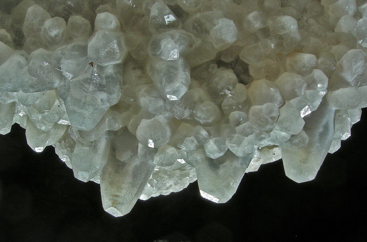
Translucent nailhead spar crystals of calcite crusting a surface in Jewel CaveNational Park Service / public domain via Wikimedia Commons
🌲Natural

Jewel Cave National Monument

Part ofCuster State Park & the Southern Hills

A cave the prospectors who found it sold to the government for $750, thought to be two miles long until a climbing couple began to walk it in 1959.

Year-RoundCaves
⏱
Duration
Two to three hours.
🎟
Admission
No entrance fee; cave tours are ticketed.
📅
Best Season
Year-round; summer tours fill early.

The Story

In 1900 Frank and Albert Michaud, prospectors working Hell Canyon west of Custer, felt cold air blowing from a small hole in the rock. They blasted it open and found a chamber lined with calcite crystals that glittered in their lamps, and named it Jewel Cave. They filed a mining claim, built a lodge and a trail and tried to sell tours, but visitors were few, and after Theodore Roosevelt proclaimed the cave a national monument on February 7, 1908, the first ever made to protect a cave, they sold their claim to the government for $750.

For half a century the monument was thought to be a small cave, about two miles long. In 1959 Herb and Jan Conn, rock climbers from Custer, began exploring with the geologist Dwight Deal, and within two years they had mapped fifteen miles. They kept going for two decades, crawling, chimneying and squeezing, and had found, named and surveyed more than sixty-four miles by 1979. Their routes became the tours.

Volunteer survey teams carry the work on, adding a few miles most years, and the mapped cave now runs to more than 220 miles, among the five longest known on Earth. All of it lies beneath about four square miles of hillside, and studies of the air moving through the entrance suggest that what has been found is only a few percent of the whole.

Visitor Info

⏱
Time Needed
Two to three hours.
🎟
Admission
No entrance fee; cave tours are ticketed.
📅
Best Season
Year-round; summer tours fill early.
🛣️
Highway
US-16

On the Map

Nearby

The closest stops worth working into your route

cultural13 mi away
Crazy Horse Memorial
A Lakota elder's answer to Mount Rushmore, carved for more than seventy years by one family with private money, and still argued over by Crazy Horse's own relatives.
natural18 mi away
Black Elk Peak
The highest summit in the Black Hills, renamed in 2016 for an Oglala holy man after carrying, for 150 years, the name of the general who attacked a Sicangu camp in 1855.
natural18 mi away
Needles Highway
Fourteen miles that Governor Peter Norbeck laid out on foot and horseback through the granite spires, threading a tunnel eight feet wide.
attraction19 mi away
1880 Train
A steam excursion on a mining branch line that hauled gear for Mount Rushmore, named for a decade it never ran in by a man who wanted steam to survive.
historical21 mi away
Mount Rushmore National Memorial
Four faces blasted out of a sacred mountain by 400 workers in fourteen years, with a Jefferson that had to be dynamited off and a hall of records never finished.
natural21 mi away
Wind Cave National Park
A cave that breathes through a hole the size of a dinner plate, lined with nearly all the boxwork known on Earth, under a prairie restocked with bison shipped from New York.

Historical markers nearby

Roadside plaques and monuments within a short detour

Marker15 mi away
Cheyenne-Deadwood Trail
Wyoming
Marker16 mi away
The Jenney Stockade
Wyoming
Marker16 mi away
Camp Jenney
Wyoming
Marker17 mi away
Site of Field City
Wyoming
Marker22 mi away
Cambria
Wyoming
Marker25 mi away
Cambria Salt Mine
Wyoming