Home / Idaho / Clearwater Country & Hells Canyon / Heaven's Gate Lookout
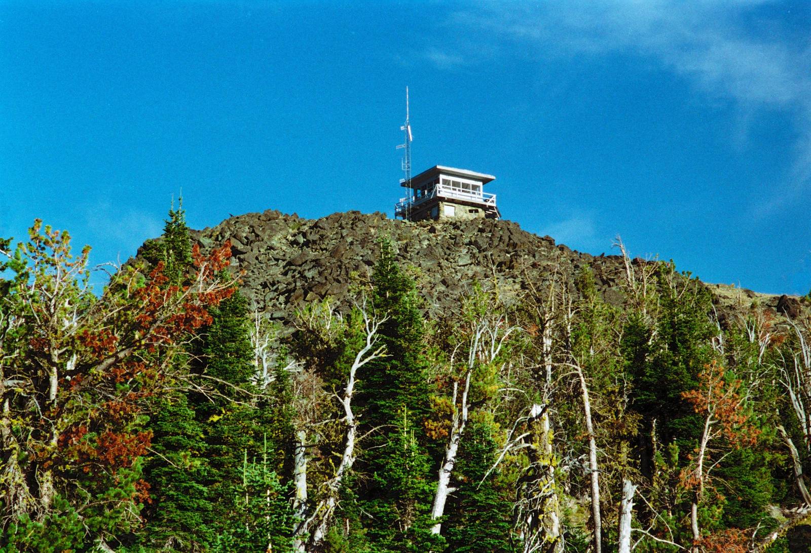
The fire lookout on the rocky summit of Heavens Gate above subalpine firsDavid Dugan / CC BY-SA 3.0 via Wikimedia Commons
🌲Natural

Heaven's Gate Lookout

Part ofClearwater Country & Hells Canyon

A staffed fire lookout at 8,429 feet on the rim of North America's deepest river gorge, nearly reachable by car.

Off the Beaten PathPhotography
⏱
Duration
Half a day from Riggins, with an hour at the top.
📅
Best Season
July through early October; the road is snowbound the rest of the year.

The Story

From Riggins, Forest Road 517 climbs west out of the Salmon River canyon for about eighteen miles, steep, narrow, gravel and switchbacked most of the way, into the Seven Devils Mountains. It ends a few hundred feet below the top of Heaven's Gate, and a short trail finishes the climb to the lookout at 8,429 feet.

The view is the reason to come. To the west the ground falls away into Hells Canyon, the Snake River more than seven thousand feet below — too deep to see the water, not too deep to feel the drop. Beyond it rise the Wallowa Mountains of Oregon. To the south stand the peaks that gave the range its name, He Devil and She Devil, the Goblin and the Black Imp, and to the east the Salmon River canyon and the long ridges of central Idaho run toward the Bitterroots on the Montana line. On a clear day the horizon takes in Idaho, Oregon, Washington and Montana.

There has been a lookout here since the 1920s. A log cabin with a cupola went up in 1924 and lost the cupola to a wildfire in 1958; the lookout that stands now, a cab on a two-story concrete base, dates from 1978. The Forest Service still staffs it from early summer through fire season, and the lookout on duty keeps a register for visitors to sign.

The road opens once the snow is gone, usually in July, when the high slopes around Windy Saddle fill with lupine, penstemon and paintbrush. It is no road for a trailer, and low cars struggle on it.

Visitor Info

⏱
Time Needed
Half a day from Riggins, with an hour at the top.
📅
Best Season
July through early October; the road is snowbound the rest of the year.
🛣️
Highway
US-95; Forest Road 517

On the Map

Nearby

The closest stops worth working into your route

historical31 mi away
White Bird Battlefield
Six Nimiipuu men rode out under a white flag. A shot came from the soldiers' side, and the Nez Perce War began.
cultural36 mi away
Joseph and the Bronze Foundries
A ranch town under the Wallowas that became a bronze-casting center after local sculptors talked a resident into opening a foundry in 1982, with seven monumental bronzes now on Main Street.
historical38 mi away
McCall Smokejumper Base
Where conscientious objectors in the Second World War parachuted onto forest fires, and were shunned in camp for it.
cultural52 mi away
Wallowa and the Tamkaliks Celebration
The town in the valley the Wallowa band of the Nez Perce was driven from in 1877, where since 1991 their descendants have come home each summer for a celebration named for where you can see the mountains.
cultural63 mi away
Heart of the Monster
Where the Nimiipuu say their story begins: Coyote, a monster, and the heart he tore loose, still on the Clearwater's bank.
historical71 mi away
National Historic Oregon Trail Interpretive Center
A hilltop museum that Baker City built to revive its economy, above a mile of wagon ruts and the first view the emigrants had of the valley ahead.

Historical markers nearby

Roadside plaques and monuments within a short detour

Marker15 mi away
Hydraulic Mining
Marker15 mi away
Fabulous Florence
Marker20 mi away
Salmon River Canyon