Home / Wyoming / Cody & the Bighorn Basin / Heart Mountain Interpretive Center
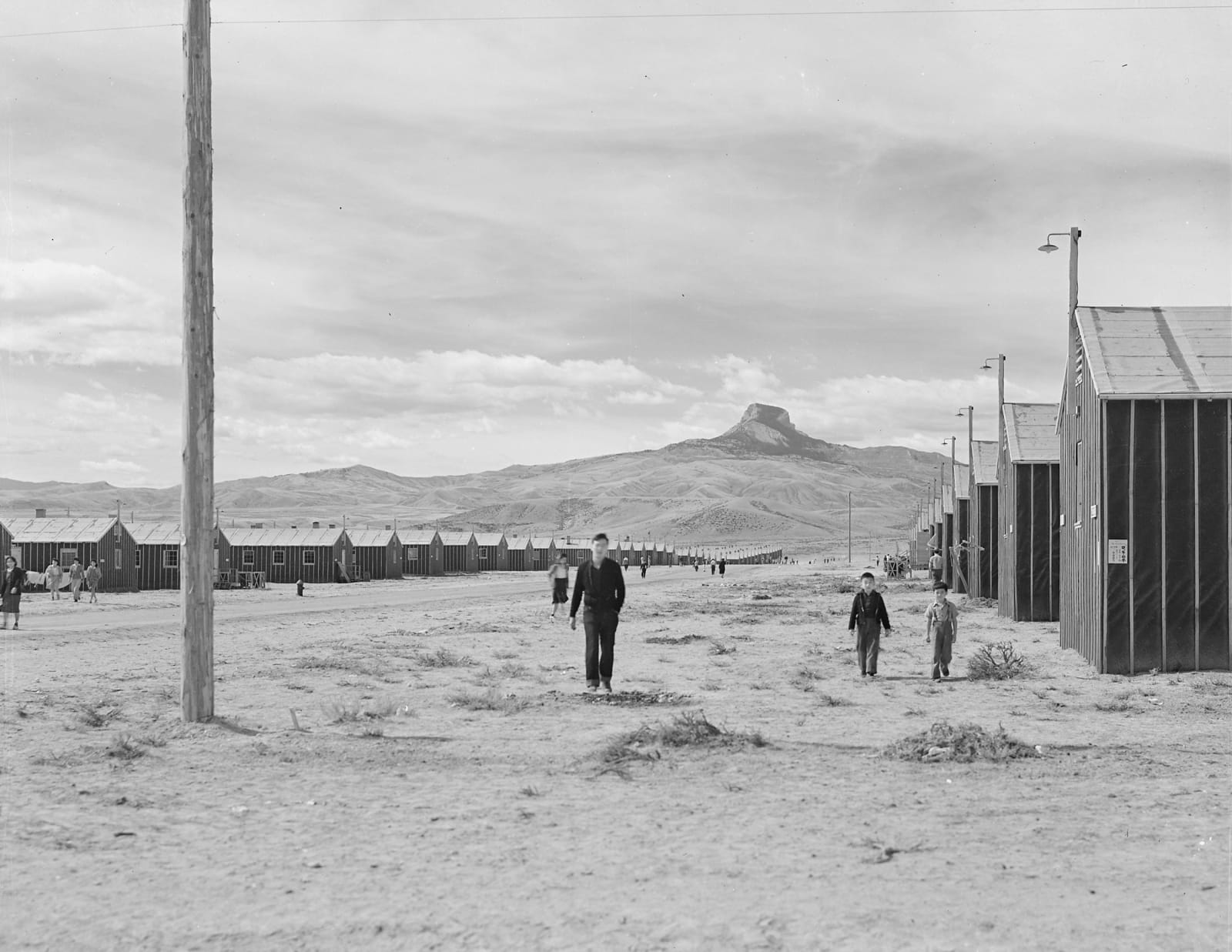
A War Relocation Authority photograph of the Heart Mountain camp: rows of tar-paper barracks along a dirt street, a man and two boys walking toward the camera, and Heart Mountain rising beyondTom Parker, War Relocation Authority / public domain via Wikimedia Commons
🏛️Historical

Heart Mountain Interpretive Center

Part ofCody & the Bighorn Basin

The incarcerated cleared and watered the land; when the camp closed it went to veterans to homestead, and the barracks sold for a dollar each.

Paid EntryJapanese American History
⏱
Duration
Two hours.
📅
Best Season
Year-round; check winter hours.

The Story

The camp went up in about six months in 1942, built by some two thousand workers on a bench above the Shoshone River: roughly 650 buildings, among them more than 450 tar-paper barracks twenty feet by 120, each split into rooms for as many as six families, with army cots, a coal stove, a single hanging light and no running water. Each block shared its mess halls, latrines and laundry. There were schools, churches, a weekly paper called the Heart Mountain Sentinel, and a 150-bed hospital where some 550 babies were born. The people held here also worked the land around the camp, clearing and irrigating thousands of acres and digging a 5,000-foot stretch of the Heart Mountain canal for the federal Shoshone Project.

When the camp closed in 1945, the government opened that land to homesteading by veterans, and the barracks were sold for a dollar apiece to anyone who would haul them away. Many still stand as barns, sheds and houses across the county. On the site itself almost nothing stayed in place: the brick chimney of the hospital's boiler house on the hill, a few hospital and staff buildings, and a root cellar.

In 2015 the Heart Mountain Wyoming Foundation bought back one barrack and brought it home to stand beside the interpretive center, whose galleries tell the camp in the first-person words of the people imprisoned there.

Visitor Info

⏱
Time Needed
Two hours.
📅
Best Season
Year-round; check winter hours.
🛣️
Highway
US-14A

On the Map

Nearby

The closest stops worth working into your route

cultural12 mi away
Buffalo Bill Center of the West
A memorial begun the year Buffalo Bill died that grew, wing by stone-walled wing, into five museums and a library under one roof.
historical13 mi away
Old Trail Town
Bob Edgar's rescued log buildings, outlaw cabins and an Apsáalooke scout's home among them, rebuilt on the ground where Cody City was first laid out.
natural34 mi away
Beartooth Highway
A road over the top of the world, built because a coal town's mines closed and it needed tourists instead.
industrial36 mi away
Smith Mine
Rusting buildings beside the highway, all that is left of the mine where Montana's worst coal disaster emptied a valley.
historical56 mi away
Chief Plenty Coups State Park
The log house of the last traditional chief of the Apsáalooke, given in 1928 as a park for Crow and white people together.
cultural62 mi away
Legend Rock State Petroglyph Site
Ten thousand years of images pecked into a sandstone cliff, most by the ancestors of the Eastern Shoshone, now behind a gate after vandalism.