Home / Arkansas / Bentonville, Fayetteville & Eureka Springs / Devil's Den State Park
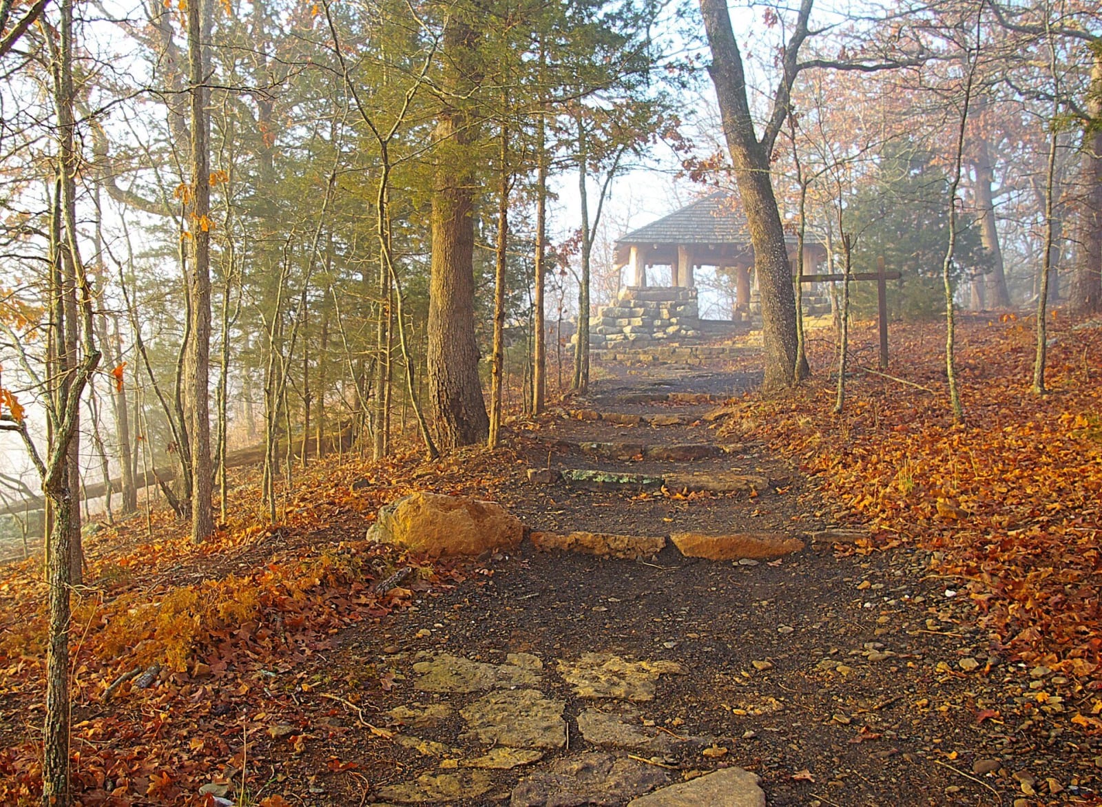
A stone-stepped path climbs through autumn leaves and light fog to the log-and-stone overlook shelter at the top of the Yellow Rock Trail.Sam Wilson / CC BY-SA 2.0 via Wikimedia Commons
🏕️Recreational

Devil's Den State Park

Part ofBentonville, Fayetteville & Eureka Springs

A Civilian Conservation Corps park begun in October 1933 in the Lee Creek valley, with log-and-stone cabins, a 1937 stone dam, about sixty crevice caves and a 15-mile trail.

⏱
Duration
Half a day to a weekend.
🎟
Admission
No park entry fee is listed; the pool charges separately in summer.
📅
Best Season
Spring and fall for hiking; the visitor center is open daily 8 a.m. to 5 p.m. and closed Thanksgiving, Christmas Eve and Christmas (state parks site, November 2026).

The Story

Devil's Den State Park was created on October 13, 1933, and the first Civilian Conservation Corps company, men from North Dakota, moved in a week later, on October 20. Their first project was a gravel road to Devil's Den, later Arkansas 170. They went on to build the first hiking trails, log-and-stone cabins, campgrounds, offices, a restaurant and a stone dam across Lee Creek, finished on April 1, 1937. Trail, road and building work continued until the corps disbanded in 1942. The whole park was listed as a National Historic District in 1994, and the state describes it as one of the most intact CCC sites in the country.

The park lies in the Lee Creek valley in the Boston Mountains, on about 2,200 acres. Its sandstone crevice area holds about sixty crevice caves, and Devil's Den Cave is the longest, reaching 550 feet into the hillside. The area went on the Natural Heritage Commission's registry in 1982. Big Ear Cave shelters hibernating Ozark big-eared bats and is closed to visitors. The dam, an 8-acre fishing lake behind it, was damaged by floodwater on April 24, 2004, and the old log-and-stone bridge across the creek washed away in a flood.

The park is at 11333 West Arkansas Highway 74 in West Fork. Yellow Rock Trail climbs to a view of the Lee Creek valley, the Butterfield Hiking Trail makes a 15-mile loop, and Fossil Flats was the first mountain bike trail in the Arkansas state parks. There are 18 cabins with kitchens and fireplaces, many from the CCC era, and 107 campsites.

Visitor Info

⏱
Time Needed
Half a day to a weekend.
🎟
Admission
No park entry fee is listed; the pool charges separately in summer.
📅
Best Season
Spring and fall for hiking; the visitor center is open daily 8 a.m. to 5 p.m. and closed Thanksgiving, Christmas Eve and Christmas (state parks site, November 2026).
🛣️
Highway
AR 74

On the Map

Nearby

The closest stops worth working into your route

historical14 mi away
Prairie Grove Battlefield State Park
The December 7, 1862 battlefield where about 2,700 fell and Hindman withdrew in the night, with the Borden orchard, Hindman Hall's free museum, and walking and driving tours.
historical24 mi away
Van Buren Historic District
Eight blocks of Main Street on the Arkansas River, from Phillips Landing, with 1889 banks, a beer depot and a railroad depot, on the National Register since 1976.
cultural28 mi away
U.S. Marshals Museum
A star-shaped museum on the Arkansas riverbank, opened in 2023, telling the story of the nation's oldest federal law enforcement agency and the marshals who worked out of Fort Smith.
historical29 mi away
Fort Smith National Historic Site
Two army forts, a federal courthouse and a basement jail on the bluff where the Poteau meets the Arkansas, from the 1817 riflemen to Judge Parker's court and its gallows.
historical29 mi away
Fort Smith National Cemetery
The post burial ground of the first Fort Smith, kept since 1819, holding its first commander, more than 400 Confederate dead, Judge Parker and veterans of every war since.
historical29 mi away
Sequoyah's Cabin Museum
The log cabin near Akins where Sequoyah, who gave the Cherokee language its syllabary, settled in 1829, kept since 2016 by the Cherokee Nation inside a stone shelter of 1936.

Historical markers nearby

Roadside plaques and monuments within a short detour

Marker26 mi away
Robert Rogers
Oklahoma
Marker26 mi away
Baptist Mission
Oklahoma
Marker29 mi away
Fort Wayne
Oklahoma