Home / Kansas / Dodge City & the Southwest / Cimarron National Grassland and Point of Rocks
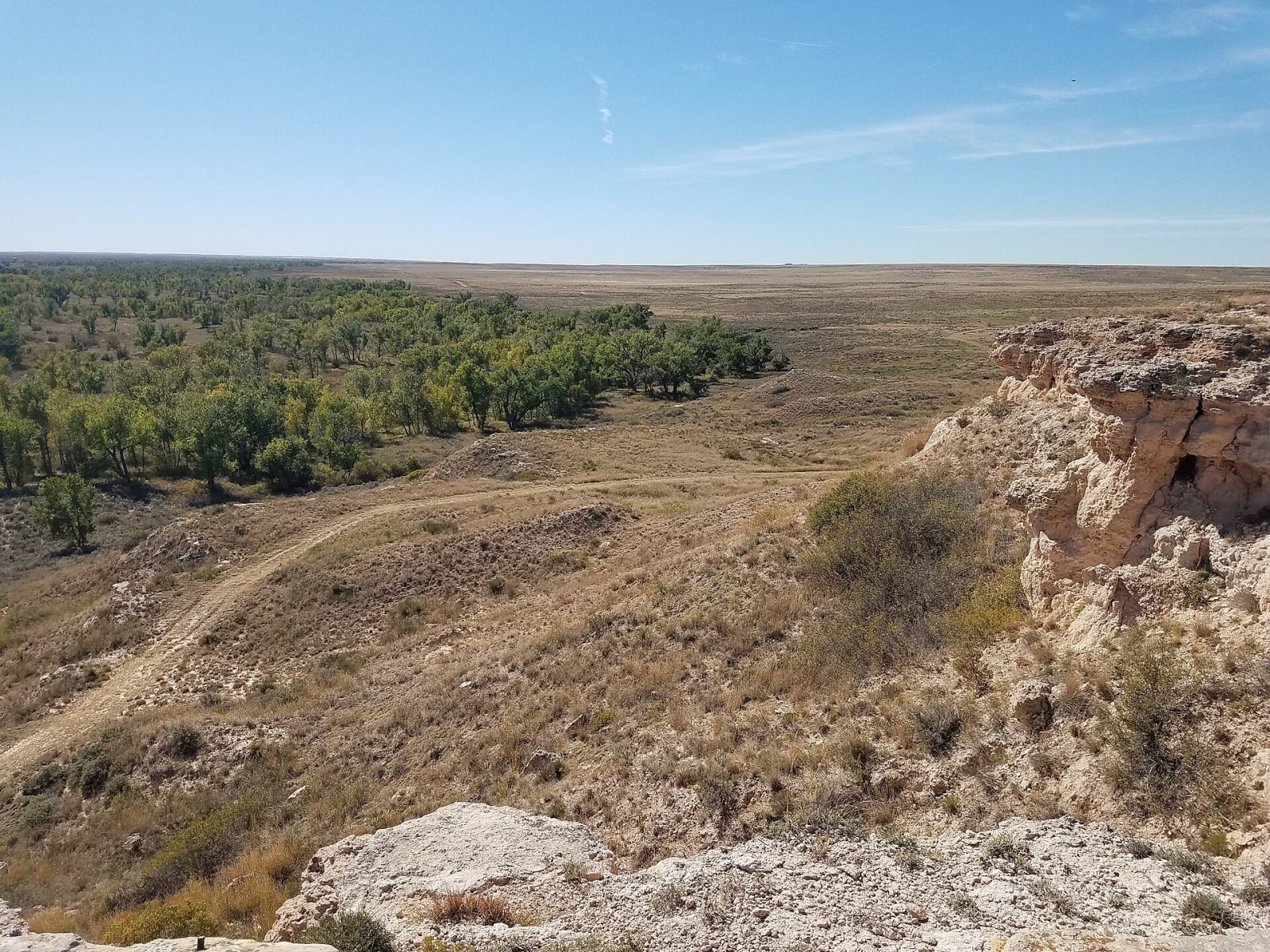
From the caprock of Point of Rocks, the view falls over cottonwoods along the Cimarron River and a faint trail trace across the grassland.NPS / public domain via Wikimedia Commons
🌲Natural

Cimarron National Grassland and Point of Rocks

Part ofDodge City & the Southwest

The largest public land in Kansas, 108,175 acres of shortgrass and sand sage along the usually dry Cimarron, where a bluff capped with white calcrete gave Santa Fe Trail drivers their landmark.

⏱
Duration
Two to three hours for the auto tour; longer to camp or hike.
📅
Best Season
Spring and fall; summer is hot and roads turn bad after rain.

The Story

The Cimarron National Grassland covers 108,175 acres of Morton and Stevens counties, the largest public land in Kansas, in the old territory of the Comanche and their allies and an Apache hunting ground. It is shortgrass prairie dominated by sand sagebrush, cut by the Cimarron River, which is usually dry on the surface from late summer through winter, though lush growth and groves of cottonwood line its banks, and beaver dams make pools below Middle Spring. Bluffs rise about a hundred feet above the valley, and the best known of them, Point of Rocks, was the landmark wagon drivers on the trail's Dry Route watched for after the waterless stretch, because it meant springs.

The bluff is a short lesson in the geology of southwest Kansas. Its cap is white Ogallala Formation calcrete, sand and gravel washed off the Rocky Mountains millions of years ago and cemented hard. Beneath lie red shales, siltstones and sandstones whose age geologists argued over for more than a century, guessing everything from Permian to Cretaceous. Kansas Geological Survey researchers settled it by measuring uranium and lead in tiny zircon grains: the red beds are the Permian Big Basin Formation, named for the mile-wide sinkhole in Clark County where it was first identified.

The Forest Service's 30-mile auto tour, mostly on dirt roads, passes a prairie dog town, the trail, Point of Rocks and the river. The Cimarron Recreation Area has 12 campsites under cottonwoods and the 10.5-mile Turkey Trail.

Visitor Info

⏱
Time Needed
Two to three hours for the auto tour; longer to camp or hike.
📅
Best Season
Spring and fall; summer is hot and roads turn bad after rain.
🛣️
Highway
K-27

On the Map

Nearby

The closest stops worth working into your route

attraction55 mi away
Mid-America Air Museum
More than 100 aircraft in a former Beechcraft plant on the old Liberal Army Airfield, where nearly a third of all B-24 Liberator command pilots trained during World War II.
historical69 mi away
Amache National Historic Site
A Japanese American incarceration camp kept from vanishing by a Granada social studies teacher and three decades of his high school students, a national park unit since 2024.
natural82 mi away
Meade State Park
An 80-acre fishing lake among springs south of Meade, in country once known for artesian wells that pushed groundwater up under its own pressure, before irrigation drew the water table down.
natural82 mi away
Sandsage Bison Range and Wildlife Area
The 3,760-acre remnant of the Kansas National Forest south of Garden City, where federal tree planting failed and the state's oldest publicly owned bison herd now grazes sand sage prairie.
attraction83 mi away
Lee Richardson Zoo
Garden City's zoo in Finnup Park, begun in 1927 with two skunks and now accredited, free to walk in and open to cars on a drive-through loop for a vehicle fee.
historical104 mi away
Bent's Old Fort National Historic Site
A cornfield with foundations in it by the 1960s, rebuilt from an army lieutenant's 1845 drawings in 160,000 machine-made adobes for the Bicentennial.

Historical markers nearby

Roadside plaques and monuments within a short detour

Marker7.8 mi away
La Jornada & Point of Rocks