Home / Oklahoma / The Arbuckles & Chickasaw Country / Chickasaw National Recreation Area
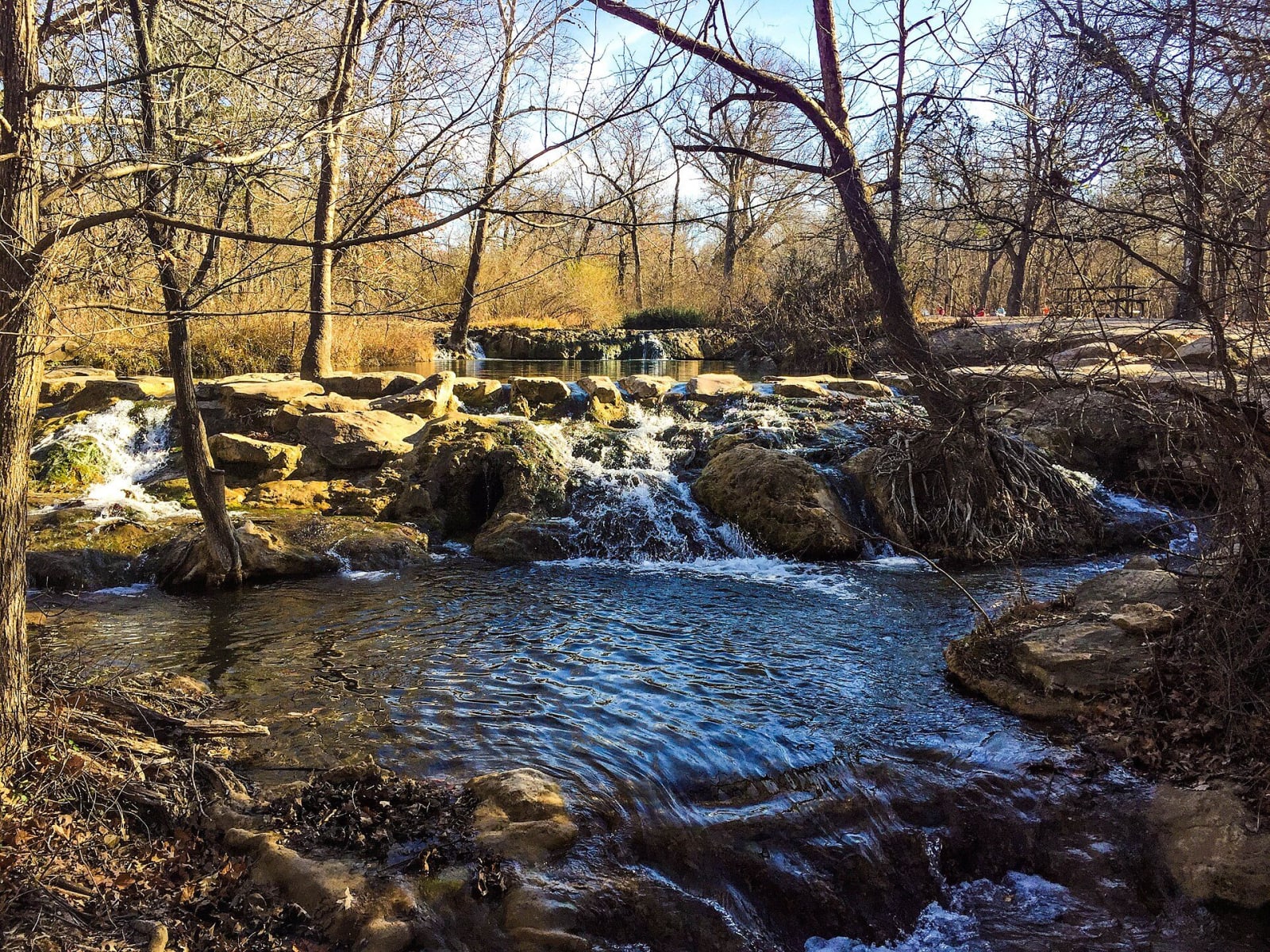
Water spilling over travertine ledges on a wooded creek in the Chickasaw National Recreation Area.NPS / public domain via Wikimedia Commons
๐ŸŒฒNatural

Chickasaw National Recreation Area

Part ofThe Arbuckles & Chickasaw Country

Springs the Chickasaw and Choctaw nations sold to the government in 1902 rather than lose them to developers, later Platt National Park, now the Travertine district's creeks, CCC stonework and bison pasture.

โฑ
Duration
Half a day to a full day.
๐ŸŽŸ
Admission
No entrance fee. Camping and boat launch fees are charged.
๐Ÿ“…
Best Season
Late fall to early spring for easy parking; summer for swimming in the creeks.

The Story

More than thirty springs, fresh and mineral, rise in the hills south of Sulphur, and their strong-smelling mineral water drew Caddo, Comanche and Wichita people before the Chickasaw came. By 1900 a town had grown up around them and developers talked of a resort to rival Hot Springs, Arkansas. The Chickasaw and Choctaw nations, afraid of losing access to the water, appealed to federal officials, and in 1902 the United States bought 640 acres from them as the Sulphur Springs Reservation. In 1906 Congress made it Platt National Park, named for Senator Orville H. Platt of Connecticut.

The look of the place is the Civilian Conservation Corps'. CCC Company 808 camped here from 1933 to 1940, about two hundred men at a time, and built campgrounds, pavilions, trails, dams and springhouses of native stone and wood. More than two hundred survive, and the Platt district became a National Historic Landmark in 2011. In 1976 the park was joined with the Arbuckle Recreation Area and Lake of the Arbuckles and given the name of the people who first offered the land.

Start at the Travertine Nature Center, built across Travertine Creek in 1969 in a style modeled on Frank Lloyd Wright's. Antelope and Buffalo springs feed the creek at the east end, and bison graze the east pasture, seen from the Veterans Trail. There is no entrance fee. On summer weekends and holidays every lot fills; the park says parking rarely fills on weekdays or from late fall to early spring.

Visitor Info

โฑ
Time Needed
Half a day to a full day.
๐ŸŽŸ
Admission
No entrance fee. Camping and boat launch fees are charged.
๐Ÿ“…
Best Season
Late fall to early spring for easy parking; summer for swimming in the creeks.
๐Ÿ›ฃ๏ธ
Highway
US-177

On the Map

Stories

A story featuring this place

Go deeper into the history and character of this stop

Geology
The Water Under the Arbuckles
Open Road Guide ยท 3 min read

Nearby

The closest stops worth working into your route

cultural2.8 mi away
Chickasaw Cultural Center
The Chickasaw Nation's 184-acre campus at Sulphur, opened in 2010, with an exhibit hall on the Nation's history, a recreated 1700s town with daily stomp dance, and a bridge into the national recreation area.
natural13 mi away
Turner Falls Park
Honey Creek dropping 77 feet over Arbuckle rock into a swimming hole off I-35, in a 1,500-acre city park named for the man who settled here with his Chickasaw wife.
historical24 mi away
Chickasaw National Capitol
The red granite capitol the Chickasaw Nation finished at Tishomingo in 1898, forced out of at statehood, used as the county courthouse for most of a century and reclaimed by the Nation in 1992.
recreational32 mi away
Lake Murray State Park
Oklahoma's first and largest state park, built by New Deal crews on former Chickasaw Nation land south of Ardmore, with Tucker Tower, a governors' retreat never finished, on a point above the lake.
cultural48 mi away
Choctaw Cultural Center
The Choctaw Nation's history told from the Chahta side at Calera, with galleries from Nanih Waiya to the Trail of Tears and the reservation today, a living village and daily stickball.
cultural52 mi away
Seminole Nation Museum
A community museum in Wewoka, capital of the Seminole Nation of Oklahoma, telling the Seminole story from Florida to Indian Territory and the town that John Horse's people founded in 1849.

Historical markers nearby

Roadside plaques and monuments within a short detour

Marker1.3 mi away
Civilian Conservation Corps and Platt National Park
Marker1.4 mi away
Sulphur
Marker18 mi away
Natural Mound
Marker22 mi away
Delaware Mount
Marker23 mi away
Tishomingo
Marker24 mi away
Founding of Ada, "Queen City of the Chickasaw Nation"