Home / Wyoming / Green River Country & the Red Desert / Boar's Tusk and the Killpecker Dunes
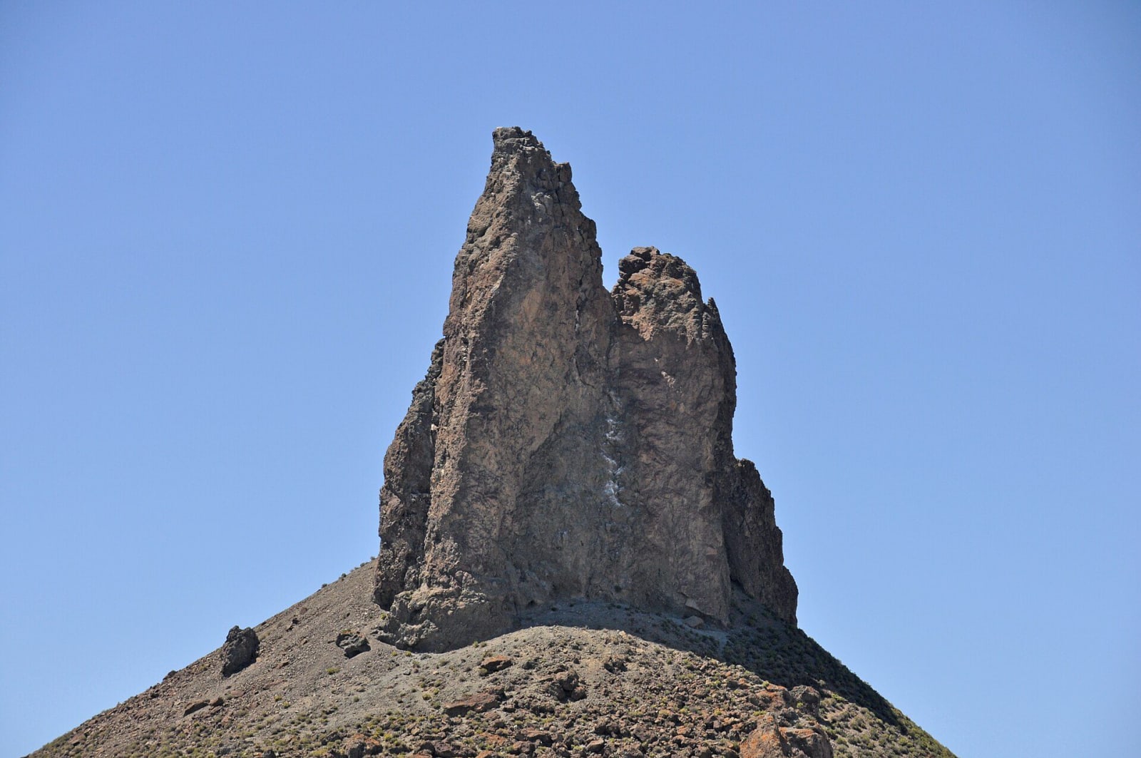
Boars Tusk, a jagged dark volcanic spire rising from a slope of loose rubble against a clear blue skyJames St. John / CC BY 2.0 via Wikimedia Commons
🏜️Geological

Boar's Tusk and the Killpecker Dunes

Part ofGreen River Country & the Red Desert

The throat of a vanished volcano made of rock from the mantle, standing over a fifty-five-mile river of dunes that crosses the Continental Divide.

PhotographyVolcanicOff-RoadingRequires 4WD
⏱
Duration
Half a day.
📅
Best Season
Late spring through fall.

The Story

Boar's Tusk rises about four hundred feet out of the Killpecker Valley north of Rock Springs, the eroded throat of a volcano long since worn away. It belongs to the Leucite Hills, a field of some twenty-two volcanic necks, mesas, cones and dikes that geologists count among the most important lamproite fields in the world. Lamproite is a rare rock that comes up from the earth's mantle, in some parts of the world carrying diamonds, and the Tusk holds broken pieces of everything it pushed through on the way: mantle rock, granite from the crust, and the sandstones of the Wasatch and Green River formations.

At its foot begin the Killpecker Sand Dunes, one of the largest active dune fields in North America, running about fifty-five miles east across the Continental Divide into the Great Divide Basin and covering some 109,000 acres. The sand was washed out of the Wind River Range by the Big and Little Sandy rivers as the glaciers melted and has been driven east by the prevailing wind ever since. The dunes soak up snowmelt and rain, and in spring ponds form between them, drawing shorebirds, wild horses and the Red Desert's elk, the largest herd of desert-dwelling elk in the world.

The dunes are reached by gravel county roads off US-191 about ten miles north of Rock Springs. Part of the field is open to off-road vehicles, the base of the Tusk is best reached with four-wheel drive, and there are no services.

Visitor Info

⏱
Time Needed
Half a day.
📅
Best Season
Late spring through fall.
🛣️
Highway
US-191

On the Map

Nearby

The closest stops worth working into your route

historical34 mi away
Expedition Island
Where John Wesley Powell's 1871 survey left for the canyons of the Green and Colorado; where his 1869 trip started has never been proven.
historical40 mi away
South Pass City State Historic Site
The Carissa lode built the town in a year; the mine outlived the boom by eight decades, and its mill runs again for visitors.
historical53 mi away
Names Hill State Historic Site
The Sublette Cutoff's register cliff above the Green River crossing, where the most famous name, Jim Bridger's, is probably not his.
geological55 mi away
Sinks Canyon State Park
A river that vanishes into a limestone cave and comes back a quarter mile on, slower than it should, warmer, and with more water than went in.
cultural71 mi away
Museum of the Mountain Man
Six fur-trade rendezvous met near here on the Green; the only artist who ever saw one, Alfred Jacob Miller, came in 1837.
geological73 mi away
Sheep Creek Canyon Geological Loop
A drive through twisted and upturned rock layers spanning 600 million years