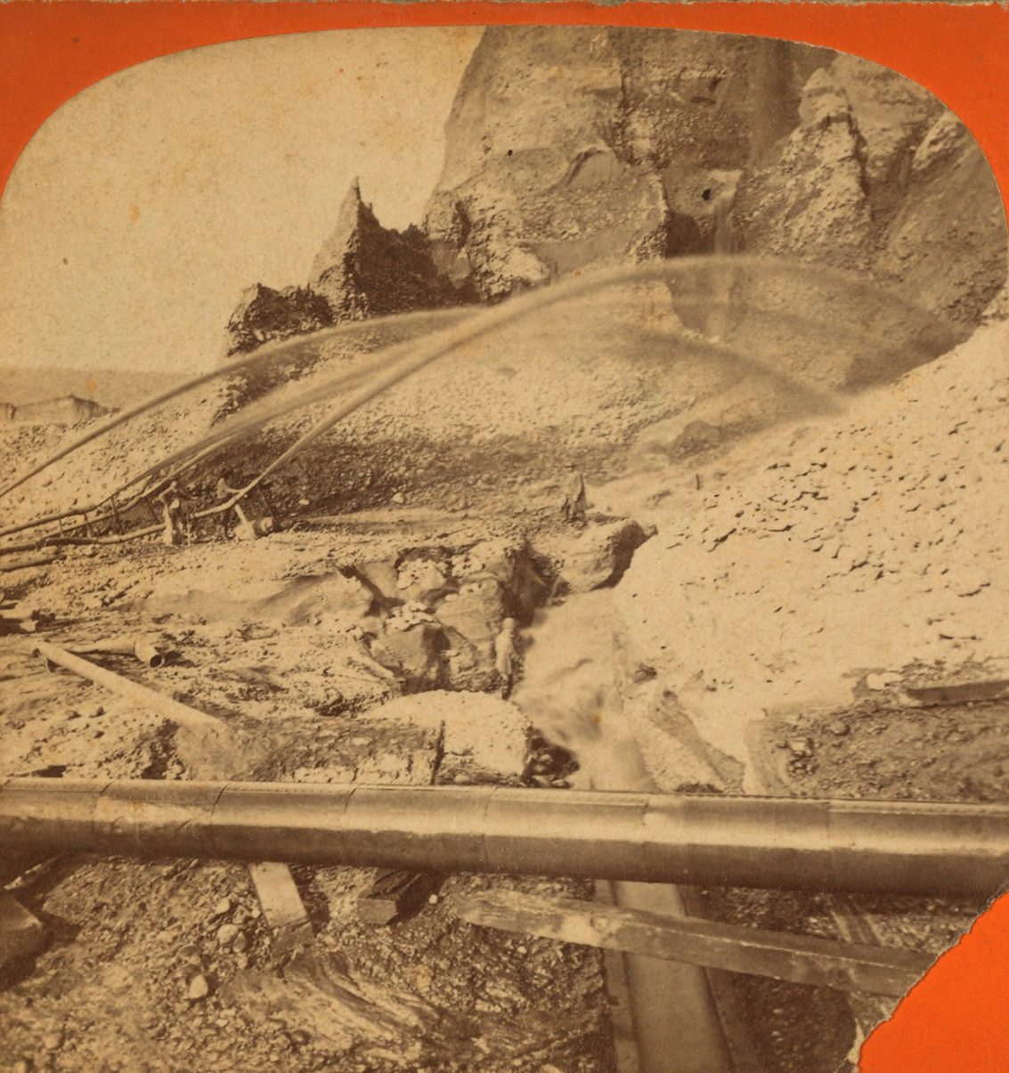
Stand at the overlook at Malakoff Diggins and the hole in front of you runs well over a mile end to end and drops hundreds of feet, in orange and white cliffs that photograph like Utah. It was a hill. Water cannons took it apart from the mid-1860s until the courts stopped them in 1884, and the state has kept the pit as a park ever since.
The pit is the part everyone comes to see. The more interesting question is where the hill went.
Downhill, mostly
Hydraulic mining processed more than 1.5 billion cubic yards of gravel out of the northern Sierra between the 1850s and the 1880s. It did not stay in the mountains. The monitors washed it into the creeks, the creeks carried it into the Yuba and the Bear and the American, and those carried it into the Feather and the Sacramento and eventually into the Bay.
Nineteenth-century Californians had a word for the fine grey sediment that came to rest on their land: slickens. It buried orchards and wheat fields. It filled river channels until steamboats could not get up them, and it raised beds so far above the surrounding country that the rivers began leaving them. During North Bloomfield's operating years, the Yuba's bed rose about fifteen feet. Marysville and Sacramento both flooded because of it, which is part of why Sacramento eventually jacked its downtown into the air rather than keep drowning.
You can read the same event in gentler form further south, where the pale limestone knobs standing around Columbia are simply what was left after the gravel around them was washed off.
Not every mine worked this way. The hard-rock operations, like Empire Mine at Grass Valley, followed quartz veins underground and left their waste in mills and tailings piles rather than in the rivers. Hydraulic mining was different in kind. It did not so much dig for the gold as remove the landscape around it and sort the remains downstream, at the expense of whoever lived there.
The part that is still in the water
The other thing the mining put into the rivers was mercury.
Placer and hydraulic operations recovered fine gold by running the slurry over liquid mercury in the sluices, which bonds with gold into an amalgam. It worked. It also leaked: contemporary estimates put the loss at somewhere between ten and thirty percent of the mercury charged, per season. Across the Sierra gold country the total lost to the environment is estimated at roughly ten million pounds.
That mercury did not degrade or go anywhere useful. It is still in the sediment. In some drainages you can still find beads of the liquid metal in the streambed, and where bacteria in wet sediment convert it to methylmercury, it moves into the food web and concentrates upward. Fish in the Bear and Yuba watersheds carry enough of it that the state issues advice about eating them.
What 1884 did and did not fix
The lawsuit that ended it came from a Marysville wheat farmer named Edward Woodruff, who sued the North Bloomfield company in 1882 over what Malakoff was doing to his land. Judge Lorenzo Sawyer took two years and produced a 225-page decision on January 7, 1884, enjoining the discharge of mining debris into the rivers.
What that decision stopped was the discharge. It did not remove anything already in the system, and it was not the end of the industry either: the Caminetti Act of 1893 made hydraulic mining legal again where operators could contain their tailings, under license from a federal debris commission, and mercury kept being used in the Yuba watershed into about 1950.
So the correct way to think about 1884 is not as a cleanup. It is the moment California stopped adding to the pile.
It has not finished arriving
Here is the part that surprises people. The debris is still on the move.
The U.S. Geological Survey has spent decades tracking it, and the reason is that the deposits are actively eroding. At the confluence of the South Yuba River and Humbug Creek — the creek that drains Malakoff — there is a cliff of hydraulic mining debris roughly fifty feet high that the river is cutting into, with mercury concentrations in its fine fraction well above background. Another monitored site sits at Stocking Flat on Deer Creek, a couple of miles below Nevada City.
The mechanism is unhelpful. The mercury rides on the silt and clay, and silt and clay are exactly the fractions that travel farthest once a river picks them up. Every high-water year moves some more of it toward the Delta. The material coming off that cliff today was blasted out of a hillside before the invention of the automobile.
What you are actually looking at
None of this makes Malakoff a bad place to spend an afternoon. The pit is a beautiful thing to look at, the town of North Bloomfield is preserved, and the story is told honestly on site.
But it is worth arriving with the scale right. The park is not a monument to a finished event. It is the upstream end of something still in progress, and the rivers running out of these hills — the ones people raft and swim and fish in all summer — are still carrying the nineteenth century downhill a little at a time. The gold went to the banks in Sacramento and San Francisco in about thirty years. The bill is taking considerably longer.