Home / South Dakota / Deadwood & the Northern Hills / Bear Butte
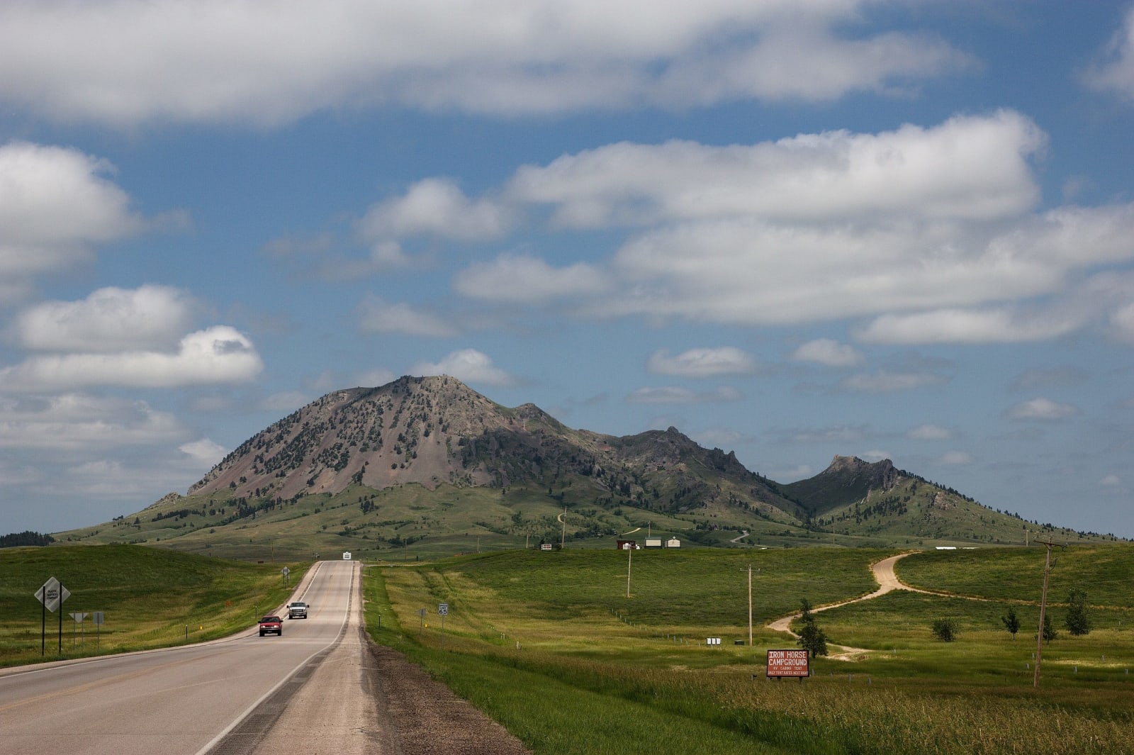
Bear Butte rising alone above the prairie at the end of a straight two-lane roadWilliam Neuheisel / CC BY 2.0 via Wikimedia Commons
🎭Cultural

Bear Butte

Part ofDeadwood & the Northern Hills

Mato Paha to the Lakota and Noahvose to the Cheyenne, a lone mountain off the plains where both nations still come to fast and pray.

Native American HeritagePaid EntryHiking
⏱
Duration
Two to three hours with the summit trail.
🎟
Admission
State park entrance license.
📅
Best Season
Late spring through fall; ceremonies run through the summer, and rally crowds fill the area in early August.

The Story

Bear Butte stands by itself a few miles northeast of Sturgis, a mass of igneous rock that pushed up under the plains and was left standing when the softer layers around it wore away. The Lakota call it Mato Paha, Bear Mountain, for the sleeping bear its outline makes from a distance. To the Cheyenne it is Noahvose, the place where the people were taught: their prophet Sweet Medicine went into the mountain and came out with the laws and the Sacred Arrows that made them a nation. Artifacts found around its base go back some ten thousand years.

It is still a place of prayer, and the state park is run around that fact. People come to fast and seek visions on its slopes, and the strips of colored cloth and small bundles of tobacco tied in the pines along the trail are prayers, to be left where they hang and not photographed up close. East of Highway 79 the park bans alcohol, and it asks that no one scatter ashes, because the mountain is not a burial ground.

The state bought the butte in 1961. Since then the Sturgis motorcycle rally has grown into an August crowd of hundreds of thousands, and campgrounds and bars have crept toward the mountain's base, a pressure Lakota and Cheyenne people have protested for decades. The summit trail climbs the south side through pine and bare rock to the top, and a bison herd ranges the grass below.

Visitor Info

⏱
Time Needed
Two to three hours with the summit trail.
🎟
Admission
State park entrance license.
📅
Best Season
Late spring through fall; ceremonies run through the summer, and rally crowds fill the area in early August.
🛣️
Highway
SD-79

On the Map

Nearby

The closest stops worth working into your route

historical16 mi away
Mount Moriah Cemetery
The hillside where Deadwood moved its dead: Wild Bill and Calamity Jane side by side, Seth Bullock looking at his friend's tower, and the Chinese burner of 1908.
historical16 mi away
Deadwood Historic District
A gold-rush town on treaty land, rebuilt in brick after the 1879 fire and rescued a century later by a vote to let casinos pay for its preservation.
industrial18 mi away
Homestake Open Cut & Sanford Lab Visitor Center
A 1,250-foot pit on Lead's Main Street, the visible top of a gold mine that went down 8,000 feet in 125 years and is a physics laboratory now.
natural26 mi away
Spearfish Canyon
A limestone canyon nineteen miles long whose waterfalls ran dry for most of a century while the Homestake piped their water to its power plants.
cultural28 mi away
The Journey Museum and Learning Center
Four collections under one roof in downtown Rapid City, among them the federal Sioux Indian Museum, founded in 1939 to keep Lakota art in Lakota country.
cultural37 mi away
Vore Buffalo Jump
A gypsum sinkhole where hunters trapped bison for 250 years, each hunt sealed in its own layer, and the reason Interstate 90 bends south here.