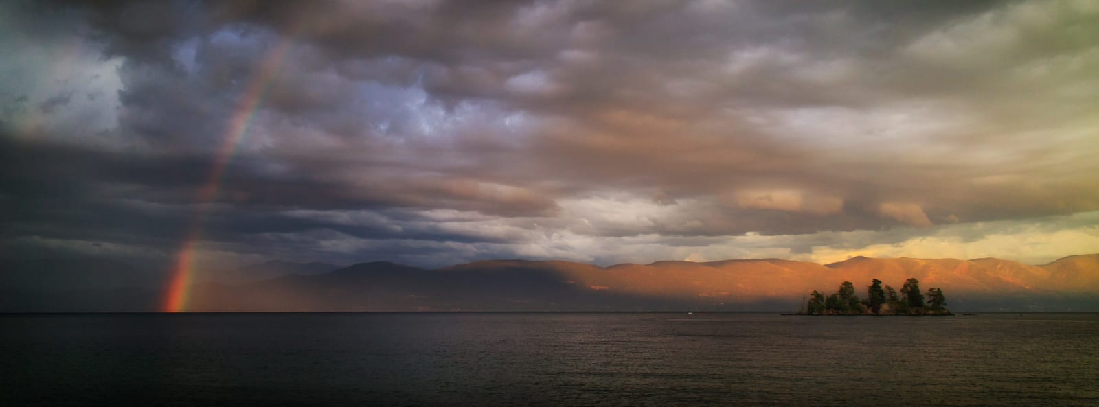
Storm light over Flathead Lake, a rainbow at the left and a small wooded island before the mountains on the far shore
David Lee / CC BY 2.0 via Wikimedia Commons
Montana · Region

Glacier & the Flathead

Séliš, Ksanka and Ql̓ispé country: the Flathead Reservation and the Bison Range returned in 2022, Flathead Lake, and Going-to-the-Sun Road over Glacier's Logan Pass.

9 places to explore

The Séliš, Ksanka and Ql̓ispé peoples reserved this country for themselves in the Hellgate Treaty of 1855, and the United States promised it would be their homeland for good. Within fifty years the Flathead Reservation was opened to homesteaders over the tribes' objections, and in 1908 Congress took nearly nineteen thousand acres from the middle of it for a National Bison Range, stocked from a herd that tribal members had raised from orphaned calves. The Confederated Salish and Kootenai Tribes have been taking their country back piece by piece. In September 2015 they paid $18.2 million for Kerr Dam on the lower Flathead River, renamed it Séliš Ksanka Ql̓ispé, and became the first tribe in the nation to own a major hydroelectric dam. On January 2, 2022, the Bison Range came home.

North of the dam lies Flathead Lake, the largest natural freshwater lake by area west of the Mississippi, cherry orchards along its east shore. Past Kalispell and Whitefish the road climbs into Glacier National Park, created on May 11, 1910. The Going-to-the-Sun Road, finished in 1932 after eleven years of work, crosses the Continental Divide at Logan Pass, 6,646 feet up, and its high section is usually plowed open only in late June or early July. The ice the park was named for is going: about 150 glaciers in 1850, 26 at the park's count in 2015, every one of them shrinking.

West of the lake the land turns to timber, the Kootenai River and the Cabinet Mountains, the far northwest corner of the state.

What to See in Glacier & the Flathead

9 places across the region, grouped by what they are.

Natural Areas
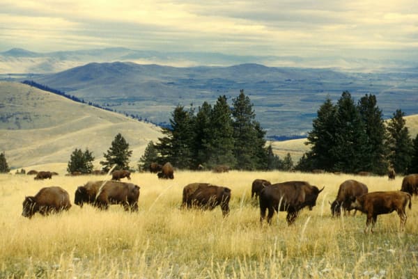
Bison grazing in golden grass on the CSKT Bison Range, with timbered ridges and the valley beyond

CSKT Bison Range

Moiese

The herd the tribes saved, the government forced them to sell, and the range they finally got back.

View details →
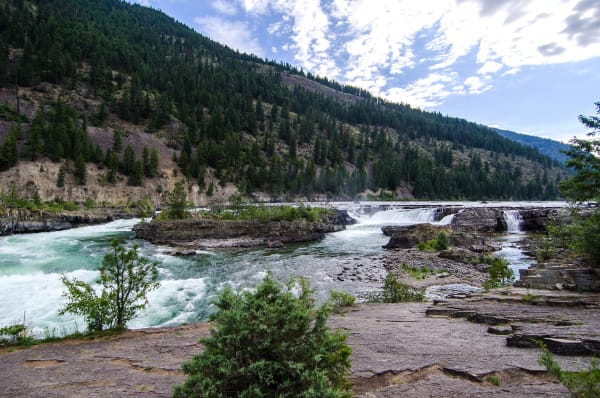
Kootenai Falls, the river breaking white over ledges of rock below forested hills

Kootenai Falls

Libby

The Kootenai people's sacred falls, kept running free by a nine-year fight against a dam.

View details →
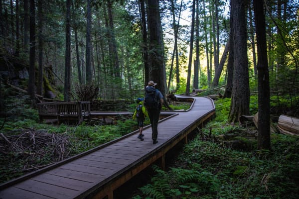
A park ranger and a child walking away along the boardwalk of the Trail of the Cedars through tall redcedar and hemlock

Trail of the Cedars

West Glacier

A Pacific forest that runs out of ocean air at the foot of the Continental Divide.

View details →

Historic Sites

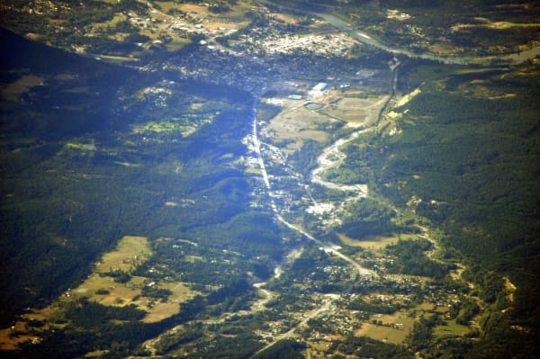
Libby from the air, the town spread along the Kootenai River valley between forested mountains

Libby

Libby

A timber town where the mine's dust killed hundreds, and the first place the EPA ever declared a public health emergency.

View details →
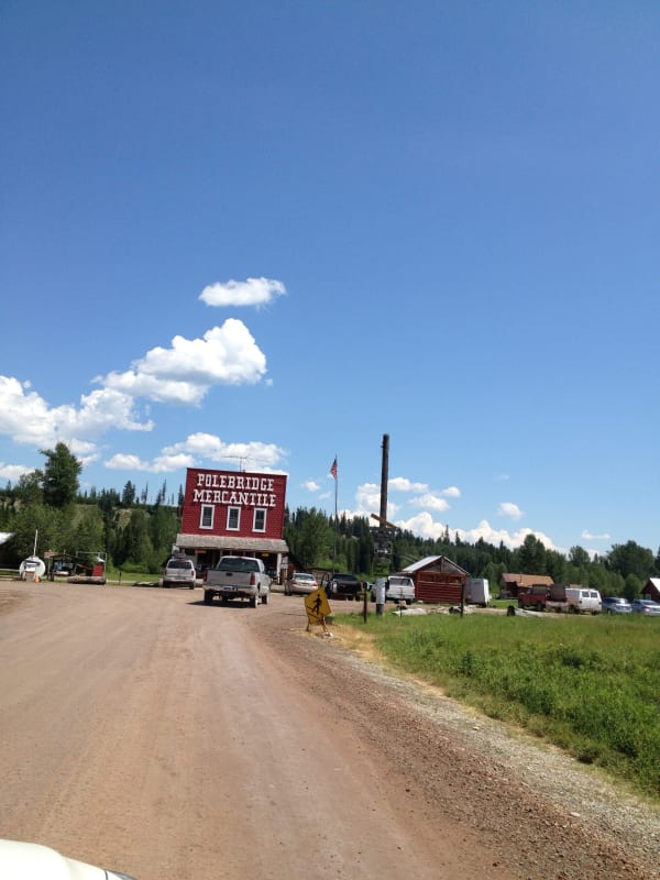
The red false-front Polebridge Mercantile at the end of a gravel road under a wide sky

Polebridge Mercantile

Polebridge

A 1914 log store past the end of the power lines, still baking for whoever makes it up the North Fork Road.

View details →

Towns & Gateways

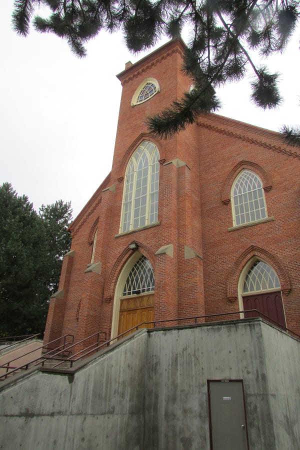
The red-brick St. Ignatius Mission church, its tall arched windows and gabled front rising above a concrete stair

St. Ignatius Mission

St. Ignatius

A brick church painted wall to ceiling by the mission cook, beside the boarding schools the mission ran for Native children.

View details →

Architecture

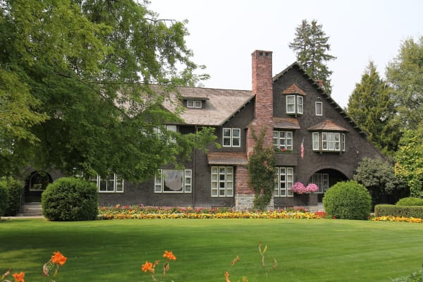
The Conrad Mansion in Kalispell, a dark shingled house with a red stone chimney behind a lawn and flower beds

Conrad Mansion

Kalispell

Kalispell's founder built it in 1895; in 1974 the town's voters said no to owning it.

View details →
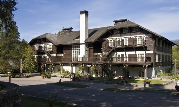
Lake McDonald Lodge, a Swiss chalet of dark timber and white walls with wooden balconies, among the trees

Lake McDonald Lodge

West Glacier

A hunting lodge built with its front door on the lake, because in 1914 its guests arrived by boat.

View details →

Industry & Mining

The round concrete morning-glory spillway standing in the reservoir beside the Hungry Horse Dam intake tower

Hungry Horse Dam

Hungry Horse

Named for two freight horses that nearly starved in the snow, and home to the tallest morning-glory spillway in the world.

View details →

Scenic Drives through Glacier & the Flathead

Scenic Byway

Going-to-the-Sun Road: West Glacier to St. Mary

Fifty miles across Glacier National Park: Lake McDonald, the Loop, the Garden Wall and Logan Pass, then down past Jackson Glacier to St. Mary Lake and the Blackfeet Reservation.

50 mi · 2 hrs

Stories from Glacier & the Flathead

Nature

Two Bears, One Night

On August 13, 1967, two grizzlies killed two young women miles apart in Glacier National Park. Both bears had learned to look to people for food, and the park has managed bears differently ever since.

4 min read

Glacier & the Flathead rewards the unhurried. Pick a base, fan out, and let the country between the headline stops surprise you.

← Explore more of Open Road Guide