Home / Arkansas / Buffalo River & the Ozark Mountains / Whitaker Point (Hawksbill Crag)
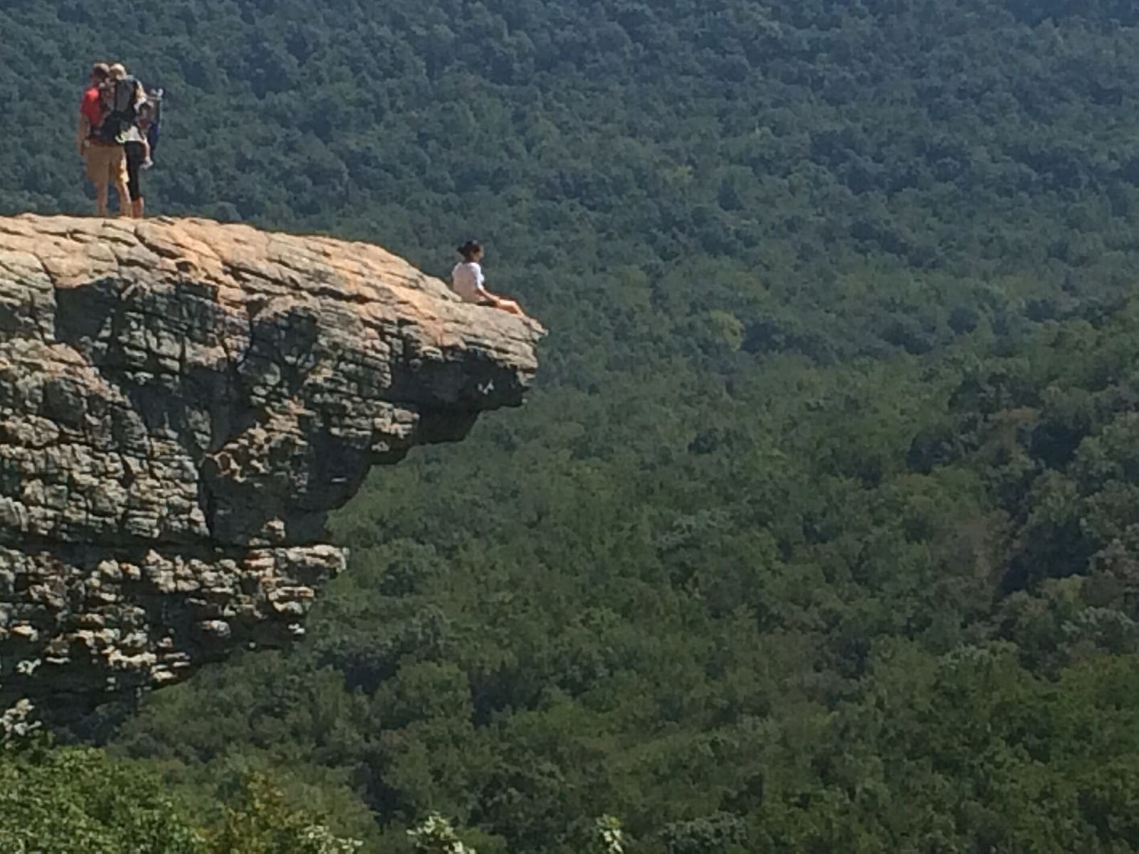
Hikers stand and sit on the edge of Hawksbill Crag, a rock ledge jutting out over a forested valley.Sogandka / CC BY-SA 4.0 via Wikimedia Commons
🌲Natural

Whitaker Point (Hawksbill Crag)

Part ofBuffalo River & the Ozark Mountains

The one designated trail in the Upper Buffalo Wilderness leads to Hawksbill Crag, a bluff over the river's headwaters in a valley no one has lived in since 1948.

⏱
Duration
Two to three hours.
🎟
Admission
Free; the trailhead is open 24 hours with no restroom or drinking water (Forest Service).
📅
Best Season
Year round (Forest Service listing).

The Story

Hawksbill Crag, also called Whitaker Point, sits inside the Upper Buffalo Wilderness, and the trail to it is the only designated hiking route in the wilderness. Congress created the main section in 1974 and added land in the 1984 Arkansas Wilderness Act, for about 12,000 acres in all. The Buffalo River's headwaters rise here. The forest is mostly second- and third-growth oak and hickory, with shortleaf pine standing in old fields from when the Forest Service bought the land in the 1930s and 1940s. No one has lived in the area since 1948, and hikers still pass decaying houses, farm implements and roads in the valleys.

The approach is rough. Hikers drive Cave Mountain Road, a steep gravel track that one local hiking guide measures at about six miles from Boxley, and park at a small lot marked for wilderness access. The Forest Service lists the trailhead as open around the clock, free, with no restroom or drinking water. The trail is developed but unmarked and runs about 2.7 miles out and back with 324 feet of climbing.

As in any federal wilderness, motors and bicycles are barred. Camping and fishing are generally allowed with a proper permit, hunting is allowed in season, and black bears live in the area. Bring water, since none is provided.

Visitor Info

⏱
Time Needed
Two to three hours.
🎟
Admission
Free; the trailhead is open 24 hours with no restroom or drinking water (Forest Service).
📅
Best Season
Year round (Forest Service listing).
🛣️
Highway
Cave Mountain Road

On the Map

Nearby

The closest stops worth working into your route

natural9 mi away
Lost Valley Trail
A box-canyon walk past a natural bridge, a 2,000-year-old bluff shelter and a 53-foot waterfall, the most popular hike in Buffalo National River.
historical9.1 mi away
Boxley Valley Historic District
A seven-mile farm valley of log houses, a grist mill and a 1980s elk herd inside Buffalo National River, still lived in and still grazed by cattle.
recreational23 mi away
Withrow Springs State Park
A 54-degree spring that runs underground into War Eagle Cave and out to War Eagle Creek, on land Roscoe Hobbs gave the state in 1962, with float trips and an oak-hickory forest.
culinary35 mi away
Wiederkehr Wine Cellars
The oldest operating winery in Arkansas, begun in 1880 in a hand-dug cellar on St. Mary's Mountain by a Swiss shoemaker, in the village that grew around it.
natural38 mi away
Hobbs State Park-Conservation Area
Arkansas's largest state park, about 12,000 acres on Beaver Lake, with the Van Winkle mill site, a graveyard of enslaved people, 54 miles of trail and regulated hunting.
historical38 mi away
Eureka Springs Historic District
An 1879 Ozark spring town on a bluff, with 230 streets and none at right angles, Basin Spring Park, the 1886 Crescent Hotel and a National Register district since 1970.