Home / Arkansas / Buffalo River & the Ozark Mountains / Boxley Valley Historic District
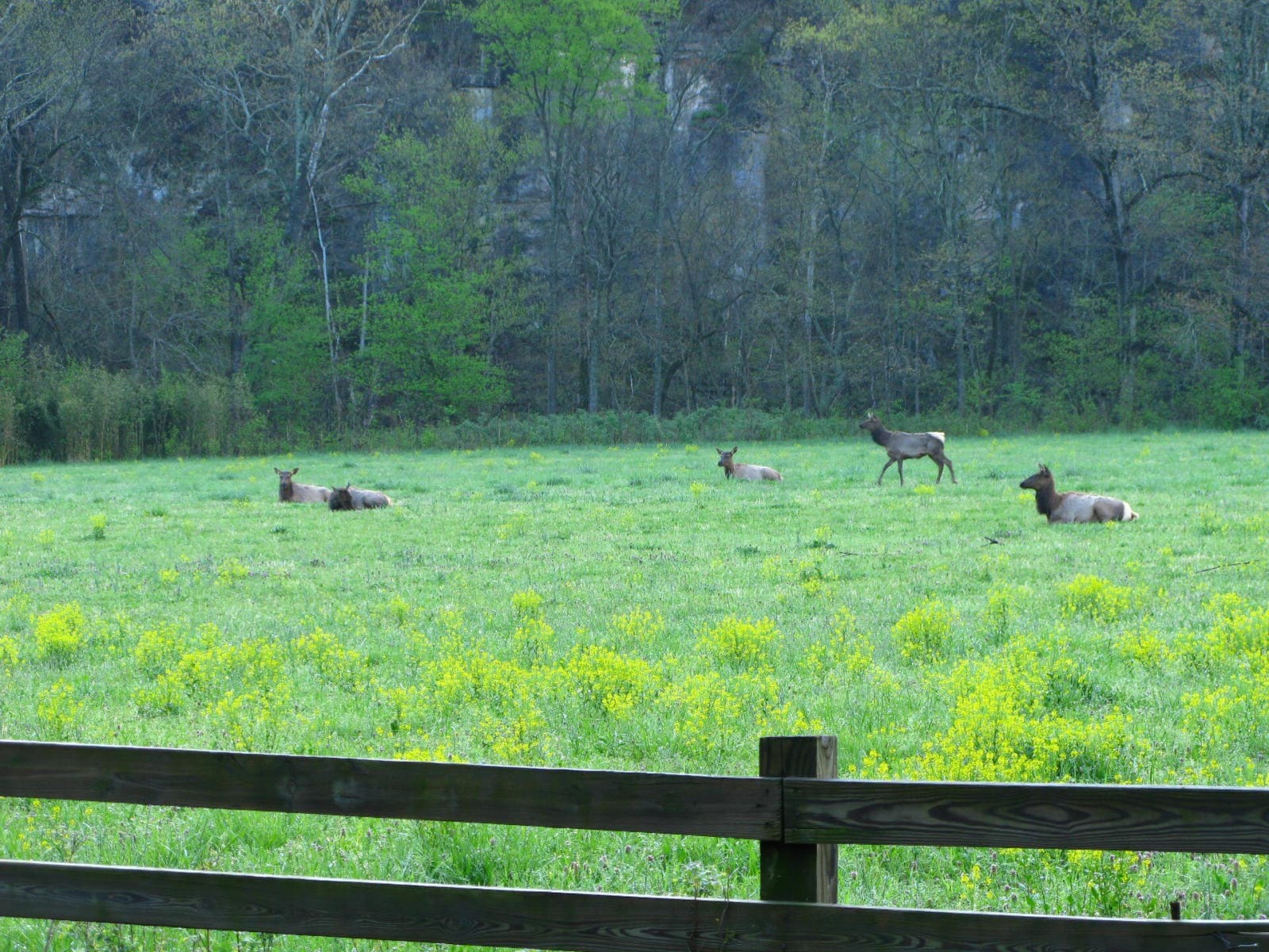
Elk rest and graze in a green, yellow-flowered field beneath a wooded bluff in Boxley Valley, seen past a wooden fence.OakleyOriginals / CC BY 2.0 via Wikimedia Commons
🏛️Historical

Boxley Valley Historic District

Part ofBuffalo River & the Ozark Mountains

A seven-mile farm valley of log houses, a grist mill and a 1980s elk herd inside Buffalo National River, still lived in and still grazed by cattle.

⏱
Duration
One to two hours.
🎟
Admission
The valley is open to the public; the farms along AR 43 are private homes.
📅
Best Season
Year round.

The Story

The Osage hunted the Buffalo River country, and from 1817 to 1828 it was part of the Cherokee treaty lands, until the Cherokee were removed to Indian Territory. Some Boxley families still trace their ancestry to that Cherokee presence. Settlers took up land in the valley about 1830, among them the Whitley, Casey and Villines families, and the Walnut Grove Baptist congregation and a water-powered grist mill date to around 1840. The mill standing today replaced that first one and has been on the National Register since 1974.

The Civil War reached the valley because of a bat-guano cave on Cave Mountain that supplied nitre for gunpowder. Union forces destroyed the Confederate mining operation in January 1863. Today the valley is a National Register district of more than 8,000 acres, with around 170 historic buildings, from one-room log houses to dogtrots, stores, a sawmill and a church and school. Landowners could sell easements rather than their land, and the Park Service meant the valley to stay a living community, so small farms still keep large garden plots and livestock.

The valley's most recent residents came back by truck. Elk were gone from Arkansas by the 1840s. In 1981 Game and Fish Commissioner Hilary Jones of Pruitt and his friends traded channel catfish to Colorado for elk, and the first calf was born in 1982. The herd was estimated at 450 to 500 in 2009. Please watch from the road, because the fields and farmsteads are private.

Visitor Info

⏱
Time Needed
One to two hours.
🎟
Admission
The valley is open to the public; the farms along AR 43 are private homes.
📅
Best Season
Year round.
🛣️
Highway
AR 43

On the Map

Nearby

The closest stops worth working into your route

natural0.9 mi away
Lost Valley Trail
A box-canyon walk past a natural bridge, a 2,000-year-old bluff shelter and a 53-foot waterfall, the most popular hike in Buffalo National River.
natural9.1 mi away
Whitaker Point (Hawksbill Crag)
The one designated trail in the Upper Buffalo Wilderness leads to Hawksbill Crag, a bluff over the river's headwaters in a valley no one has lived in since 1948.
recreational23 mi away
Withrow Springs State Park
A 54-degree spring that runs underground into War Eagle Cave and out to War Eagle Creek, on land Roscoe Hobbs gave the state in 1962, with float trips and an oak-hickory forest.
natural34 mi away
Buffalo National River at Tyler Bend
The country's first national river, kept free-flowing after a dam fight that ended in 1965, seen from the Middle District's visitor center, the Collier Homestead and the Riverview Trail.
historical34 mi away
Eureka Springs Historic District
An 1879 Ozark spring town on a bluff, with 230 streets and none at right angles, Basin Spring Park, the 1886 Crescent Hotel and a National Register district since 1970.
architectural36 mi away
Thorncrown Chapel
E. Fay Jones's 1980 glass-and-timber chapel in the Eureka Springs woods, 48 feet high with 425 windows, ranked by the AIA among the best American buildings of its century.