Home / Montana / Missoula & the Bitterroot / Historic St. Mary's Mission
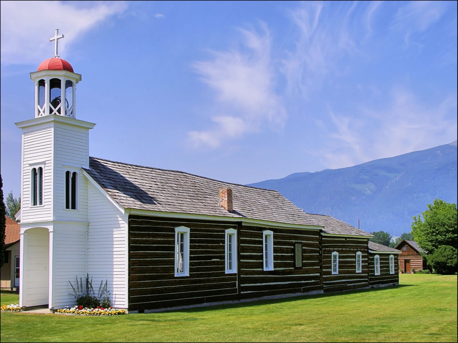
St. Mary's Mission chapel, dark squared logs under a shingle roof with a white clapboard bell tower topped by a cross, the Bitterroot Range beyondRaymond Hitchcock / CC BY-SA 3.0 via Wikimedia Commons
๐ŸŽญCultural

Historic St. Mary's Mission

Part ofMissoula & the Bitterroot

The mission the Salish asked for, abandoned, rebuilt, and closed again the year the Salish were made to leave.

Native American Heritage
โฑ
Duration
About an hour.
๐Ÿ“…
Best Season
Spring through fall.

The Story

The Bitterroot Salish had asked for the Black Robes to come, and in September 1841 Father Pierre-Jean De Smet and a small party of Jesuits came up the valley and founded St. Mary's Mission among them. Father Antonio Ravalli, an Italian Jesuit trained as a physician as well as a priest, joined them in the 1840s. The mission farmed, built Montana's first mills and kept a school, but Blackfeet raids wore it down, and in 1850 the Jesuits closed it and sold the buildings to the trader John Owen.

In 1866 the church sent Ravalli back to reopen it, half a mile south of the first site. He found the old mission in ruins and built anew, and the chapel and the small log building where he lived and kept his pharmacy, the first in Montana, are the ones that stand here now. The mission closed in 1891, the same year the last of the Bitterroot Salish were forced north to the Flathead Reservation; the local congregation went on using the chapel until 1951.

The chapel, Ravalli's house and pharmacy, and a museum make up the grounds, on the west edge of Stevensville. The town claims to be the oldest continuous settlement of newcomers in Montana; the Salish had lived in this valley for thousands of years before any of them arrived.

Visitor Info

โฑ
Time Needed
About an hour.
๐Ÿ“…
Best Season
Spring through fall.
๐Ÿ›ฃ๏ธ
Highway
MT-269

On the Map

Nearby

The closest stops worth working into your route

historical0.8 mi away
Fort Owen
A trader bought a failed mission for $250, walled it in adobe, and lost it all at a sheriff's sale.
natural3.4 mi away
Lee Metcalf National Wildlife Refuge
Bitterroot wetlands bought with duck stamps and named for the senator who signed off on refuges across the country.
historical17 mi away
Travelers' Rest State Park
The one Lewis and Clark campsite with proof in the ground: hearths, gun lead and a latrine still laced with mercury.
historical17 mi away
Fort Fizzle
A log barricade built to stop the Nimiipuu in 1877. They climbed the ridge behind it and walked around.
architectural17 mi away
Daly Mansion
A copper king's summer farm, finished by his widow after his death and boarded up for forty-six years after hers.
historical23 mi away
Fort Missoula
An 1877 Army post that held Italian seamen and Japanese immigrant men behind its fence in World War II.

Historical markers nearby

Roadside plaques and monuments within a short detour

Marker16 mi away
Lewis and Clark in Salish Territory
Marker16 mi away
The Bitterroot Valley, Homeland of the Selรญลก
Marker17 mi away
Lewis and Clark on Lolo Creek
Marker17 mi away
Fort Fizzle
Marker17 mi away
The Lolo Trail
Marker18 mi away
The Nez Perce Sikum