Home / Texas / Big Bend, Marfa & Alpine / Santa Elena Canyon
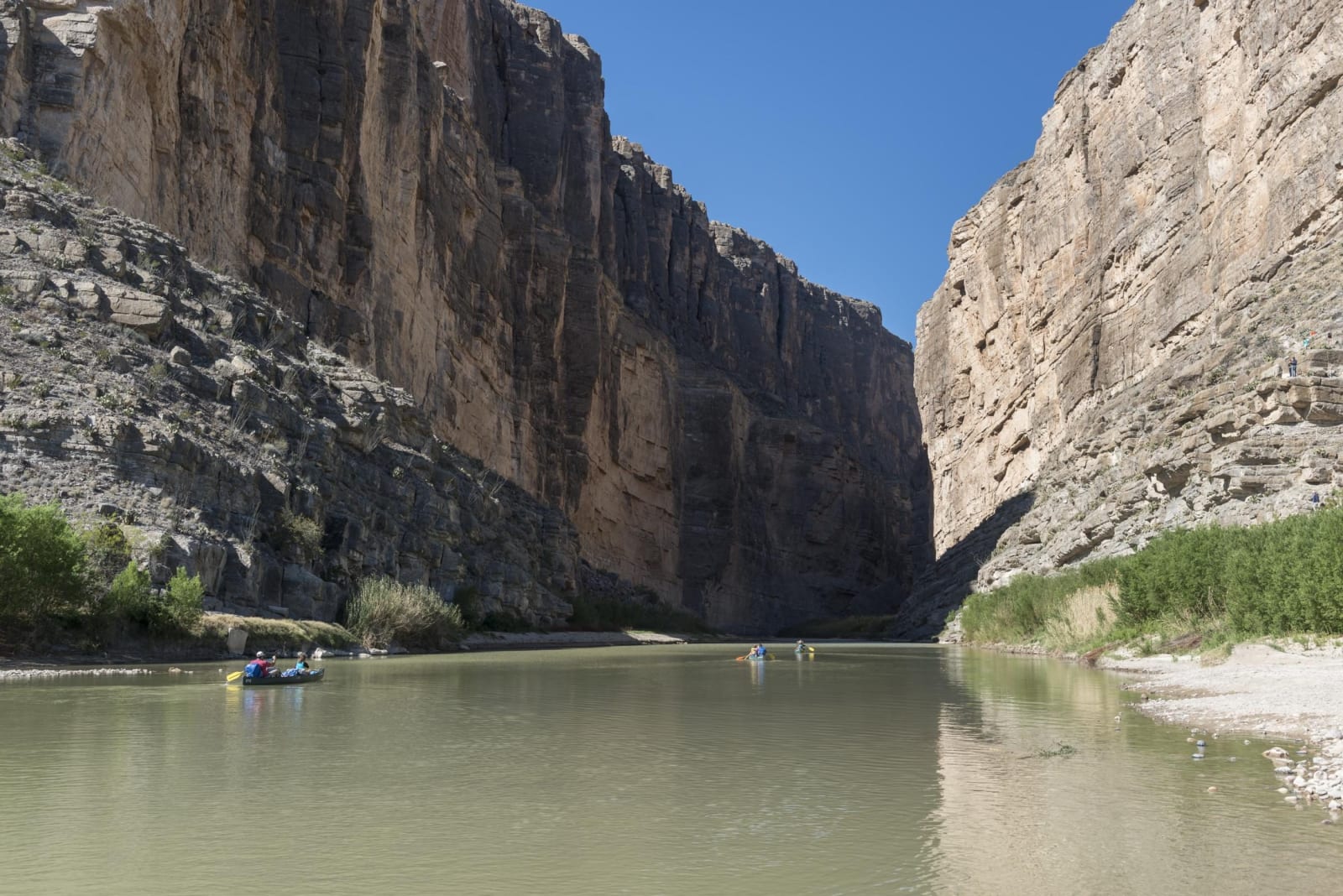
The Rio Grande flowing out of Santa Elena Canyon between sheer limestone walls, with paddlers on the water.Carol M. Highsmith / public domain via the Library of Congress
🏜️Geological

Santa Elena Canyon

Part ofBig Bend, Marfa & Alpine

The Rio Grande's 1,500-foot-deep slot through limestone at the west end of Big Bend National Park, reached by a short trail at the end of the Ross Maxwell Scenic Drive.

⏱
Duration
One to two hours.
🎟
Admission
Included in the park entrance fee.
📅
Best Season
October through April. Summer afternoons are very hot; summer storms can flood Terlingua Creek.

The Story

Santa Elena Canyon is where the Rio Grande cuts through a wall of limestone at the west end of Big Bend National Park. The cliffs rise 1,500 feet straight from the water, Mexico on one side and Texas on the other, and in places the canyon is only 30 feet wide. The river set its course on soft sediments that once filled the basin and then cut down through the hard Lower Cretaceous limestone beneath, leaving the walls that show those ancient layers today.

The canyon is at the end of the Ross Maxwell Scenic Drive, past Castolon. An overlook shows the mouth from a distance. The Santa Elena Canyon Trail goes inside: 1.6 miles round trip with 80 feet of climbing, about an hour. First you cross the bed of Terlingua Creek, which may be dry sand, thick mud or running water depending on recent rain, and climb a short steep bank. Concrete steps lead up to a viewpoint, and then the path drops to the river and winds among boulders until it ends where the canyon wall meets the water. Listen for canyon wrens.

Do not try to keep your feet dry by scrambling around the creek on the cliffs; that is not the trail, and it can be extremely dangerous. If the creek is deep and swift, do not cross, and enjoy the view from the near side. The trail can be impassable after summer floods. River trips of two or three days through the whole canyon start at Lajitas, outside the park.

Visitor Info

⏱
Time Needed
One to two hours.
🎟
Admission
Included in the park entrance fee.
📅
Best Season
October through April. Summer afternoons are very hot; summer storms can flood Terlingua Creek.
🛣️
Highway
Ross Maxwell Scenic Drive

On the Map

Nearby

The closest stops worth working into your route

historical6.2 mi away
Castolon Historic District
An army camp built in 1919 for the Mexican Revolution and never really used, which became La Harmonia's trading post for families on both sides of the river until 1961.
historical11 mi away
Terlingua Ghost Town
The stone shells of the Chisos Mining Company's quicksilver camp west of Study Butte, where a Chicago owner made a fortune from a mine he seldom came to see.
natural11 mi away
Big Bend Ranch State Park
The largest park in the Texas system, more than 300,000 acres of volcanic desert and river canyon west of Big Bend, bought from a working ranch in 1988.
natural20 mi away
Chisos Basin
The mountain bowl at the heart of the Chisos, with the park's only lodge, the Window pour-off and trails to Emory Peak, closed for rebuilding since May 2025.
natural27 mi away
Big Bend National Park
More than 1,250 square miles of Chihuahuan Desert, the Chisos Mountains and the canyons of the Rio Grande, opened in 1944 as the first national park in Texas.
cultural40 mi away
Boquillas Crossing Port of Entry
The Big Bend port of entry opened in 2013, where visitors with passports cross the Rio Grande by rowboat ferry to the village of Boquillas del Carmen, Coahuila.

Historical markers nearby

Roadside plaques and monuments within a short detour

Marker10 mi away
Terlingua
Terlingua
Marker11 mi away
Federico Villalba
Terlingua