Home / Arkansas / Buffalo River & the Ozark Mountains / Rush Historic District
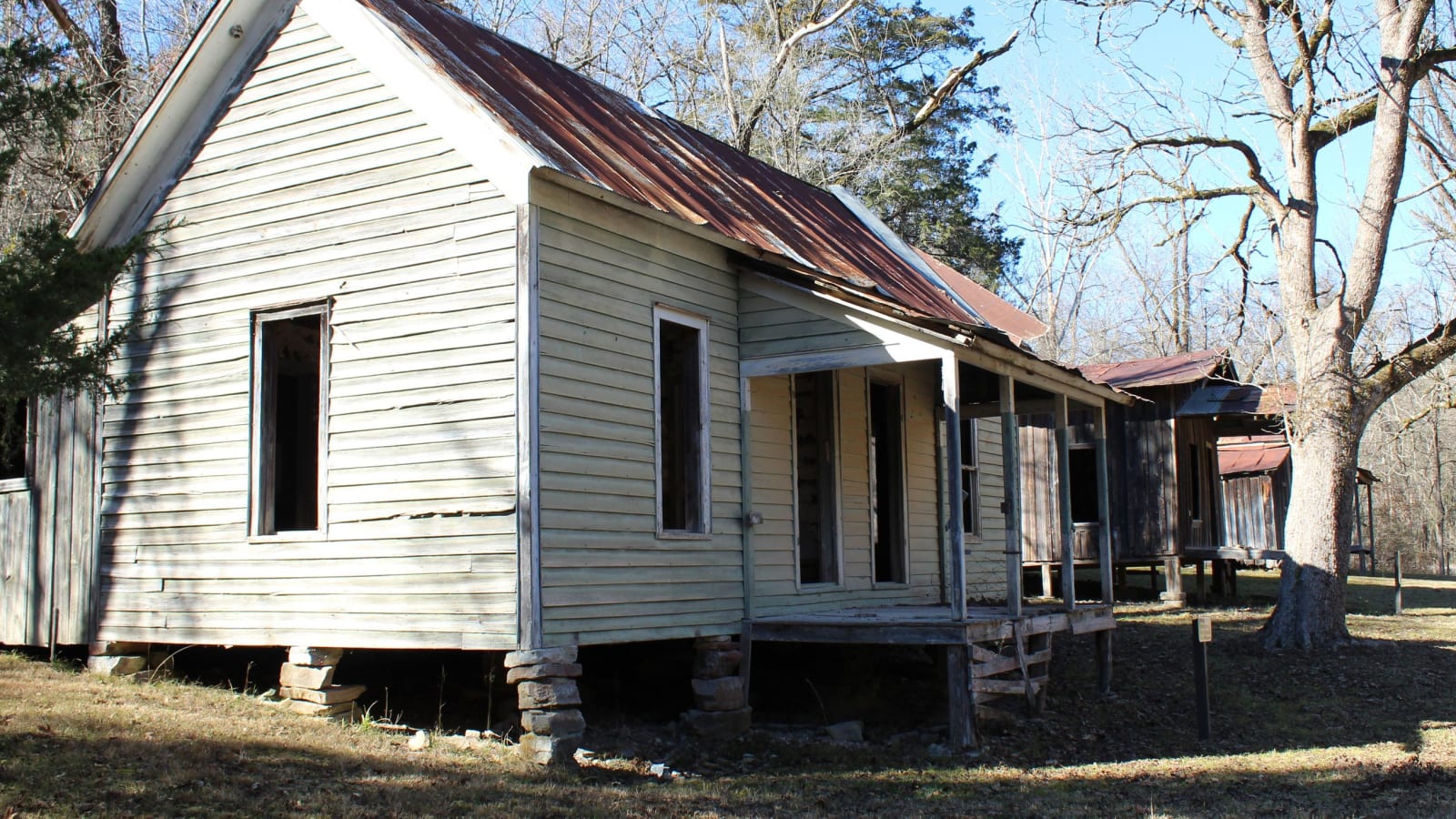
A weathered clapboard house with a rusted metal roof and an open porch stands among bare trees in the Rush Historic District.National Park Service / public domain
🏛️Historical

Rush Historic District

Part ofBuffalo River & the Ozark Mountains

The zinc-mining camp on Rush Creek that boomed from the 1880s, emptied after 1919 and now stands inside Buffalo National River as a ghost town.

⏱
Duration
One to four hours.
🎟
Admission
No activity fee posted for the trails (National Park Service).
📅
Best Season
Year round, any time of day; the road in is gravel and the Mine Level Trail is steep.

The Story

Before there was a camp, Cherokee farmed along the Buffalo River, until the 1828 Treaty of Washington pressed the Western Cherokee in Arkansas to give it up. Then in the early 1880s prospectors arrived looking for lost silver mines said to figure in Indian legends. The Encyclopedia of Arkansas says a smelter built on Rush Creek in 1886 ran its first test in January 1887 and gave off green zinc oxide fumes instead of silver. The Park Service dates the Morning Star Mine to 1885 and calls it the district's largest operation.

The camp grew past its limits. The Encyclopedia puts it near 5,000 people, while the Park Service's landscape report counts 2,000 to 3,000 at the peak. Zinc demand in World War I fed a boom from 1911 to 1918. Prices fell in 1919, the 1920 census found only 344 residents, and the last Morning Star mine closed in 1931. The post office lasted until the mid-1950s. The remaining townspeople advertised "Rush Ghost Town," and in 1972 the land became part of Buffalo National River.

Walkers can see the Taylor-Medley General Store, a blacksmith shop of 1925, the smelter and House Row, houses from about 1899, with a metal roof and open porch on each. The quarter-mile Morning Star Interpretive Loop starts at the small gravel lot. The Mine Level Trail climbs 1.5 miles past fenced mine entrances to the river access lot. Pets are not allowed, and the district has been on the National Register since 1987.

Visitor Info

⏱
Time Needed
One to four hours.
🎟
Admission
No activity fee posted for the trails (National Park Service).
📅
Best Season
Year round, any time of day; the road in is gravel and the Mine Level Trail is steep.
🛣️
Highway
AR 14 and County Road 6035

On the Map

Nearby

The closest stops worth working into your route

natural15 mi away
Buffalo National River at Tyler Bend
The country's first national river, kept free-flowing after a dam fight that ended in 1965, seen from the Middle District's visitor center, the Collier Homestead and the Riverview Trail.
historical16 mi away
Jacob Wolf House
Arkansas's oldest public structure, a two-story dogtrot log house at the Norfork confluence that served as the Izard County courthouse in 1829 and later as a family home.
recreational17 mi away
Bull Shoals-White River State Park
A state park below Bull Shoals Dam, where a visitor center overlooks the dam and lake and the White River below is a nationally known trout stream.
historical23 mi away
Calico Rock Historic District
A one-block railroad-era Main Street climbing a hillside above the White River, rebuilt in brick and stone after the 1923 fire, with a hotel of homemade cement blocks.
geological24 mi away
Blanchard Springs Caverns
A living limestone cave in the Ozark National Forest, opened to the public in 1973 on a spring that once ran a Confederate veteran's gristmill.
cultural30 mi away
Ozark Folk Center State Park
A state park of working craftspeople, a herb garden and live mountain music at Mountain View, born of a 1963 folk festival and a plan to pay for a sewer.