Home / Arkansas / Buffalo River & the Ozark Mountains / Buffalo National River at Tyler Bend
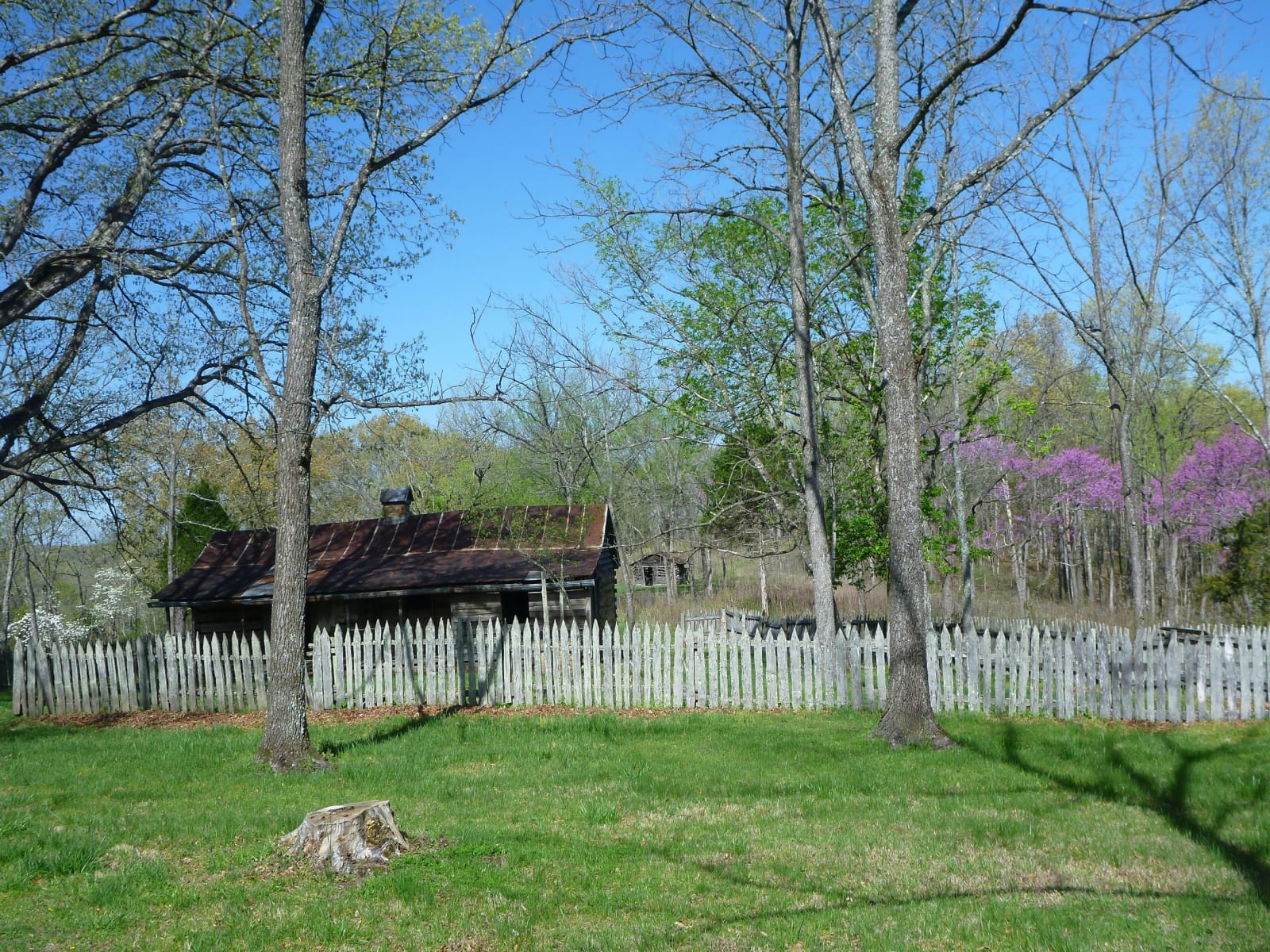
A weathered log cabin with a rusted tin roof stands behind a gray picket fence among oaks and blooming redbuds at the Collier Homestead.National Park Service / public domain
🌲Natural

Buffalo National River at Tyler Bend

Part ofBuffalo River & the Ozark Mountains

The country's first national river, kept free-flowing after a dam fight that ended in 1965, seen from the Middle District's visitor center, the Collier Homestead and the Riverview Trail.

⏱
Duration
Half a day.
🎟
Admission
No activity fee for the visitor center or Tyler Bend trails (National Park Service); campground fees apply March 15 to November 15.
📅
Best Season
Fall, winter and early spring for hiking, before ticks become common; the visitor center keeps posted hours of 8:30 a.m. to 4 p.m., Thursday through Monday (NPS listing, checked November 2026).

The Story

In February 1972 Congress voted to make the Buffalo the country's first national river, and the Park Service now protects 135 of its 150 miles. After the Flood Control Act of 1938 the Corps of Engineers planned dams on the Buffalo, one near its mouth and one above Gilbert. Neil Compton and the Ozark Society fought the dam backers through the early 1960s, Justice William O. Douglas canoed the river, and in December 1965 Governor Orval Faubus wrote the Corps that he could not support a dam. The Corps withdrew its plan.

Tyler Bend, in the park's Middle District off US 65 near St. Joe, is the easiest place to see what was saved. The visitor center has exhibits, a theater showing the park film, a small bookstore and rangers at the desk. A flat, easy walk of a tenth of a mile leads to the Collier Homestead, where Solomon "Sod" Collier, his wife Ida Mae and two of their seven children built a cabin on one of the last parcels along the river after moving from Kentucky in 1928, and stayed until 1962. The Riverview Trail runs 1.5 miles between the homestead lot and the visitor center, with overlooks high above the water.

The river's protection has stayed contested. After a large hog farm opened near Mount Judea in 2013, a 14.3-mile stretch of the river and Big Creek was listed as impaired in 2018, the state refused the farm's permit that year, and in 2019 the owner took a $6.2 million buyout and the land went to the state as a conservation easement.

Visitor Info

⏱
Time Needed
Half a day.
🎟
Admission
No activity fee for the visitor center or Tyler Bend trails (National Park Service); campground fees apply March 15 to November 15.
📅
Best Season
Fall, winter and early spring for hiking, before ticks become common; the visitor center keeps posted hours of 8:30 a.m. to 4 p.m., Thursday through Monday (NPS listing, checked November 2026).
🛣️
Highway
US 65

On the Map

Nearby

The closest stops worth working into your route

historical15 mi away
Rush Historic District
The zinc-mining camp on Rush Creek that boomed from the 1880s, emptied after 1919 and now stands inside Buffalo National River as a ghost town.
recreational29 mi away
Bull Shoals-White River State Park
A state park below Bull Shoals Dam, where a visitor center overlooks the dam and lake and the White River below is a nationally known trout stream.
historical31 mi away
Jacob Wolf House
Arkansas's oldest public structure, a two-story dogtrot log house at the Norfork confluence that served as the Izard County courthouse in 1829 and later as a family home.
geological33 mi away
Blanchard Springs Caverns
A living limestone cave in the Ozark National Forest, opened to the public in 1973 on a spring that once ran a Confederate veteran's gristmill.
historical34 mi away
Boxley Valley Historic District
A seven-mile farm valley of log houses, a grist mill and a 1980s elk herd inside Buffalo National River, still lived in and still grazed by cattle.
natural35 mi away
Lost Valley Trail
A box-canyon walk past a natural bridge, a 2,000-year-old bluff shelter and a 53-foot waterfall, the most popular hike in Buffalo National River.