Home / Colorado / Rocky Mountain National Park & the North / Pawnee Buttes
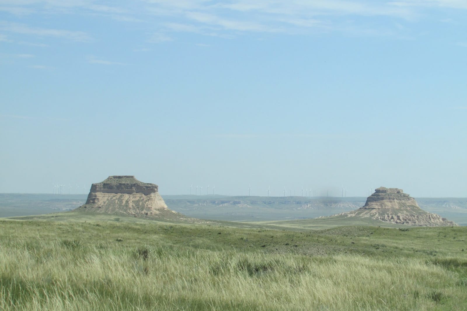
The two Pawnee Buttes standing above the shortgrass of the Pawnee National GrasslandChris Light / CC BY-SA 4.0 via Wikimedia Commons
🏜️Geological

Pawnee Buttes

Part ofRocky Mountain National Park & the North

Two remnants of a vanished plain on a grassland the government bought back from Dust Bowl homesteaders in the 1930s.

Off the Beaten PathPhotographyFossilsNo Cell ServiceFreeHiking
⏱
Duration
Two to three hours.
🎟
Admission
Free.
📅
Best Season
Spring for birds, though the cliffs are closed March 1 to June 30; fall for cool walking.

The Story

The two Pawnee Buttes stand about 300 feet above the shortgrass of northeastern Weld County, the last pieces of a higher plain that erosion has stripped away around them, with the long wall of the Chalk Bluffs to the north still holding the old level. Their layers are soft sandstone and clay, and they have yielded the fossils of mammals that grazed here long after the dinosaurs. People have hunted on these plains for some twelve thousand years.

Homesteaders came in the 1880s, and more under the enlarged homestead acts of 1909 and 1916; there were once nearly six hundred families and eighteen one-room schoolhouses on the western part of what is now the grassland. They broke the sod, and in wet years the wheat paid. By 1930 more than half the high plains of Weld County had been plowed. Then came drought, falling prices and the dust storms of the 1930s, and most of the families left.

Under the New Deal the Resettlement Administration and later the Soil Conservation Service bought up failed and eroded farms, most of the purchases complete by 1941, and set about putting them back to grass. In 1960 the land became Pawnee National Grassland, nearly 200,000 acres in two units checkered with private ranches. A trail of about two miles leads from the trailhead out to West Pawnee Butte; East Butte is mostly on private land. From March 1 to June 30 the cliffs near the trail are closed to protect nesting golden eagles, prairie falcons and hawks, the birds the grassland is now best known for.

Visitor Info

⏱
Time Needed
Two to three hours.
🎟
Admission
Free.
📅
Best Season
Spring for birds, though the cliffs are closed March 1 to June 30; fall for cool walking.
🛣️
Highway
CO-14

On the Map

Nearby

The closest stops worth working into your route

cultural43 mi away
Sterling Tree Sculptures
A plains town that answered dying shade trees by handing their trunks to a young local carver, and became the City of Living Trees.
architectural49 mi away
Wyoming State Capitol
A sandstone capitol set to face the Union Pacific depot down one long street, its copper dome gilded in 1900 when the copper tarnished.
cultural50 mi away
Cheyenne Frontier Days
A railroad agent's excursion scheme for a town with no crop to celebrate, which became a six-hour show in 1897 and the Daddy of 'em All.
natural75 mi away
Poudre Canyon
Colorado's only wild and scenic river, named for buried gunpowder in a story nobody can date, and burned along its length in 2020.
geological77 mi away
Vedauwoo
Knobs of 1.4-billion-year-old granite between Laramie and Cheyenne, rough as sandpaper and famous among climbers for its wide cracks.
natural84 mi away
Rocky Mountain Arsenal National Wildlife Refuge
Mustard gas, nerve agent and pesticides for forty years, then bald eagles, bison and black-footed ferrets on the same ground.