Home / Washington / Walla Walla & the Palouse / Palouse Falls
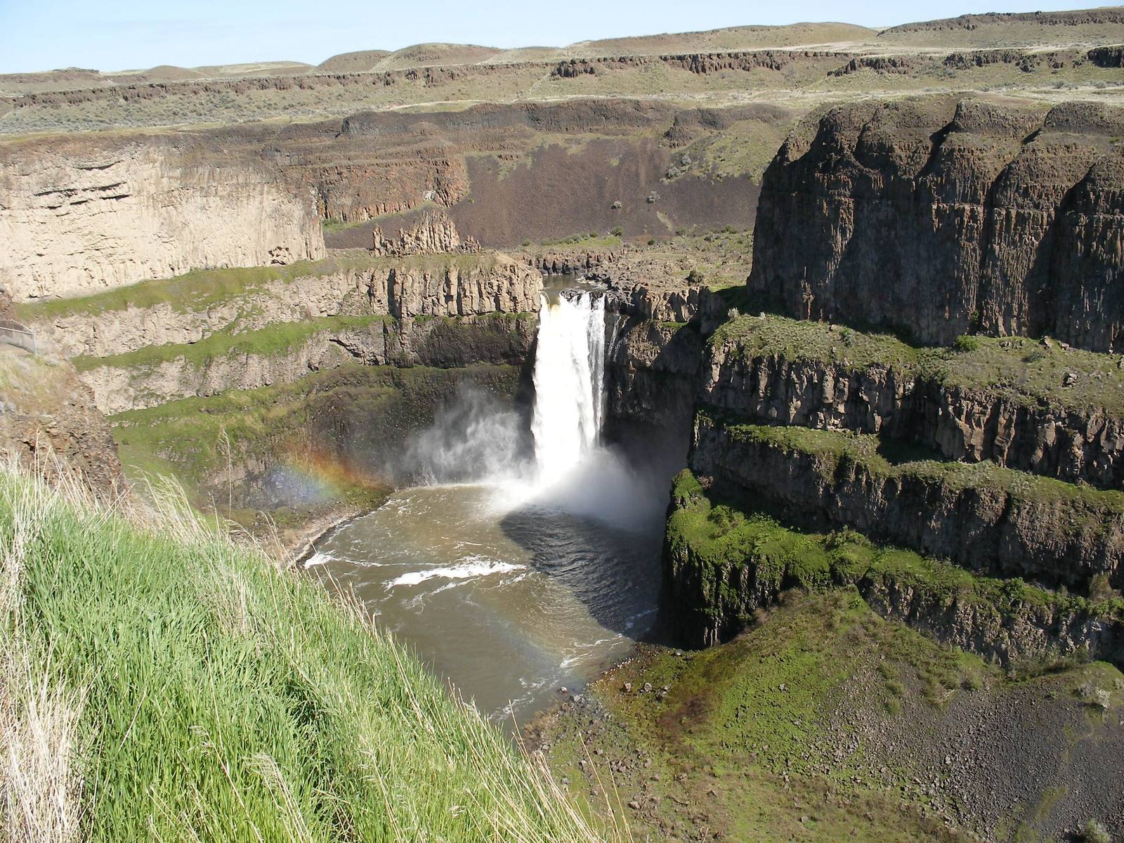
Palouse Falls dropping into its round plunge pool in a basalt canyon, a faint rainbow in the sprayPJ Blalock / public domain via Wikimedia Commons
🌲Natural

Palouse Falls

Part ofWalla Walla & the Palouse

The falls a Palouse storyteller said a giant beaver's tail made, and that a school of Washtucna children wrote into state law in 2014.

Family-FriendlyIconicPhotographySpringPaid Entry
⏱
Duration
One hour.
📅
Best Season
Spring, for the highest water.

The Story

The Palus gave the river, and the country north of the Snake, their name. Sam Fisher, a Palouse man, told how four giant brothers and their sister hunted a giant beaver for the oil in its tail. At each of the river's four falls the beaver slapped its tail as they fought, and here, at the last, its final blow made the falls and the bowl beneath them; the vertical cracks in the basalt are the marks of its claws. The geologists' account is the Ice Age floods, which carved the canyon to some 377 feet deep.

In the fall of 2013 the third- through sixth-graders of Washtucna School, in the nearest town, took up a challenge from their state representative, Joe Schmick: if they thought Palouse Falls should be the state waterfall, they could write the bill. They researched the falls' geology, culture and history and drafted House Bill 2119. In January 2014 a group of them made the icy 275-mile trip to Olympia to testify, and one told the committee the Palouse story of the beaver before adding that the falls had really been made by the Missoula floods. The House passed the bill unanimously in February and the Senate 46 to 3 in March, and on March 18, 2014, Governor Jay Inslee signed it at the falls with the children around him. A sign the students designed stands on the overlook trail.

The park is small, a few fenced overlooks on the rim with the river dropping into the bowl below. Spring brings the heaviest water. The rim is sheer and the unofficial paths down it are dangerous; the fenced overlooks give the full view.

Visitor Info

⏱
Time Needed
One hour.
📅
Best Season
Spring, for the highest water.
🛣️
Highway
SR-261

On the Map

Nearby

The closest stops worth working into your route

historical44 mi away
Whitman Mission National Historic Site
For forty years the only marks at Waiilatpu were a granite shaft on the hill and a marble slab over a common grave, and the stone arrived from Vermont too late for the anniversary it was made for.
historical44 mi away
Frenchtown Historic Site
Where the Walla Walla leader Peopeomoxmox, who had come to the Oregon volunteers under a white flag, was killed as their hostage on December 7, 1855.
historical51 mi away
Steptoe Butte
James 'Cashup' Davis opened a hotel on the summit on July 4, 1888, at seventy-two; he died alone in it eight years later, and it burned in 1911.
natural54 mi away
Drumheller Channels
A maze of flood-cut buttes and basins south of Potholes Reservoir, filled with lakes the irrigation project never meant to make, and the cranes that came for them.
natural58 mi away
White Bluffs and the Hanford Reach
Fifty-one miles of the Columbia still running free below pale cliffs, kept undammed by the same secrecy that emptied its farm towns in 1943.
industrial68 mi away
B Reactor
The first full-scale nuclear reactor started in September 1944 and died within a day, and was saved by spare fuel channels DuPont's engineers had insisted on.

Historical markers nearby

Roadside plaques and monuments within a short detour

Marker4.7 mi away
Drewyers River
Marker5.7 mi away
Mullan Road