Home / Kentucky / Mammoth Cave & South-Central Kentucky / Old Mulkey Meetinghouse State Historic Site
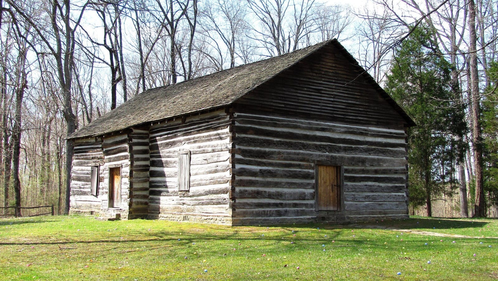
The log Old Mulkey Meetinghouse stands on a grassy clearing among bare spring trees.Brian Stansberry / CC BY 3.0 via Wikimedia Commons
🏛️Historical

Old Mulkey Meetinghouse State Historic Site

Part ofMammoth Cave & South-Central Kentucky

One of Kentucky's earliest log churches, a twelve-cornered Baptist church of 1804 near Tompkinsville, with Daniel Boone's sister Hannah in the churchyard.

⏱
Duration
Thirty minutes to an hour; longer with a picnic.
🎟
Admission
Free.
📅
Best Season
Spring through fall.

The Story

The Mill Creek Baptist congregation outgrew its first log building after the revival years, and in May 1804 its members voted for a meeting house fifty feet by thirty, shingled, with five windows and three doors, the builder to be paid in trade by subscription. What went up is a cross-shaped building of half-hewn logs with twelve outside corners, said to stand for the twelve apostles or the twelve tribes, and three doors for the Trinity. It had no fireplace. Worshippers warmed their feet in bags of heated soapstones and at a fire kept burning outside.

The name came from a quarrel. In 1809 the pastor, John Mulkey, was accused of heresy for leaning toward Barton Stone's new Christian movement, and about 150 of the 200 members went with him. From then on it was Old Mulkey. The congregation counted Black as well as white members, and it split again more than once before it stopped meeting about 1885.

The building has the original log walls, huge cross beams, peg-legged benches and a handmade pulpit; the roof and puncheon floor are replacements. In the churchyard lie fifteen soldiers of the Revolution and Hannah Boone Stewart Pennington, Daniel Boone's sister, whose first husband, John Stewart, was killed in the frontier wars over Kentucky. She died in 1828. The state keeps the site as a shrine, with picnic tables under the trees on about five acres; walk the graves with care.

Visitor Info

⏱
Time Needed
Thirty minutes to an hour; longer with a picnic.
🎟
Admission
Free.
📅
Best Season
Spring through fall.
🛣️
Highway
KY 1446

On the Map

Nearby

The closest stops worth working into your route

historical13 mi away
Red Boiling Springs
A Macon County spa town built around red sulphur springs, with five kinds of mineral water, red-painted pumps and the surviving hotels of a resort that once held more than a dozen.
historical22 mi away
Standing Stone State Park
A New Deal park on Mill Creek named for a vanished stone that Native peoples revered and railroad builders blasted, with a lake, 1930s cabins and a marbles championship.
natural23 mi away
Dale Hollow Lake State Resort Park
A 3,400-acre state park on the Kentucky end of Dale Hollow Lake, a deep, clear Corps of Engineers reservoir on the Obey River that holds the world-record smallmouth bass.
historical30 mi away
Cordell Hull Birthplace and Museum State Park
A replica of the log cabin where the secretary of state and Nobel laureate was born in 1871, with a museum of his belongings, in Pickett County's hills.
natural30 mi away
Cummins Falls State Park
A 75-foot waterfall and swimming hole on the Blackburn Fork, saved from a housing development in 2011 and opened as Tennessee's 54th state park.
geological36 mi away
Hidden River Cave and the American Cave Museum
A cave under Main Street in Horse Cave that the town's sewage killed and a regional treatment plant brought back, now home to the American Cave Museum.

Historical markers nearby

Roadside plaques and monuments within a short detour

Marker1.9 mi away
Monroe County-Tompkinsville
Tompkinsville
Marker1.9 mi away
Courthouse Burned
Tompkinsville
Marker5.1 mi away
Free-Town Church
Gamaliel
Marker7.8 mi away
Hermitage Springs
Hermitage Springs, Tennessee
Marker14 mi away
Celina During the Civil War
Celina, Tennessee
Marker15 mi away
Abraham Hananiah
Celina, Tennessee