Home / Kentucky / Mammoth Cave & South-Central Kentucky / Dale Hollow Lake State Resort Park
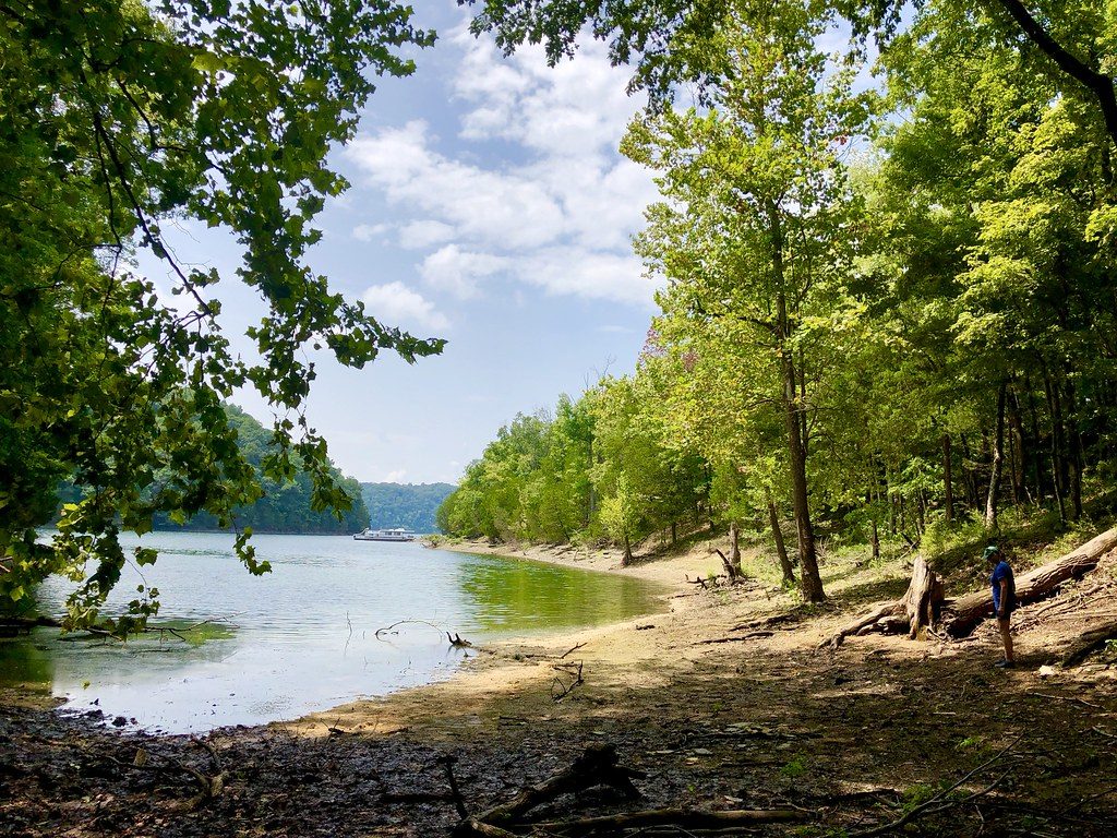
A shaded, sandy shoreline on Dale Hollow Lake with green woods running down to calm water.Stewart Bowman / public domain (PDM) via Flickr
🌲Natural

Dale Hollow Lake State Resort Park

Part ofMammoth Cave & South-Central Kentucky

A 3,400-acre state park on the Kentucky end of Dale Hollow Lake, a deep, clear Corps of Engineers reservoir on the Obey River that holds the world-record smallmouth bass.

⏱
Duration
Half a day to several days.
🎟
Admission
Free to enter; fees for lodging, camping and marina services.
📅
Best Season
Late spring to early fall for the water; winter for quiet.

The Story

Most of Dale Hollow Lake lies in Tennessee. Kentucky holds its northern arms, about 4,800 surface acres split between Cumberland and Clinton counties, of a reservoir that runs 61 miles with 620 miles of shoreline, and this park sits on the hills above them. The Army Corps of Engineers began the dam on the Obey River, a few miles above its mouth on the Cumberland, in 1942, and it was not fully working until after the war. The water backed up into hollows that had been farms and roads.

What people come for is the water itself. Just above the dam it is 130 feet deep, cool, clear and full of oxygen, the kind of lake where you can see well down off a dock. In winter the Corps draws it down about twenty feet, from roughly 27,700 acres to under 22,000, and the shoreline shows its rock. On July 9, 1955, David L. Hayes, trolling a crankbait, caught a smallmouth bass here that weighed 11 pounds, 15 ounces. It still stands as the all-tackle world record and the Kentucky state record, and anglers still come hoping to break it.

The park was established in 1978 and covers about 3,400 acres, with a lodge, a campground, a marina and trails along the ridges above the shore. Burkesville, the county seat on the Cumberland River, is the nearest town. Come in the off-season and you may have whole coves to yourself, with nothing on the water but your own wake.

Visitor Info

⏱
Time Needed
Half a day to several days.
🎟
Admission
Free to enter; fees for lodging, camping and marina services.
📅
Best Season
Late spring to early fall for the water; winter for quiet.
🛣️
Highway
KY 90 / KY 449

On the Map

Nearby

The closest stops worth working into your route

historical7.6 mi away
Cordell Hull Birthplace and Museum State Park
A replica of the log cabin where the secretary of state and Nobel laureate was born in 1871, with a museum of his belongings, in Pickett County's hills.
historical14 mi away
Standing Stone State Park
A New Deal park on Mill Creek named for a vanished stone that Native peoples revered and railroad builders blasted, with a lake, 1930s cabins and a marbles championship.
historical20 mi away
Sgt. Alvin C. York State Historic Park
The Wolf River valley farm, gristmill and grave of Alvin York, the conscientious objector turned Medal of Honor soldier, now a National Historic Landmark district.
historical23 mi away
Old Mulkey Meetinghouse State Historic Site
One of Kentucky's earliest log churches, a twelve-cornered Baptist church of 1804 near Tompkinsville, with Daniel Boone's sister Hannah in the churchyard.
recreational24 mi away
Lake Cumberland State Resort Park
A state park on the north shore of Lake Cumberland near Jamestown, on the reservoir Wolf Creek Dam made of the Cumberland River in the 1950s.
natural28 mi away
Pickett CCC Memorial State Park
A Civilian Conservation Corps park of sandstone buildings, natural bridges and rock shelters beside the Big South Fork, and an International Dark Sky Park.

Historical markers nearby

Roadside plaques and monuments within a short detour

Marker9.1 mi away
Courthouse Burned
Albany
Marker9.1 mi away
Pioneer Settler
Albany
Marker9.1 mi away
Civil War Terrorist
Albany
Marker9.2 mi away
County Named, 1835
Albany
Marker9.4 mi away
Clear Fork Baptist Church
Albany
Marker10 mi away
The Burning of Hale's Mill
Byrdstown, Tennessee