Home / North Carolina / The Great Smokies & Cherokee Country / Mountain Farm Museum and Mingus Mill
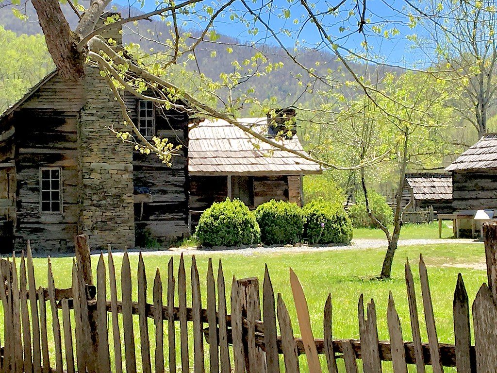
A log farmhouse with a stone chimney and smaller log outbuildings behind a split-picket fence, mountains beyond.Olin Gilbert / CC BY 2.0 via Flickr
🏛️Historical

Mountain Farm Museum and Mingus Mill

Part ofThe Great Smokies & Cherokee Country

Log farm buildings behind the Oconaluftee Visitor Center and an 1886 turbine gristmill, in the valley that was the Cherokee town of Egwanulti.

⏱
Duration
One to two hours for the farm, the visitor center and the mill.
🎟
Admission
Free; a park parking tag is required to park longer than 15 minutes ($5 daily, $15 weekly, $40 annual; NPS, 2026).
📅
Best Season
Year round for the grounds. Rangers give milling programs at Mingus Mill in summer and early fall; the mill interior was closed for rehabilitation in 2025, with the outside open (NPS).

The Story

Oconaluftee comes from Egwanulti, a Cherokee town name meaning "by the river." Archaeologists have found a Cherokee settlement on this river just inside today's park boundary, the only known permanent one within the park, probably destroyed in 1776 by General Griffith Rutherford's army during the Revolution. Cherokee neighbors told a woman who lived near Smokemont around 1900 of a deep place in the river called "where the bears wash," hidden from people, where wounded animals came to be healed.

White settlement began with John Jacob Mingus in the 1790s, the first Euro-American settler inside the present park. The Mountain Farm Museum, a short walk behind the Oconaluftee Visitor Center, gathers late nineteenth-century log buildings moved here from around the park in the 1950s: a meat house, apple house, springhouse, chicken house and working blacksmith shop around the Davis House, a log home John E. Davis built about 1902, and a barn original to the site. Lumber companies had cut much of the valley before the park commission bought it in the 1930s.

Half a mile north, Mingus Mill stands where John Mingus, a son of the first settler, had it built in 1886. The millwright Sion Thomas Early finished it in three months for $600, with help from Aden Carver, and a wooden flume drives a turbine rather than a water wheel. The Park Service bought the mill in 1934, and the Civilian Conservation Corps restored it in 1937 with Carver, then in his nineties, helping again. The valley is home to one of the park's two main elk herds.

Visitor Info

⏱
Time Needed
One to two hours for the farm, the visitor center and the mill.
🎟
Admission
Free; a park parking tag is required to park longer than 15 minutes ($5 daily, $15 weekly, $40 annual; NPS, 2026).
📅
Best Season
Year round for the grounds. Rangers give milling programs at Mingus Mill in summer and early fall; the mill interior was closed for rehabilitation in 2025, with the outside open (NPS).
🛣️
Highway
US 441 (Newfound Gap Road)

On the Map

Nearby

The closest stops worth working into your route

cultural2 mi away
Qualla Arts and Crafts Mutual
The cooperative Cherokee craftspeople founded in 1946, selling baskets, carvings and pottery made by enrolled members of the Eastern Band.
cultural2 mi away
Oconaluftee Indian Village
A re-created eighteenth-century Cherokee town in Cherokee, opened in 1952, with craft and dance demonstrations, beside the outdoor drama Unto These Hills.
cultural2.1 mi away
Museum of the Cherokee People
The Eastern Band's own museum on the Qualla Boundary, open since 1948 and now rethinking how it tells the Cherokee story in Cherokee voices.
natural9.5 mi away
Newfound Gap
The lowest drivable pass through the Smokies, at 5,046 feet on the Tennessee and North Carolina line, where Roosevelt dedicated the park in 1940 and Kuwohi's Cherokee name was restored in 2024.
historical14 mi away
Lakeview Drive (the Road to Nowhere)
The park road promised in 1943 to replace a highway drowned by Fontana Lake, stopped at a tunnel in 1971 and settled for cash in 2010.
industrial28 mi away
Fontana Dam
TVA's wartime dam on the Little Tennessee, 480 feet tall, built in under three years for aluminum power at the cost of four drowned towns.

Historical markers nearby

Roadside plaques and monuments within a short detour

Marker2.2 mi away
Nimrod Jarrett Smith
Cherokee
Marker2.9 mi away
Thomas's Legion
Cherokee
Marker5.1 mi away
Cherokee Indian Reservation
Cherokee
Marker6.6 mi away
William H. Thomas
Whittier
Marker7.8 mi away
Yonaguska
Bryson City
Marker9.8 mi away
Tsali
Bryson City