Home / Kansas / Monument Rocks & the High Plains / Mount Sunflower
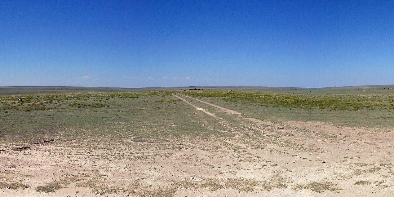
Flat shortgrass plains stretch to the horizon from the summit of Mount Sunflower, a two-track running away across the pasture.Fredlyfish4 / CC BY-SA 4.0 via Wikimedia Commons
🛣️Roadside

Mount Sunflower

Part ofMonument Rocks & the High Plains

The highest ground in Kansas, 4,039 feet on the Harold family's ranch half a mile from Colorado, with a sunflower of railroad spikes, a mailbox register and an invitation to stop by the house.

⏱
Duration
Thirty minutes at the top, plus the drive.
🎟
Admission
Free; private ranch open by the owners' courtesy.
📅
Best Season
Any season in dry weather.

The Story

The Harold family homesteaded this ranch in Wallace County in 1905, and the highest point in Kansas, 4,039 feet above sea level, sits in one of their pastures about half a mile from the Colorado line. It owes its height to the Rocky Mountains. Over millions of years streams carried sand, gravel and rock worn off the Rockies east across the plains and laid it down as a great wedge, the Ogallala Formation, the foundation of the High Plains. The state's low point, in the southeast corner, is more than 3,300 feet lower.

For decades the family has kept a small summit for visitors. There is a sunflower sculpture welded from railroad spikes, a covered picnic table, a memorial to the homesteading generation, a little free library, and a plaque reading "On this site in 1897, nothing happened." A mailbox holds the register, where visitors write their names, their towns and the size of their party, and a note inviting them to stop at the ranch house and tell the Harolds about their "trials and tribulations to the lofty summit." The family asks that you treat the place as you would your own.

Getting there is the work. From U.S. 40 or from Goodland it is long miles of gravel county road, with most of the turns signed, then a cattle guard and a ranch track through grazing pasture to the top.

Visitor Info

⏱
Time Needed
Thirty minutes at the top, plus the drive.
🎟
Admission
Free; private ranch open by the owners' courtesy.
📅
Best Season
Any season in dry weather.
🛣️
Highway
US-40

On the Map

Nearby

The closest stops worth working into your route

historical26 mi away
Fort Wallace Museum
A museum complex on US-40 in Wallace gathered from across the county: the 1865 Pond Creek stage station, the Weskan depot and a Swedish colony's 1888 church.
historical41 mi away
Sand Creek Massacre National Historic Site
Lost even to the survivors' descendants for more than a century, and found again in 1999 by tribal oral history, archives and a metal detector working together.
historical59 mi away
Beecher Island Battleground
A battlefield whose island is gone: the veterans' memorial of 1905 washed away in the flood of 1935, its pieces reset on the riverbank, the reunion still held every September.
geological61 mi away
Little Jerusalem Badlands State Park
A maze of Niobrara chalk walls above the Smoky Hill River, once ranch land, now held by The Nature Conservancy for raptors and a buckwheat that grows nowhere else.
natural65 mi away
Historic Lake Scott State Park
A spring-fed lake in a hidden canyon off U.S. 83, where water seeping out between gravel and chalk drew Apache and Pueblo farmers, a homesteading couple, and finally the state.
cultural66 mi away
Keystone Gallery
A homesteaders' stone church of 1917 on US-83 above the Smoky Hill valley, rebuilt off the power grid as a fossil museum by a family that has hunted the chalk since 1925.

Historical markers nearby

Roadside plaques and monuments within a short detour

Marker11 mi away
Butterfield Stage Line
Marker22 mi away
Colorado
Cheyenne Wells, Colorado
Marker26 mi away
Fort Wallace