Home / Kentucky / Paducah & Land Between the Lakes / Mantle Rock Nature Preserve
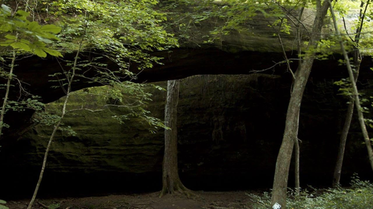
A broad natural sandstone arch spans a shaded forest floor at Mantle Rock.NPS / public domain
🏛️Historical

Mantle Rock Nature Preserve

Part ofPaducah & Land Between the Lakes

A 188-foot sandstone arch and a mile of the road where Cherokee detachments waited for the frozen Ohio in the winter of 1838-39.

⏱
Duration
Two hours for the loop.
🎟
Admission
Free.
📅
Best Season
Spring for wildflowers and fall; trails may close for prescribed fire February to April and October to November.

The Story

Mantle Rock is a natural sandstone bridge 188 feet long and 30 feet high, the largest freestanding arch east of the Mississippi. Around it are sandstone glades, among the best left in Kentucky, where the state's only known June grass grows with prickly pear and little bluestem. The Reynolds Metals Company gave the first 190 acres to The Nature Conservancy in 1988, and the preserve now covers 367.

The road that crosses the preserve was part of the northern route of the Cherokee removal. In the winter of 1838-39, eleven detachments carrying more than 10,000 Cherokee people from Tennessee to Indian Territory passed this way, not yet halfway there. The Peter Hildebrand detachment, well over a thousand people, spent about two weeks camped for miles along the road, waiting for ice on the Ohio to break so the ferry could carry them from Berry's Ferry to Golconda, Illinois. One survivor wrote of frozen ground, floating ice and having suffered a great deal.

The legends need care. The camp was a long line along the road, far too many people to shelter under the arch, and there is no evidence of burials at Mantle Rock. The 2.75-mile loop trail follows a mile of the historic road, with exhibits the Conservancy and the Park Service unveiled in 2010; the preserve has been a certified site on the Trail of Tears National Historic Trail since 2004. Cherokee people return every year.

Visitor Info

⏱
Time Needed
Two hours for the loop.
🎟
Admission
Free.
📅
Best Season
Spring for wildflowers and fall; trails may close for prescribed fire February to April and October to November.
🛣️
Highway
KY 133 (Lola Road)

On the Map

Nearby

The closest stops worth working into your route

cultural21 mi away
National Quilt Museum
Paducah's museum of contemporary quilts since 1991, with more than 700 quilts made after 1980, almost all by women.
cultural21 mi away
Paducah Floodwall Murals
The riverfront wall built after the 1937 flood, painted since 1996 with Paducah's history, at the meeting of the Tennessee and Ohio on land the Chickasaw ceded in 1818.
historical22 mi away
Hotel Metropolitan
Maggie Steed's 1908 hotel for Black travelers in Paducah's Upper Town, a Green Book and Chitlin' Circuit stop, now a museum.
industrial26 mi away
Kentucky Dam
TVA's longest dam, closed in 1944 near the mouth of the Tennessee River, and the lake that moved 2,609 families and drowned Birmingham, Kentucky.
natural36 mi away
Clarks River National Wildlife Refuge
Bottomland hardwood swamp along the East Fork of the Clarks River near Benton, a refuge since 1997 for waterfowl and migrating songbirds.
historical37 mi away
Camp Breckinridge Museum and Arts Center
The World War II NCO club at Morganfield's lost Army camp, its walls painted by a German prisoner of war, now Union County's museum.

Historical markers nearby

Roadside plaques and monuments within a short detour

Marker13 mi away
Jefferson's Sister
Smithland
Marker13 mi away
Hurricane Furnace
Tolu
Marker16 mi away
County Named, 1798
Smithland
Marker16 mi away
Civil War Base
Smithland
Marker19 mi away
Crittenden Furnace
Dycusburg
Marker19 mi away
County Named, 1842
Marion