Home / Oregon / Southern Oregon / Jacksonville and the Britt Gardens
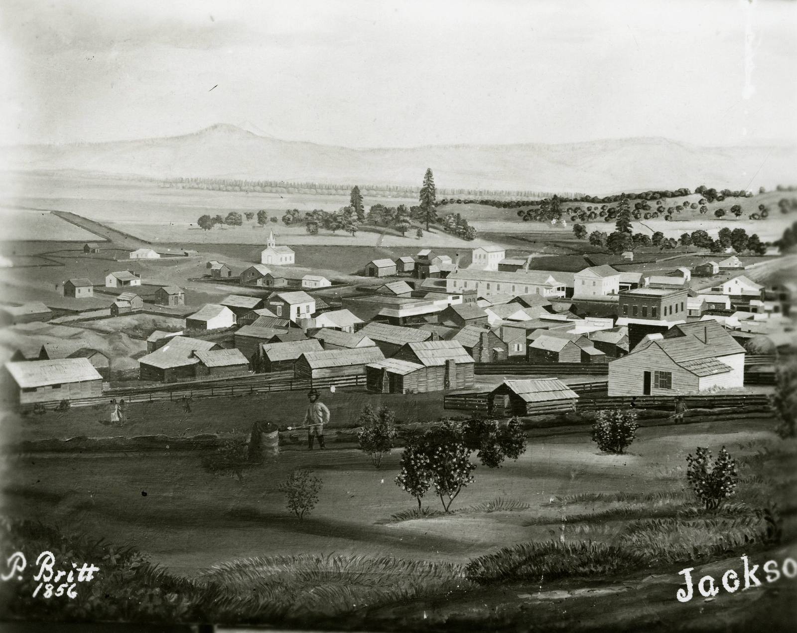
Peter Britt's 1856 photograph of Jacksonville from the hillside, the gold camp's wooden buildings spread below, signed P. Britt 1856Peter Britt / public domain via Wikimedia Commons
🏛️Historical

Jacksonville and the Britt Gardens

Part ofSouthern Oregon

The gold camp a Swiss photographer walked into in 1852 pulling his camera on a cart, and the hillside where his 1862 sequoia now shades a summer music festival.

Mining BoomSummer
⏱
Duration
Half an hour in the gardens; an afternoon with the town.
📅
Best Season
June through September for the festival; the gardens and the town any time.

The Story

Peter Britt reached Jacksonville in November 1852 on foot, nearly penniless, hauling a small cart with his photographic apparatus. He had been a portrait painter in Switzerland, learned the daguerreotype in St. Louis, and come west in the gold rush like everyone else in the camp. He opened a studio in 1854, one of the first in Oregon, and for nearly half a century photographed the town and the valley, from farmers and newspaper editors to a French hotelkeeper and the Chinese miners who worked the gulches, with whom he was on friendly terms.

In 1874, after failing in 1868 and 1869, he got a wet-plate camera to Crater Lake and made the first successful photograph of it. William Gladstone Steel later used Britt's pictures in the campaign that made the lake a national park in 1902. Britt also planted a vineyard in 1858 and is counted as the Oregon Territory's first vintner; he grew pears and peaches and kept weather records for the government.

He died in 1905. The hillside above town is now Britt Gardens, a county park, and the giant sequoia he planted in 1862, the year his son Emil was born, still towers over it. Since 1963 the grounds have hosted the Britt festival's summer concerts on the hill. His prints and negatives are in the collections of the Southern Oregon Historical Society. Below the hill, the brick main street that the railroad's 1884 bypass left frozen is a few minutes' walk away.

Visitor Info

⏱
Time Needed
Half an hour in the gardens; an afternoon with the town.
📅
Best Season
June through September for the festival; the gardens and the town any time.
🛣️
Highway
OR-238

On the Map

Nearby

The closest stops worth working into your route

geological11 mi away
The Table Rocks
Two horseshoe mesas the Takelma called Ti'tanak, where the 1853 treaty was signed at the foot of one, with a wildflower on top that grows nowhere else.
cultural15 mi away
Oregon Shakespeare Festival
A summer Shakespeare season that grew from one roofless 1935 performance into one of the country's largest repertory theaters, then had to ask for an emergency rescue in 2023.
geological27 mi away
Oregon Caves
A cave of marble rather than limestone, found in 1874 by a hunter who followed his dog in by matchlight and found his way out by the sound of a stream.
historical34 mi away
Wolf Creek Inn
A stage-road hotel built in 1883 for the overnight stop on the sixteen-day run between San Francisco and Portland, still taking guests under state ownership.
historical57 mi away
Fort Klamath
The army post that reached the Wood River Valley four years before Klamath Falls existed, and the treaty signed near it that put three peoples on one reservation.
architectural59 mi away
Crater Lake Lodge
A hotel on the caldera rim that opened in 1915 with tar paper on its walls, was never quite finished, came close to demolition, and is now mostly new behind its old face.