Home / Texas / Galveston, Brazoria & the Upper Coast / Galveston Seawall and the 1900 Storm
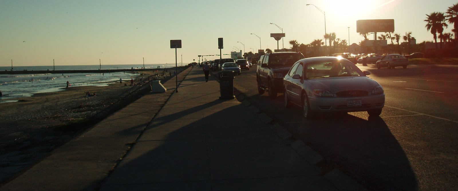
The wide walk along the top of the Galveston seawall at sunset, with the Gulf on one side and parked cars on Seawall Boulevard.Thomas Sperre / CC BY-SA 2.0 via Flickr
🏛️Historical

Galveston Seawall and the 1900 Storm

Part ofGalveston, Brazoria & the Upper Coast

The concrete wall along the Gulf that Galveston built after the hurricane of September 8, 1900, which killed between 6,000 and 8,000 people in a city of 38,000.

⏱
Duration
One hour for a walk on the wall.
🎟
Admission
Free.
📅
Best Season
October through May.

The Story

Saturday, September 8, 1900, began like a workday in Galveston, a city of 38,000. The morning paper carried one paragraph about a storm in the Gulf, and the local Weather Bureau chief, Isaac M. Cline, drove a horse cart through the low streets urging people to leave. Few did before the bridges to the mainland went down. Through the afternoon the wind rose, the anemometer blew away at 5:15, and about 6:30 a storm wave raised the water four feet at once. Soon the whole city lay under as much as fifteen feet of water. Wreckage from each row of houses battered the next. By morning between 6,000 and 8,000 people in the city were dead, and perhaps 10,000 to 12,000 on the island, and 2,636 houses were gone.

Galveston rebuilt itself higher. Besides the seawall, sand pumped from the Gulf floor raised the city's grade as much as seventeen feet, which meant first jacking up 2,146 buildings, streetcar tracks, fireplugs and water pipes. The heaviest was a 3,000-ton church, raised five feet while services went on. The storm also gave the country the commission form of city government.

The wall has been lengthened several times since, and a walk along its top is the easiest way to read the city's answer to the storm. The 1900 Storm memorial stands on the wall here.

Visitor Info

⏱
Time Needed
One hour for a walk on the wall.
🎟
Admission
Free.
📅
Best Season
October through May.
🛣️
Highway
Seawall Boulevard

On the Map

Nearby

The closest stops worth working into your route

historical2.2 mi away
Moody Mansion
A four-story, 28,000-square-foot house on Broadway, finished in 1895, that W. L. Moody Jr. bought just after the 1900 storm and his family kept until Hurricane Alicia in 1983.
historical2.3 mi away
1859 Ashton Villa
A brick Italianate house on Broadway, built with enslaved labor in 1859, whose lawn has held Galveston's Juneteenth commemoration of General Orders, No. 3 every year since 1979.
historical2.7 mi away
The Strand
Five blocks of iron-front brick buildings near the harbor that were once called the Wall Street of the Southwest, emptied after 1900 and brought back by preservationists from the 1960s.
historical2.9 mi away
Texas Seaport Museum and the Elissa
An iron barque launched in Aberdeen in 1877 that called at Galveston twice, ended up smuggling in the Adriatic, and was bought back from a Greek scrapyard to sail again from Pier 22.
architectural2.9 mi away
1892 Bishop's Palace
Nicholas Clayton's stone house on Broadway for the railroad lawyer Walter Gresham, later home to Galveston's Catholic bishops and one of the most admired Victorian houses in the country.
natural10 mi away
Galveston Island State Park
A cattle ranch willed to the state that now runs the full width of Galveston Island, from two miles of Gulf beach across dunes and prairie to the marshes of West Galveston Bay.

Historical markers nearby

Roadside plaques and monuments within a short detour

Marker24 mi away
Ritson Morris and Elmwood Plantation
Seabrook
Marker25 mi away
Prehistoric Indian Campsite
Seabrook
Marker25 mi away
Captain William Plunkett Harris
Seabrook
Marker26 mi away
Houston Yacht Club
La Porte
Marker29 mi away
La Porte
La Porte
Marker29 mi away
Gribble-Hofheinz House
Morgan's Point