Home / Louisiana / Natchitoches, the Cane River & Kisatchie / Fort Jesup State Historic Site
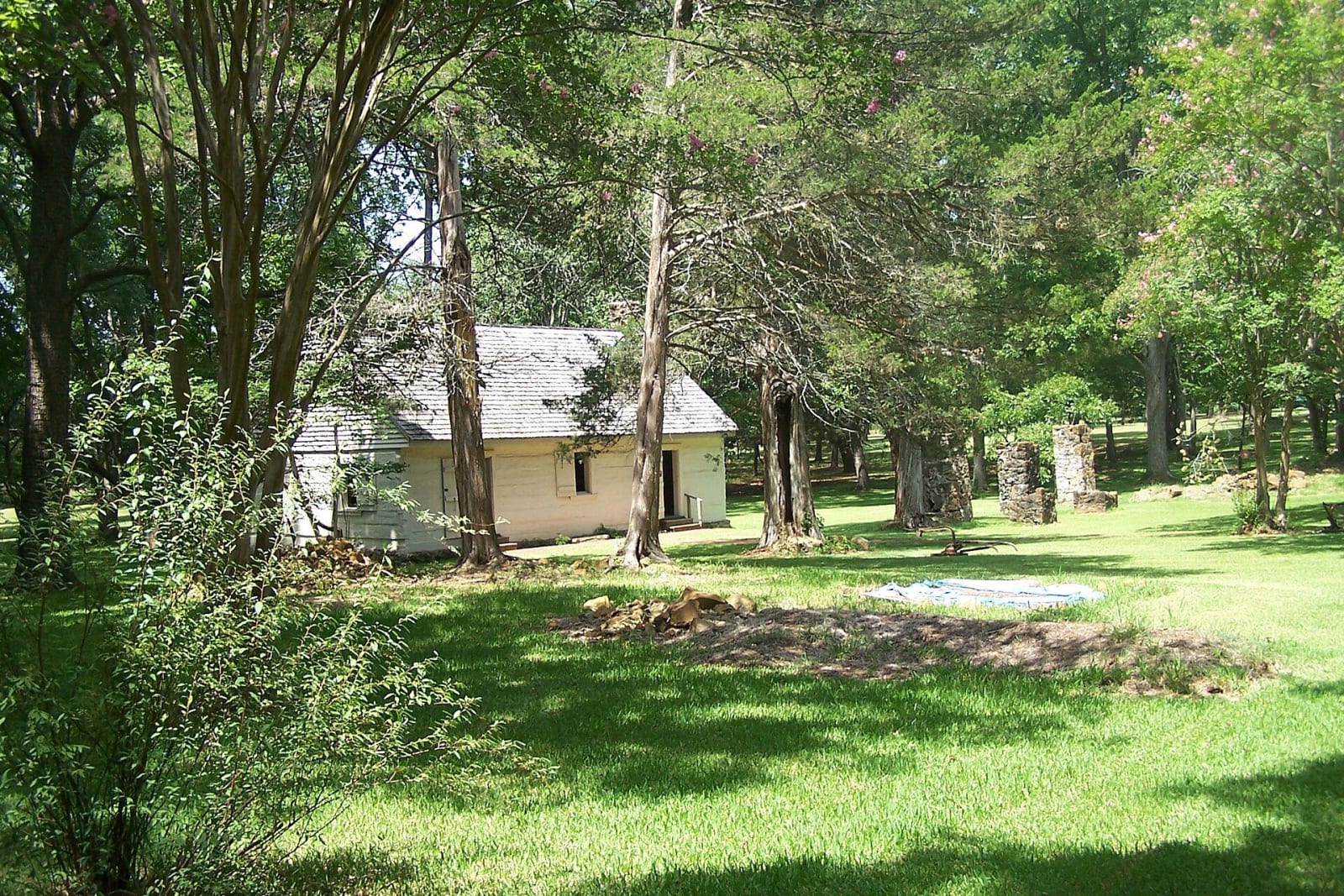
The whitewashed army kitchen with a shingle roof sits among trees on a mown lawn, with stone chimney ruins beyond it.Pat Austin / CC BY 2.0 via Wikimedia Commons
πŸ›οΈHistorical

Fort Jesup State Historic Site

Part ofNatchitoches, the Cane River & Kisatchie

The 1822 army post Zachary Taylor built to hold the Neutral Ground between Louisiana and Spanish Texas, with the one surviving kitchen, a reconstructed officers' quarters and a museum open Friday to Sunday.

⏱
Duration
One to two hours.
🎟
Admission
$6 ages 7 to 61, $4 seniors 62 and over, free for children 6 and under (as listed 2026).
πŸ“…
Best Season
Grounds open Wednesday to Sunday and the museum Friday to Sunday, 9 a.m. to 5 p.m.; closed Thanksgiving, Christmas and New Year's Day (Louisiana State Parks, 2026).

The Story

The 1803 Louisiana Purchase treaty did not say clearly where Louisiana ended in the west. The United States claimed eastern Texas and Spain claimed western Louisiana, and the strip between became the Neutral Ground, where, Louisiana State Parks says, neither nation's laws were enforced. The Florida Purchase Treaty of 1819 fixed the boundary at the Sabine River. In 1822 Lieutenant Colonel Zachary Taylor established the garrison, first called Cantonment Jesup for his friend Brigadier General Thomas Sidney Jesup.

Taylor's troops restored order in the Neutral Ground, and the fort stayed an important post for nearly 25 years. Soldiers built roads, surveyed the frontier, cleared the Red River and negotiated treaties. The state's account also lists helping to put down uprisings of enslaved people in Alexandria among their duties. In 1845 half of the United States Army passed through on its way to the Mexican War, and the fort was abandoned in 1846. The Department of the Interior designated it a National Historic Landmark in 1961.

The original kitchen is the only historic structure left from the reservation, furnished in the style of the early 1800s. The reconstructed officers' quarters holds visitor information and exhibits, and the museum shows period clothing and textile arts. The site is at 32 Geoghagan Road. The grounds are open Wednesday to Sunday and the museum Friday to Sunday.

Visitor Info

⏱
Time Needed
One to two hours.
🎟
Admission
$6 ages 7 to 61, $4 seniors 62 and over, free for children 6 and under (as listed 2026).
πŸ“…
Best Season
Grounds open Wednesday to Sunday and the museum Friday to Sunday, 9 a.m. to 5 p.m.; closed Thanksgiving, Christmas and New Year's Day (Louisiana State Parks, 2026).
πŸ›£οΈ
Highway
Geoghagan Road

On the Map

Nearby

The closest stops worth working into your route

historical9.5 mi away
Los Adaes State Historic Site
The Spanish presidio that was the capital of Texas from 1729 to 1770, some 15 miles from French Natchitoches, now an archaeological site where Native pottery is the most abundant find.
recreational20 mi away
North Toledo Bend State Park
A 900-acre park on the Louisiana shore of the 186,000-acre Toledo Bend Reservoir, with trails, disc golf and cabins, near the flooded sites of Pine Flat and other Sabine Parish communities.
architectural21 mi away
Natchitoches Historic District
The riverfront blocks of the oldest permanent settlement in the Louisiana Purchase, founded in 1714 at a Natchitoches village, with a brick-paved Front Street, Cane River frontage and the largest bousillage construction in the South.
historical21 mi away
Fort St. Jean Baptiste State Historic Site
A reconstruction of the 1716 French fort beside the Natchitoches village, with a palisade of nearly 2,000 pine logs, a chapel and storeroom, and living-history programs, open Wednesday to Sunday.
historical24 mi away
Cane River Creole National Historical Park
Oakland and Magnolia, two Cane River cotton plantations kept as they stood, told through the enslaved families who worked them, the 1864 and 1804 freedom seekers and the tenant farmers who stayed into the 1960s.
cultural25 mi away
St. Augustine Church, Isle Brevelle
The parish church at the heart of the Cane River Creoles of color, begun by Augustin Metoyer on his family's land and still holding Mass for the community that grew from Marie Thérèse Coincoin's children.

Historical markers nearby

Roadside plaques and monuments within a short detour

Marker8.9 mi away
Los Adaes
Robeline
Marker9.2 mi away
The Presidio Nuestra Senora del Pilar de los Adais
Robeline
Marker14 mi away
Saint Tekakwitha Plaque and Statue
Robeline
Marker14 mi away
Church of St. Anne (Mother Church of Caddo Adai Indians)
Robeline
Marker19 mi away
Francois Rouquier Homesite
Natchitoches
Marker21 mi away
Old Normal Hill
Natchitoches