Home / Texas / Fort Worth & the Cross Timbers / Dinosaur Valley State Park
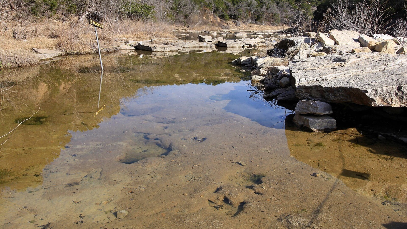
A shallow pool in the Paluxy River at the main track site of Dinosaur Valley State Park, with dinosaur footprints visible in the limestone bed beneath the clear water and a Tracks sign standing in the pool.Larry D. Moore / CC BY 4.0 via Wikimedia Commons
🌲Natural

Dinosaur Valley State Park

Part ofFort Worth & the Cross Timbers

Theropod and sauropod trackways of about 113 million years ago in the bed of the Paluxy River, a National Natural Landmark where R. T. Bird found the first distinct sauropod tracks in 1937.

⏱
Duration
Two to four hours.
🎟
Admission
Adults 13 and older $8 a day; 12 and under free. Day passes can be reserved online.
📅
Best Season
Year round, but the Paluxy often stops flowing in summer and tracks are sometimes covered by sand and mud; trails close when wet. Check with the park for track visibility.

The Story

People lived on this stretch of the Paluxy River for about 6,000 years before Europeans came, probably ancestors of the Tonkawa, according to Texas Parks and Wildlife. Wichita groups moved south in the 1700s, and a large Comanche band known as the "Honey-Eaters" wintered under the limestone bluffs, out of the north wind.

About 113 million years ago this was the edge of an advancing and retreating sea, and the limey mud of the tidal flats took tracks. A flood in 1908 may have uncovered the three-toed ones; a nine-year-old, George Adams, found them in 1909. In 1937 R. T. Bird, collecting for the American Museum of Natural History, found the first distinct sauropod tracks, which showed scientists that these giants walked on four legs. The park believes the sauropod tracks belong to Sauroposeidon and the theropod tracks to Acrocanthosaurus.

The Handbook of Texas says the department established the park in 1969; the park's own history says it opened in 1972, and the National Park Service has named it a National Natural Landmark. Fiberglass models of an Apatosaurus and a Tyrannosaurus rex, made for the 1964-65 New York World's Fair, were given to the park in 1970. The tracks lie in the riverbed and are not always visible, so check trail and track conditions with the park before you drive out.

Visitor Info

⏱
Time Needed
Two to four hours.
🎟
Admission
Adults 13 and older $8 a day; 12 and under free. Day passes can be reserved online.
📅
Best Season
Year round, but the Paluxy often stops flowing in summer and tracks are sometimes covered by sand and mud; trails close when wet. Check with the park for track visibility.
🛣️
Highway
FM 205 / Park Road 59

On the Map

Nearby

The closest stops worth working into your route

architectural14 mi away
Granbury Courthouse Square
A National Register square of limestone storefronts around W. C. Dodson's Second Empire courthouse, whose clock tower citizens saved after a 1968 tornado.
historical15 mi away
Acton State Historic Site
The smallest state historic site in Texas, a grave plot holding Elizabeth Crockett, widow of David Crockett, under a 1913 statue of a pioneer woman shading her eyes toward the west.
recreational15 mi away
Cleburne State Park
A 1930s Civilian Conservation Corps park on the old Chisholm Trail crossing country, with a spring-fed lake, a hand-carved three-tiered spillway and a CCC bridge in Johnson County.
recreational25 mi away
Meridian State Park
A 505-acre park in Bosque County where World War I veterans of a Civilian Conservation Corps company dammed Bee Creek in 1933-34 for a 72-acre lake and cut stone buildings around it.
roadside33 mi away
Dublin Bottling Works
The Erath County plant that bottled Dr Pepper with cane sugar from 1891 until a 2012 settlement ended its Dr Pepper license, and that still makes its own sodas the same way.
cultural35 mi away
Chandor Gardens
A portrait painter's English-and-Chinese garden rooms, blasted and planted from a bare 3.5-acre hillside in Weatherford beginning in 1936, abandoned after 1978 and reopened by the city in 2002.

Historical markers nearby

Roadside plaques and monuments within a short detour

Marker2.5 mi away
Post Oak Community
Glen Rose
Marker3.5 mi away
Somervell County
Glen Rose
Marker8.5 mi away
Chalk Mountain Cemetery
Chalk Mountain
Marker8.5 mi away
Mitchell Bend Cemetery
Granbury
Marker9.8 mi away
Comanche Peak
Granbury
Marker11 mi away
George's Creek Baptist Church
Glen Rose