Home / Kansas / The Little Balkans & the Southeast / Brush Creek Bridge (Rainbow Bridge)
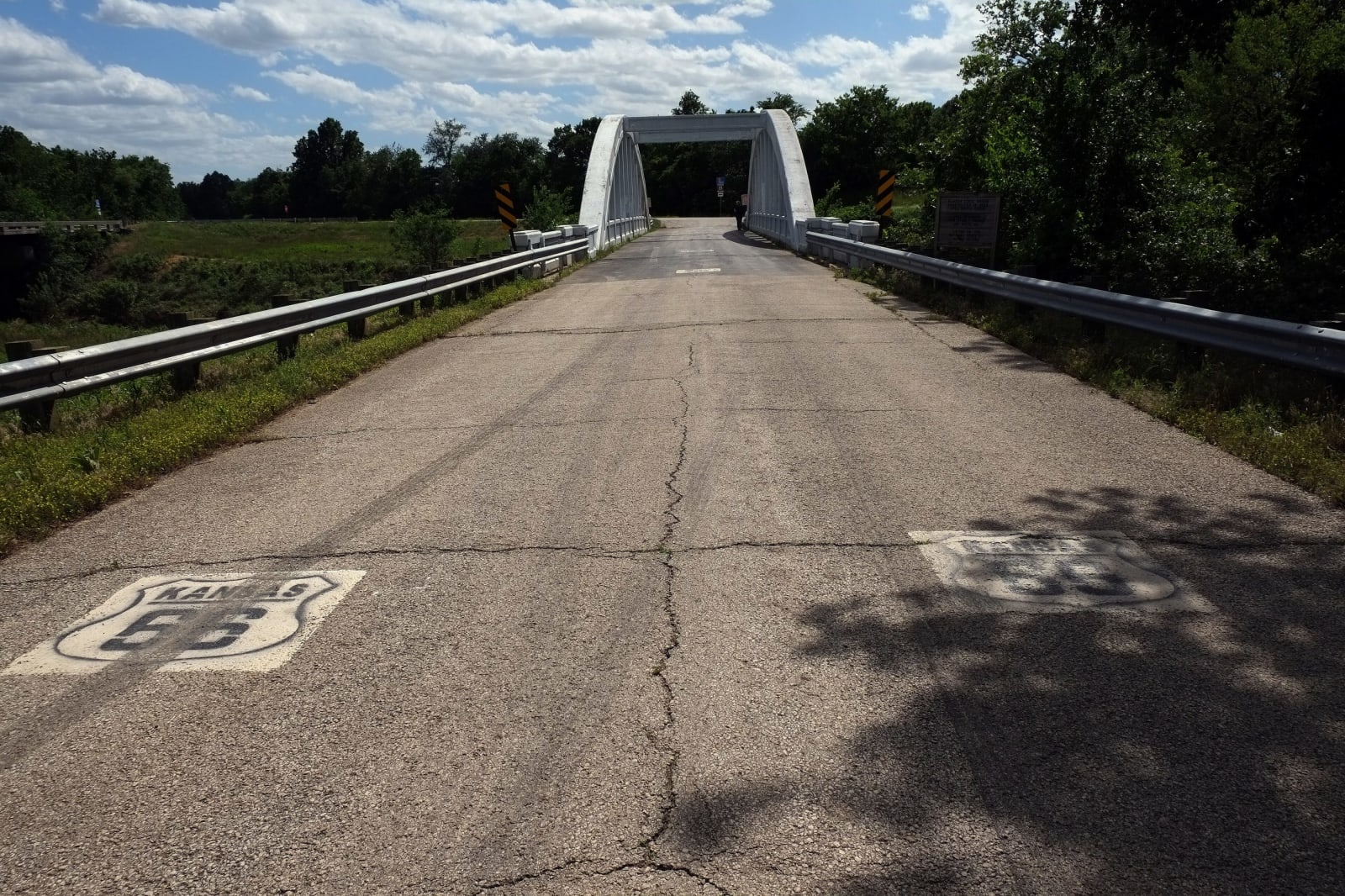
Old Route 66 pavement, painted with route shields, leading to the white concrete arch of the Brush Creek Bridge.Gorup de Besanez / CC BY-SA 4.0 via Wikimedia Commons
🛣️Roadside

Brush Creek Bridge (Rainbow Bridge)

Part ofThe Little Balkans & the Southeast

The last of three Marsh rainbow arch bridges on Kansas's short stretch of Route 66, built in 1923 and kept standing in 1992 when the road association refused to let it go.

⏱
Duration
Fifteen to thirty minutes.
🎟
Admission
Free.
📅
Best Season
Year-round.

The Story

Route 66 spends only about 13 miles in Kansas, across the corner of Cherokee County through Galena, Riverton and Baxter Springs. The concrete road it followed was built in the early 1920s to tie those mining towns together, and with it came three bridges of a design that James Barney Marsh, an Iowa bridge designer, had patented in 1912. Marsh spent the next two decades building about 70 of his rainbow arches across the Midwest, most of them in Kansas, where about 35 still stand. The patent called for sliding plates where deck met beams, so the concrete could expand and contract with heat and wet.

This one, 130 feet long, went up over Brush Creek in 1923 and carried Route 66 traffic until the road was bypassed in the 1960s. When Interstate 44 opened in 1961 it ran straight from Oklahoma into Missouri and missed Kansas by about a quarter mile. In the early 1990s the other two Marsh bridges on the Kansas stretch, over the Spring River and Willow Creek, were taken down. In 1992 the Kansas Historic Route 66 Association worked to save this one. A new bridge was built just to the east for local traffic, and the old span, on the National Register since 1983, was repaired by the association and the county and later with National Park Service grant money.

You can still walk or drive across it, on a short spur off the county road about three and a half miles north of Baxter Springs.

Visitor Info

⏱
Time Needed
Fifteen to thirty minutes.
🎟
Admission
Free.
📅
Best Season
Year-round.
🛣️
Highway
Old US-66 / US-400

On the Map

Nearby

The closest stops worth working into your route

industrial18 mi away
Big Brutus
A 16-story electric coal shovel parked in 1974 where it stopped digging, among the flooded strip pits and reclaimed grassland of the Cherokee County coal field.
historical31 mi away
Miners Hall Museum
Franklin's museum of the Crawford County coal camps and their immigrant families, and of the December 1921 morning the miners' wives marched to shut the mines.
historical48 mi away
Dalton Defenders Museum
Coffeyville's museum named for the four townsmen killed on October 5, 1892, when the Dalton gang tried to rob two banks at once, across the street from the bank where the plan fell apart.
historical53 mi away
Fort Scott National Historic Site
An 1840s army post on the old Missouri border where officers kept enslaved servants, and where twenty years later the 1st Kansas Colored Infantry was mustered onto the parade ground.
cultural57 mi away
Martin and Osa Johnson Safari Museum
Chanute's museum of the hometown singer and the jeweler's son who filmed the South Seas, East Africa and Borneo for paying audiences, and of the West African art that now shares their building.
historical61 mi away
Little House on the Prairie Museum
The Ingalls family's claim of 1869 and 1870 southwest of Independence, a squatter's homestead on the Osage Diminished Reserve, with a replica cabin, schoolhouse and post office.

Historical markers nearby

Roadside plaques and monuments within a short detour

Marker2.8 mi away
Baxter Springs Massacre