Home / New Mexico / Route 66 & the Eastern Plains / Blue Hole
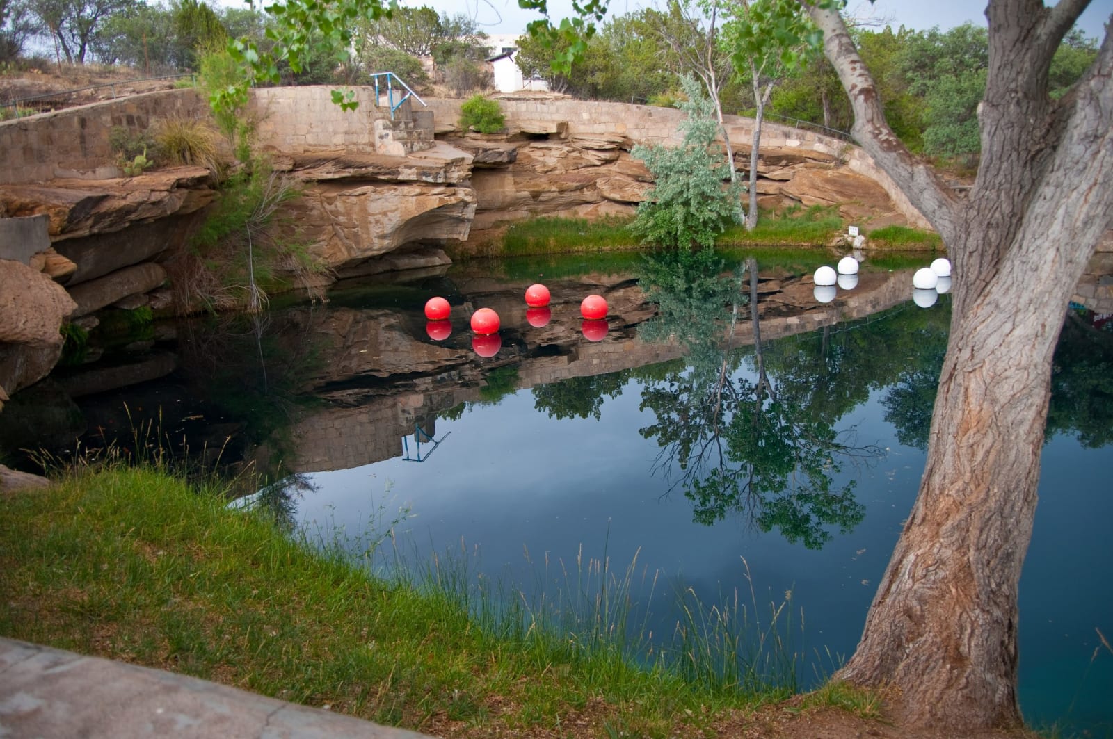
The still blue water of the Blue Hole in Santa Rosa, ringed by sandstone ledges, a cottonwood and floating dive buoysDeborah Lee Soltesz / CC0 via Wikimedia Commons
🌲Natural

Blue Hole

Part ofRoute 66 & the Eastern Plains
On this driveRoute 66: Glenrio to Albuquerque

A bell-shaped artesian spring in Santa Rosa, 81 feet deep and a steady 61 or 62 degrees, where divers from across the region learn to dive at altitude.

SwimmingFamily-FriendlySummerWeird & WonderfulFree
⏱
Duration
An hour to swim; a day to dive.
🎟
Admission
Free to swim; divers need a city permit.
πŸ“…
Best Season
Summer for swimming; winter is the busiest diving season.
πŸ’‘
Fun Fact
At this altitude a dive to the 81-foot bottom is treated, for planning, like a dive to about 95 feet at sea level.

The Story

Santa Rosa sits on the Pecos where old Route 66 and I-40 run along the edge of the plains, and it calls itself the City of Natural Lakes for the water that rises out of the limestone here. The best known is the Blue Hole, a round pool ringed with sandstone ledges, its water so clear the bottom shows 81 feet down. Below the surface it widens like a bell. A cave system near the bottom pushes in about 3,000 gallons a minute, enough to replace the whole pool every few hours, and holds it at about 61 or 62 degrees all year. It was once used as a fish hatchery.

In summer it is a swimming hole, and people jump from the ledges ten feet above the water. The rest of the year it belongs to scuba divers. There are few inland dive sites in the Southwest, and classes come from Texas, Colorado, Oklahoma and Kansas to train here; winter is the busiest season.

The pool sits at about 4,600 feet, so every dive in it is an altitude dive. The thinner air above means a dive to the bottom has to be planned as if it were deeper than it is, and divers heading west toward Albuquerque wait several hours before driving over the pass of more than 7,000 feet on the way.

Diving needs certification and a permit from the city, sold by the week, and a dive shop beside the pool fills tanks and rents gear.

Visitor Info

⏱
Time Needed
An hour to swim; a day to dive.
🎟
Admission
Free to swim; divers need a city permit.
πŸ“…
Best Season
Summer for swimming; winter is the busiest diving season.
πŸ›£οΈ
Highway
I-40

On the Map

Nearby

The closest stops worth working into your route

historical46 mi away
Bosque Redondo Memorial
The state site at Fort Sumner that for decades told the story of an army post and an outlaw, remade with DinΓ© and NdΓ© people into a memorial to those held here.
architectural56 mi away
Blue Swallow Motel
A twelve-room tourist court on Tucumcari's stretch of Route 66, built in 1939, run for four decades by one woman, and lit by one of the most photographed motel signs on the road.
architectural60 mi away
Montezuma Castle
The railroad's turreted resort at the Las Vegas hot springs, burned twice in its first years, empty for most of a century, and now home to an international school.
historical69 mi away
Fort Union National Monument
Three forts in one prairie valley where the two branches of the Santa Fe Trail met: a log post, a star-shaped earthwork, and an adobe supply town that fed the army's wars.
historical71 mi away
Pecos National Historical Park
The red walls of a 1717 mission church inside the foundations of a far larger one, beside the kiva Pecos people dug in front of the old church during the revolt of 1680.
historical88 mi away
Palace of the Governors
The long adobe on the north side of the Santa Fe plaza, called the oldest public building in continuous use in the country, though its own founding date is in dispute.